Garut Regency
Garut Regency is a Regency in the West Java province of Indonesia. It covers an area of 3,065.19 km2 (1,186.91 mi2). Geographically, it lies between 6°57′34″ – 7°44′57″ South latitude and 107°24′34″ – 108°7′34″ East longitude. The population at the 2010 census was 2,404,121,[2] and at the 2020 census was 2,585,607; [3] the official estimate as at mid 2022 was 2,627,220 (comprising 1,345,400 males and 1,281,820 females).[1] South Tarogong (Tarogong Kidul) is the regency seat.
Garut Regency
Kabupaten Garut | |
|---|---|
| Other transcription(s) | |
| • Sundanese | ᮊᮘᮥᮕᮒᮦᮔ᮪ ᮌᮛᮥᮒ᮪ |
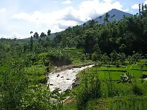 Rice field in Garut, West Java | |
 Flag  Coat of arms | |
| Nickname(s): Kabupaten Intan (Regency of Diamonds) | |
| Motto(s): Tata Tengtrem Kerta Raharja (Orderly, peaceful, and prosperous) | |
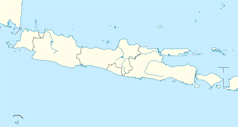
 Location within West Java | |
| Coordinates: 7°12′10″S 107°53′09″E | |
| Country | |
| Province | West Java |
| Regency seat | South Tarogong (Tarogong Kidul) |
| Government | |
| • Regent | Rudy Gunawan |
| Area | |
| • Total | 3,065.19 km2 (1,183.48 sq mi) |
| Population (mid 2022 estimate) | |
| • Total | 2,627,220 |
| [1] | |
| Time zone | UTC+7 (WIB) |
| Area code | 0262 |
| Website | garutkab.go.id |

Adjacent regencies
It is bordered by:
- Eastern side: Tasikmalaya Regency
- Western side: Cianjur Regency and Bandung Regency
- Northern side: Sumedang Regency
- Southern side: Indian Ocean
Geography
In general, Garut has a cool but tropical climate, with an average temperature of 24 °C (76 °F). Average annual rainfall is 2,590 mm (102 inches). This area includes valley territory surrounded by volcanoes (Mount Karacak: 1,838 m, Mount Cikuray: 2,821 m, Mount Guntur: 2,249 m, Mount Papandayan: 2,622 m) on the northern side, with average heights of 700–750 m above sea level. Streams of solidified lava are present on their slopes.
Administrative Districts
Garut Regency is currently divided into 42 districts (kecamatan), listed below with their areas and populations at the 2010[2] and 2020 censuses, [3] together with the official estimates as at mid 2022. [1] The table also includes the locations of the district administrative centres, the number of villages (rural desa and urban kelurahan) in each district, and its post code.
However, in 2013 the National Legislative Council approved a proposal to create a new Regency - South Garut Regency (Kabupaten Garut Selatan) - to include the 16 southernmost districts (those listed first in the table below) of the existing Garut Regency,[4] with a combined population of 681,360 in mid 2022.[1] The new Regency would thus inherit 63% of the land area of the existing regency, but only 26% of its population in mid 2022. As at 2023, this proposal has not yet been implemented, but for convenience the table below has been split to distinguish those districts in the proposed South Garut Regency.
| Name of District (kecamatan) | Area in km2 | Pop'n 2010 census | Pop'n 2020 census | Pop'n mid 2022 estimate | Admin centre | No. of Villages | Post code |
|---|---|---|---|---|---|---|---|
| Cisewu | 172.83 | 32,976 | 33,412 | 33,540 | Cisewu | 9 | 44169 |
| Caringin | 99.03 | 29,566 | 32,010 | 32,550 | Purbayani | 6 | 44166 |
| Talegong | 108.74 | 30,715 | 28,747 | 28,820 | Sukamulya | 7 | 44167 |
| Bungbulang | 146.98 | 59,659 | 58,300 | 58,480 | Bungbulang | 13 | 44165 |
| Mekarmukti | 55.22 | 15,634 | 18,161 | 18,720 | Cijayana | 5 | 44155 |
| Pamulihan | 132.44 | 17,570 | 18,592 | 18,820 | Pakenjeng | 5 | 44168 |
| Pakenjeng | 198.44 | 65,752 | 68,277 | 68,870 | Jatiwangi | 13 | 44164 |
| Cikelet | 172.32 | 40,928 | 44,488 | 45,280 | Cikelet | 11 | 44177 |
| Pameungpeuk | 44.11 | 38,852 | 42,560 | 43,380 | Mandalakasih | 8 | 44175 |
| Cibalong | 213.59 | 40,768 | 44,565 | 45,400 | Karya Mukti | 11 | 44176 |
| Cisompet | 172.25 | 49,848 | 52,746 | 53,400 | Cisompet | 11 | 44174 |
| Peundeuy | 56.79 | 22,408 | 23,755 | 24,060 | Peundeuy | 6 | 44178 |
| Singajaya | 67.69 | 45,509 | 47,313 | 47,740 | Singajaya | 9 | 44170 |
| Cihurip | 40.42 | 17,993 | 18,691 | 18,880 | Cihurip | 4 | 44173 |
| Cikajang | 124.95 | 78,164 | 83,944 | 88,230 | Cikajang | 12 | 44171 |
| Banjarwangi | 123.82 | 56,100 | 57,780 | 58,190 | Banjarwangi | 11 | 44172 |
| Totals South Garut | 1,929.62 | 642,442 | 673,341 | 681,360 | 141 |
| Name of District (kecamatan) | Area in km2 | Pop'n 2010 census | Pop'n 2020 census | Pop'n mid 2022 estimate | Admin centre | No. of Villages | Post code |
|---|---|---|---|---|---|---|---|
| Cilawu | 77.63 | 100,073 | 107,738 | 109,440 | Cilawu | 18 | 44181 |
| Bayongbong | 49.95 | 93,102 | 102,703 | 104,820 | Bayongbong | 18 | 44162 |
| Cigedug | 31.20 | 38,199 | 43,475 | 44,640 | Cigedug | 5 | 44116 |
| Cisurupan | 80.88 | 95,086 | 98,587 | 99,420 | Balewangi | 17 | 44163 |
| Sukaresmi | 35.17 | 37,082 | 39,844 | 40,460 | Sukaresmi | 7 | 44154 |
| Samarang | 59.71 | 71,169 | 77,181 | 78,510 | Samarang | 13 | 44160 |
| Pasirwangi | 46.70 | 62,048 | 64,935 | 65,600 | Pasirwangi | 12 | 44161 |
| Tarogong Kidul | 19.46 | 108,192 | 114,965 | 116,490 | Sukakarya | 12 | 44150 |
| Tarogong Kaler | 50.57 | 84,843 | 95,942 | 98,390 | Cimanganten | 13 | 44151 |
| Garut Kota | 27.71 | 126,452 | 127,583 | 127,980 | Pakuwon | 11 | 44111 - 44119 |
| Karangpawitan | 52.07 | 116,833 | 135,814 | 140,030 | Sindanglaya | 20 | 44182 |
| Wanaraja | 35.26 | 44,036 | 48,281 | 49,220 | Wanaraja | 9 | 44180 |
| Sucinaraja | 33.83 | 26,045 | 29,105 | 29,780 | Tegalpanjang | 7 | 44115 |
| Pangatikan | 19.72 | 38,472 | 42,043 | 42,830 | Cimaragas | 8 | 44183 |
| Sukawening | 38.83 | 49,689 | 55,890 | 57,260 | Sukamukti | 11 | 44179 |
| Karangtengah | 23.28 | 16,107 | 18,371 | 18,870 | Sindanggalih | 4 | 44184 |
| Banyuresmi | 47.88 | 78,190 | 91,016 | 92,530 | Bagendit | 15 | 44191 |
| Leles | 73.51 | 76,056 | 83,445 | 85,080 | Leles | 12 | 44152 (a) |
| Leuwigoong | 19.35 | 41,485 | 46,398 | 47,480 | Leuwigoong | 8 | 44192 |
| Cibatu | 41.43 | 63,598 | 73,646 | 74,940 | Cibatu | 11 | 44185 |
| Kersamanah | 16.50 | 35,583 | 38,612 | 39,280 | Kersamanah | 6 | 44189 |
| Cibiuk | 19.90 | 30,368 | 34,560 | 35,490 | Cipareuan | 5 | 44193 |
| Kadungora | 37.31 | 86,516 | 92,233 | 93,520 | Karangtengah | 14 | 44153 |
| Blubur Limbangan | 73.59 | 76,530 | 78,608 | 79,130 | Limbangantimur | 14 | 44186 |
| Selaawi | 34.07 | 37,167 | 41,703 | 42,700 | Selaawi | 7 | 44187 |
| Malangbong | 92.38 | 118,671 | 129,588 | 132,000 | Malangbong | 24 | 44188 |
| Totals North Garut | 1,135.55 | 1,761,679 | 1,912,266 | 1,945,860 | 301 | ||
| Totals Garut Regency | 3,065.19 | 2,404,121 | 2,585,607 | 2,627,220 | 442 |
Note: (a) except the desa of Cangkuang, which has a post code of 44119.
Administratively, the 42 districts are subdivided into 442 villages, comprising 421 rural desa and 21 urban kelurahan. The kelurahan comprise all 11 villages in Kota Garut, 4 of the 20 villages in Karangpawitan, 5 of the 12 villages in Tarogong Kidul and 1 of the 13 villages in Tarogong Kaler. Cibalong District is the largest district and covers 6.97% of the area of all Garut Regency districts, while the Kersamanah District is the smallest, with an area of 1,650 ha or 0.54%. Garut constitutes the buffer land and hinterland for the development of Bandung Raja's territory. It has a strategic position and acts as the supplier for the needs of Bandung Municipality and Bandung Regency's populations.
The Garut Regency has two distinct topographical areas:
- Northern Garut consists of highlands and mountainous terrain, which have the largest rice fields of Garut
- Southern Garut is mostly made out of downward sloping lands, along with twelve main rivers which flow south into the Sunda Trough, an area of oceanic crust near the southern coast of Java that is part of the larger Indian Ocean.
Tourist resorts are well-established in Garut Regency, with coastal views, and others with craters, waterfalls, lakes and a hot springs.[5]
History
.svg.png.webp)
On March 2, 1811, the Balubur Limbangan Regency was defeated by Governor General Herman W. Daendels (of the Dutch Colonial Army), and Regent Tumenggung Wangsakusumah II resigned. Balubur Limbangan Regency then comprised 6 districts: Balubur, Malangbong, Wanaraja, Wanakerta, Cibeureum and Papandak.
On February 16, 1813, a new Limbangan Regency was founded by Lt. Governor Sir Stamford Raffles which became Garut Regency. R.A.A. Adiwijaya was the first Regent of Garut Regency. He governed from 1813 until 1821. He was well known for his call of Dalem Cipeujeuh.
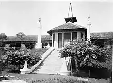 Garut sanatorium in the 1920s
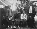 The Regent of Garut Raden Adipati Aria Wiratanudatar VII with his wife, RA Lasminingrat, and family.
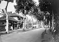 Garut's main street in 1936
Localities
Local produce
Land fertility varies greatly because of influence by mountains, rivers and coastal lowlands. As a result, agricultural businesses are primarily plantation-based, as well as subsistence farming and animal husbandry, followed by forest resources.
Some known products from Garut are:
- Garut Orange fruits (Jeruk Garut)
- Mangdogars Handycraft "Mang Dogar" as Garut Icon likes ornament, dolls, souvenir, clothes
- Garut Lamb (Domba Garut)
- Dodol Garut (a snack)
- Vetiver Root Oil (Andropogon zizanioides)
- Batik Tulis Garutan (hand painted clothes)
- Silk clothes
- Gemstones
- Leather crafts
- Bamboo crafts
Tourism in Garut
Garut is known as Zwitserse van Java (Switzerland of Java). It has so many tourist attractions divided into several tourism zone units (Indonesian: Satuan Kawasan Wisata (SKW)):
- Cangkuang TZU including Paragliding Mount Haruman, Cikembulan Zoo, Cimandi Racun Waterfall, Cangkuang Lake, Cangkuang Temple, Jafar Umar Sidiq Tomb,
- Cipanas TZU including Bagendit Lake, Citiis Waterfall, Mount Guntur, Cipanas Water Park
- Darajat Crater TZU including Darajat Crater and water parks around.
- Mbah Godog Tomb TZU including Godog Tomb, Linggaratu Tomb, Cinunuk Tomb, Talaga Bodas,
- Ngamplang TZU including Cihanyawar Waterfall, Flamboyan Golf Course, Dayeuh Manggung Tea Plantation,
- Pameungpeuk TZU including Darmaga Beach, Manulusu Beach, Gunung Geder, Santolo Beach, Neglasari Beach, Sayang Heulang Beach
- Papandayan TZU including Cimmanuk River Rafting, Ciburuy Site, Curug Orok, Papandayan Crater,
- Rancabuaya TZU including Rancabuaya Beach, Cikandang River Rafting, Sanghiyang Taraje Waterfall,
- Sancang TZU including Sancang Forest, Cijeruk Indah Beach and Karang Paranje Beach
References
- Badan Pusat Statistik, Jakarta, 2023, Kabupaten Garut Dalam Angka 2023 (Katalog-BPS 1102001.3205)
- Biro Pusat Statistik, Jakarta, 2011.
- Badan Pusat Statistik, Jakarta, 2021.
- "Council backs south Garut as new regency". The Jakarta Post. Retrieved July 22, 2019.
- Ika Krismantari, 'Garut: The Hidden Beauty of West Java', The Jakarta Post, 19 April 2011.
Bibliography
- Witton, Patrick (2003). Indonesia (7th edition). Melbourne: Lonely Planet. p. 191. ISBN 1-74059-154-2.
External links
![]() Media related to Garut Regency at Wikimedia Commons
Media related to Garut Regency at Wikimedia Commons