Gallatin National Forest
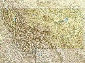
The Gallatin National Forest (now known as the Custer-Gallatin National Forest) is a United States National Forest located in South-West Montana. Most of the Custer-Gallatin goes along the state's southern border, with some of it a part of North-West Wyoming.
| Gallatin National Forest | |
|---|---|
 | |
  | |
| Location | Montana, United States |
| Nearest city | Bozeman, Montana |
| Coordinates | 45°16′21″N 110°22′06″W |
| Area | 2,129,194 acres (8,616.54 km2)[1] |
| Established | February 10, 1899[2] |
| Governing body | U.S. Forest Service |
| Website | Custer-Gallatin National Forest |
Geography
The forest area comprises a total of 3,411,239 acres (13,804.79 km2) with around 2,129,194 acres (8,616.54 km2) located in the Gallatin Forest area and 1,282,045 acres (5,188.25 km2) within the Custer. Most of the Gallatin borders Yellowstone National Park and is a part of the Greater Yellowstone Ecosystem, an area which encompasses almost 20,000,000 acres (81,000 km2) in and around the park. The Custer National Forest is spread out along Eastern Montana and the North-West side of Wyoming, with most of its land being held in Montana.[3] The forest stretches through about six counties, including Park, Gallatin, Sweet Grass, Madison, Carbon, and Meagher.
There are six separate mountain ranges within the forest including the Gallatin, Madison, Bridger, Crazy, Absaroka, and Beartooth Ranges. The Beartooth's are home to Granite Peak, which at 12,799 ft (3,901 m), is the highest point both in the forest and in Montana. A separate section of the forest north of Livingston, Montana, is located in the Crazy Mountains which rise over 7,000 ft (2,100 m) above the Great Plains to the east. The forest includes two wilderness areas, the Absaroka–Beartooth and the Lee Metcalf, along with some of the tributaries for the Yellowstone, Madison, and Missouri rivers.
Wilderness Areas
- Absaroka–Beartooth Wilderness (943,626 acres (3,818.72 km2))
- Lee Metcalf Wilderness (254,288 acres (1,029.07 km2)).
Wildlife and vegetation
While the lower elevations are often covered in grasses and sagebrush, higher altitudes support Douglas fir, with several species of spruce, cottonwood and aspen being the dominant tree species. Of the 4,000 mi (6,400 km) of streams and rivers there are major tributaries of the Yellowstone River, which bisects the western and eastern sections of the forest running through Paradise Valley. Major tributaries of the Missouri River, the Gallatin and Madison Rivers, also are found in the forest. The habitat supports over 300 wildlife species, including the grizzly bear, bald eagle, and peregrine falcon. Many western North American species are represented in this climax ecosystem including elk, mule deer, bison, moose, bighorn sheep, pronghorn, cougar, gray wolf and black bear.
Fish within the numerous rivers and other bodies of water include white sucker, longnose sucker, mountain sucker, longnose dace, western mosquitofish, mottled sculpin, and gamefish such as Yellowstone cutthroat trout, mountain whitefish, and the introduced rainbow trout, brown trout, and brook trout.[4] Various subspecies of trout are plentiful in the streams and they contribute to the forest being one of the preeminent fly fishing regions in the United States. The population of Yellowstone cutthroat trout in and near Gallatin National Forest have been at risk of hybridization with rainbow trout.[3]
History
The forest is a cross roads and homelands of a number of Indian tribes, and subject to the treaties, cultural traditions and practices of various tribes.[5]
The forest was founded in 1899 as a part of the Northern U.S. Forest Service, eventually being named after Albert Gallatin (1761–1849), a U.S. Secretary of the Treasury and scholar of Native American languages and cultures.
In 1959, a 7.2-magnitude earthquake occurred in Madison Canyon outside of Yellowstone National Park, resulting in a massive landslide that blocked the Madison River and formed what we know as Quake Lake.
As of 2014, the Gallatin National Forest and Custer National Forest were merged administratively in order to combat rising costs, with a new management plan created for both national forests in 2020.[6]
Management
Since 2014, the Gallatin and Custer National Forests are managed together as the Custer–Gallatin National Forest with a headquarters in Bozeman, Montana and an additional office in Billings.[3] There are seven local ranger district offices for the forest, with locations in West Yellowstone, Livingston, Bozeman, Gardiner, Ashland, and Red Lodge for Montana and Camp Crook for South Dakota.
Access

There's access to the forest off Interstate 90 South on U.S. Highway 89 from Livingston, Montana, to Gardiner, Montana, or South on U.S. 191 from Bozeman, Montana, to West Yellowstone.
Over 2,290 mi (3,690 km) of hiking trails are located in the forest providing access to wilderness areas and interlinking with trails in Yellowstone National Park. There are almost 40 vehicle accessible campgrounds scattered throughout the forest, numerous picnic areas, and even cabins that can be rented for a nominal fee through the forest's district offices. West Yellowstone, Montana provides access both into the forest and to Yellowstone National Park and is a popular snowmobile center during the winter. Nighttime temperatures can be below freezing any time of the year, and mosquitoes in the late spring and early summer are abundant. Summertime high temperatures average in the 70s Fahrenheit (21–26 °C), and the wintertime lows can drop below −40 degrees. Most of the precipitation falls in the form of snow with some places averaging over 33 ft (10 m) annually.
.jpg.webp) Daisy Pass near Cooke City, Montana
Daisy Pass near Cooke City, Montana.jpg.webp) A view of Gallatin National Forest in 1921
A view of Gallatin National Forest in 1921.jpg.webp) A photograph taken of the Forest in 1962
A photograph taken of the Forest in 1962.jpg.webp) Yellowstone National Park, seen from Gallatin
Yellowstone National Park, seen from Gallatin.jpg.webp) The remains of a building damaged by the 1959 Yellowstone earthquake
The remains of a building damaged by the 1959 Yellowstone earthquake
References
- "Land Areas of the National Forest System" (PDF). U.S. Forest Service. October 2021. Retrieved May 24, 2022.
- "The National Forests of the United States" (PDF). U.S. Forest Service. Archived from the original (PDF) on October 28, 2012. Retrieved June 25, 2012.
- "Land Areas of the National Forest System" (PDF). U.S. Forest Service. January 25, 2021. Retrieved May 24, 2022.
- Holton, George D. (2003). A field guide to Montana fishes. Howard E. Johnson, Wildlife, and Parks Montana. Department of Fish (3rd ed.). Helena, Mont.: Produced by Montana Fish, Wildlife & Parks. ISBN 1-56044-479-7. OCLC 34618216.
- Bergstrom, Mike (February 16, 2017). Assessment, Forest Plan Revision, Final Areas of Tribal Importance Report (PDF) (Report). Custer Gallatin National Forest.
- Lundquist, Laura (November 14, 2014). "Custer and Gallatin forests finalize merger". Bozeman Daily Chronicle. Retrieved May 24, 2022.