Dahiyat al-Assad
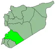
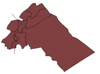
Dahiyat Harasta or Dahiyat al-Assad (Arabic: ضاحية حرستا or ضاحية الأسد, literally: Harasta Suburb or al-Assad Suburb) is a suburb in southern Syria, administratively part of the Rif Dimashq Governorate, located northeast of Damascus, near Harasta in Eastern Ghouta.
Dahiyat Harasta/Dahiyah al-Assad
ضاحية حرستا\ضاحية الأسد | |
|---|---|
 Dahiyat Harasta/Dahiyah al-Assad Location in Syria | |
| Coordinates: 33°34′52″N 36°21′36″E | |
| Country | |
| Governorate | Rif Dimashq |
| District | Douma |
| Subdistrict | Harasta |
| Population (2004 census) | |
| • Total | 9,858[1] |
History
The suburb was established in 1982 by Hafez al-Assad to house Syrian Arab Army officers and their families.[2]
On 4 September 2015, the Syrian Observatory for Human Rights reported that dozens of shells landed on Dahiyat al- Assad, information reported casualties. The clashes took place between the regime forces and allied militiamen against the rebel and Islamist factions.[3]
On 10 September 2015, non-State armed opposition groups made advances from Eastern Ghouta towards Tall al-Kurdi and reached positions close to Adra Prison and Dahiyat al-Assad. Around 15,000 civilians were temporarily displaced from Dahiyat al-Asad and surrounding areas as a result. Government forces subsequently halted the advances in Dahiyat al-Asad.[4]
On 12 September 2015, rebels pushed into the town of Dhahiyat Al-Assad, but were reportedly pushed back by the National Defence Forces (NDF).[5] Around 200 men of the 105th Brigade of the Republican Guard were brought in as reinforcements to recapture two hills overlooking Dhahiyat Al-Assad.[6]
References
- "The results of Population and Housing Census of 2004 at the level of city / village - area Harasta". CBSSYR. Archived from the original on December 9, 2019. Retrieved 2013-11-17.
- "Assad's Officer Ghetto: Why the Syrian Army Remains Loyal". Carnegie. 4 November 2015. Retrieved 20 July 2016.
- "Dozens of shells target Dahiyat al- Assad, while the regime forces advance on Damascus – Homs highway". Syrian Observatory for Human Rights. Retrieved 31 May 2016.
- "Report of the Secretary-General on the implementation of Security Council resolutions 2139 (2014), 2165 (2014) and 2191 (2014)". United Nations. Archived from the original on 14 April 2016. Retrieved 31 May 2016.
- IraqiSuryani. "status643830658339590144". Twitter. Retrieved 31 May 2016.
- Leith Fadel. "Jaysh Al-Islam Attempts to Break-Out of the East Ghouta". Al-Masdar News. Retrieved 14 September 2015.

