Den Ham, Westerkwartier
Den Ham is a linear village in the municipality of Westerkwartier in the Netherlands province Groningen. The village lies on the road from Aduard to Saaksum.
Den Ham | |
|---|---|
.jpg.webp) Reformed Church | |
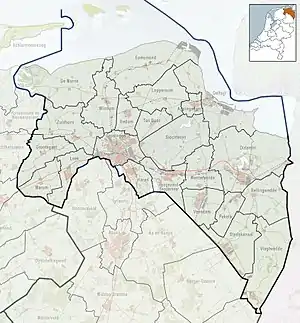 Den Ham Location of Den Ham in the province of Groningen  Den Ham Den Ham (Netherlands) | |
| Coordinates: 53°16′23″N 6°25′41″E | |
| Country | |
| Province | |
| Municipality | |
| Area | |
| • Total | 0.41 km2 (0.16 sq mi) |
| Elevation | 1.0 m (3.3 ft) |
| Population (2021)[1] | |
| • Total | 140 |
| • Density | 340/km2 (880/sq mi) |
| Postal code | 9883[1] |
| Dialing code | 0594 |
History
The village was first mentioned around 1475 as Horham. The current name means "bend in a waterway". The etymology of the earliest form is unclear.[3] De Ham is a road village which developed on the Aduard to Saaksum road in the Late Middle Ages as a linear settlement.[4]
The current Dutch Reformed church dates from 1729, however part of the wall is from its 1555 predecessor. The church was renovated in 1912 after a lightning strike which caused a fire.[4][5]
Den Ham was home to 341 people in 1840.[5] The village was part of the municipality of Aduard until 1989, when it became part of Zuidhorn. In 2019, it became part of Westerkwartier.[5]
Gallery
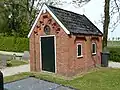 "Baarhuis" on the cemetery of Den Ham
.jpg.webp) The old bakery-grocery of W.E. Dijk
The old bakery-grocery of W.E. Dijk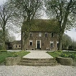
References
- "Kerncijfers wijken en buurten 2021". Central Bureau of Statistics. Retrieved 9 April 2022.
- "Postcodetool for 9883PA". Actueel Hoogtebestand Nederland (in Dutch). Het Waterschapshuis. Retrieved 8 April 2022.
- "Den Ham - (geografische naam)". Etymologiebank (in Dutch). Retrieved 9 April 2022.
- Ronald Stenvert & Redmer Alma (1998). "Den Ham" (in Dutch). Zwolle: Waanders. ISBN 90 400 9258 3. Retrieved 9 April 2022.
- "Den Ham (Zuidhorn)". Plaatsengids (in Dutch). Retrieved 9 April 2022.