Lutjegast
Lutjegast (Dutch pronunciation: [ˈlʏcəˌɣɑst]) is a village in the municipality of Westerkwartier in Groningen, Netherlands. It had a population of around 1,125 in January 2017.[3]
Lutjegast | |
|---|---|
 The Reformed Church in Lutjegast | |
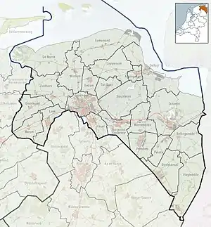
 Lutjegast Location in the province of Groningen in the Netherlands  Lutjegast Lutjegast (Netherlands) | |
| Coordinates: 53°14′0″N 6°15′28″E | |
| Country | |
| Province | |
| Municipality | |
| Area | |
| • Total | 19.89 km2 (7.68 sq mi) |
| Elevation | 2.3 m (7.5 ft) |
| Population (2021)[1] | |
| • Total | 1,120 |
| • Density | 56/km2 (150/sq mi) |
| Postal code | 9866[1] |
| Dialing code | 0594 |
History
The name Lutjegast originates from Gronings in which lutje means small or little and a ga(a)st is a higher, sandy ridge in an otherwise swampy area. The village was first mentioned in 1459 as "op de Lutkegast".[4] Lutjegast is a road village which developed on a sandy ridge.[5]
The Dutch Reformed church was built in 1877 and was restored in 1922. The Reformed Church is a cruciform church built in 1922 without a tower in expressionist style.[5]
Lutjegast was the birthplace of the explorer Abel Tasman. He is memorialised in town by a monument, plaque and street name. In 2014, a museum dedicated to Abel Tasman opened in the village house.[6]
Until 1828, a manor house named "Rikkerdaborg" stood in Lutjegast. Its most famous occupant was Bernard Johan Prott who was the commander of Bourtange in 1672. Christoph Bernhard von Galen, the Prince-bishop of Münster had allegedly offered Prott ƒ200,000.- to take Bourtange, however Prott refused the offer and von Galen was unable to take the fortress by force.[7]
Lutjegast was home to 294 people in 1840.[6] The village used to be part of the municipality of Grootegast. In 2019, it was merged into Westerkwartier.[6]
Notable people
- Abel Tasman (ca.1603–1659), explorer, first European to discover Tasmania.[8]
- Arjen Lubach (born 1979), comedian, author, music producer and TV presenter.
- Klaasje Meijer (born 1995), singer, actress and flautist
Gallery
 Rikkerdaborg
 Former clergy house
 View on Lutjegast
%252C_kristlik_grifformearde_tsjerke.jpg.webp) Reformed church in Lutjegast
Reformed church in Lutjegast
References
- "Kerncijfers wijken en buurten 2021". Central Bureau of Statistics. Retrieved 9 April 2022.
two entries
- "Postcodetool for 9866AA". Actueel Hoogtebestand Nederland (in Dutch). Het Waterschapshuis. Retrieved 9 April 2022.
- Kerncijfers wijken en buurten 2017 - CSB Statline
- "Lutjegast - (geografische naam)". Etymologiebank (in Dutch). Retrieved 9 April 2022.
- Ronald Stenvert & Redmer Alma (1998). "Lutjegast" (in Dutch). Zwolle: Waanders. ISBN 90 400 9258 3. Retrieved 9 April 2022.
- "Lutjegast". Plaatsengids (in Dutch). Retrieved 9 April 2022.
- "Rikkerdaborg". Groninger borgenpad (in Dutch). Retrieved 9 April 2022.
- Beazley, Charles Raymond (1911). . Encyclopædia Britannica. Vol. 26 (11th ed.). pp. 437–438.
External links
 Media related to Lutjegast at Wikimedia Commons
- (in Dutch) Lutjegast Online