Dijkshoek
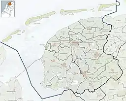
Dijkshoek (Dutch pronunciation: [ˈdɛi̯ks.ɦuk]; West Frisian: Dykshoeke) is a hamlet in the Dutch municipality of Waadhoeke in the province of Friesland. It is located near the Wadden Sea north of Tzummarum and northwest of Firdgum, of which it is a part administratively. The settlement of the hamlet is located on the Camstrawei, consisting of mainly farms on the edge of the Hornestreek.
Dijkshoek
| |
|---|---|
 Dijkshoek Location in the province of Friesland in the Netherlands  Dijkshoek Dijkshoek (Netherlands) | |
| Coordinates: 53.26129°N 5.54628°E | |
| Country | |
| Province | |
| Municipality | |
| Village | Firdgum |
| Elevation | 0.7 m (2.3 ft) |
| Population | |
| • Total | c. 15 |
| Time zone | UTC+1 (CET) |
| • Summer (DST) | UTC+2 (CEST) |
| Postcode | 8852 |
| Area code | 0518 |
Dijkshoek is mainly known for its location. It is a crossroads and border point; southwest of Westhoek, east of Koehool (where a bunker complex stood during the Second World War) and west of the Griene Dyk.
The hamlet was potentially first attested as Dijkshorn in 1287,[3] the year in which the region was completely destroyed by the St. Lucia's flood.[4] The hamlet later also appears as Dyckshoek in 1664,[5] Dijkshoek in 1840, and Dykshoek in 1841.[6] The name is a combination of dijk ('dyke') and hoek ('corner') as it is located on the corner of the Waddenzeedijk and the Griene Dyk.[6] There once was an inn located in the hamlet.[7][8]
The hamlet was part of the municipality of Barradeel until 1984, when it became part of Franekeradeel. In 2018, Franekeradeel became part of the current municipality of Waadhoeke.[2]
References
- "Postcodetool for 8852RJ". Actueel Hoogtebestand Nederland (in Dutch). Het Waterschapshuis. Retrieved 9 October 2023.
- "Dijkshoek". Plaatsengids (in Dutch). Retrieved 9 October 2023.
- Van Berkel, Gerard; Samplonius, Kees (2018). Nederlandse plaatsnamen verklaard (in Dutch). Mijnbestseller.nl. ISBN 9789463679176.
- "Verhaal Firdgum". Terpen en Wierden land (in Dutch). Retrieved 9 October 2023.
- Schotanus, Bernardus (1664). "Friese grietenij landkaarten van Bernardus Schotanus 1664 / Friesland 'county' maps 1664 - Het Bildt". Schotanus.us. Retrieved 9 October 2023.
- Gildemacher, Karel F. (2007). Friese plaatsnamen: alle steden, dorpen en gehuchten (in Dutch). Leeuwarden: Friese Pers/Noordboek. p. 254. ISBN 9789033006432.
- Van der Aa, A.J. (1851). Aardrijkskundig Woordenboek der Nederlanden (in Dutch).
- Leistra, W. "Buurtschap Dykshoek". Oud Tzummarum en Omstreken (in Dutch). Retrieved 9 October 2023.