Dongjum
Dongjum (Dutch pronunciation: [ˈdɔŋ.jʏm], West Frisian: Doanjum) is a village in Waadhoeke in the province Friesland of the Netherlands and has around the 326 citizens as of January 2014.[3]
Dongjum
Doanjum | |
|---|---|
Village | |
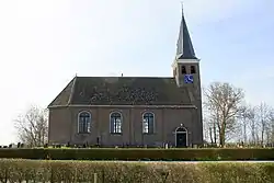 Dongjum church | |
 Coat of arms | |
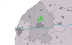 Location in the Franekeradeel municipality | |
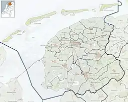 Dongjum Location in the Netherlands  Dongjum Dongjum (Netherlands) | |
| Coordinates: 53°12′32″N 5°32′34″E | |
| Country | |
| Province | |
| Municipality | |
| Area | |
| • Total | 3.50 km2 (1.35 sq mi) |
| Elevation | 0.4 m (1.3 ft) |
| Population (2021)[1] | |
| • Total | 375 |
| • Density | 110/km2 (280/sq mi) |
| Postal code | 8808[1] |
| Dialing code | 0517 |
History
Before 2018, the village was part of the Franekeradeel municipality. Dongjum consists of a group Artificial dwelling hills, on an old bank of a watercourse. The area needs as demonstrated by archaeological research already in Roman times have been occupied. From pottery excavated at the time that the residents were quite wealthy. From the end of the Roman Empire until the 5th century, the area was uninhabited for all thoughts.
Goslinga State
In the early 17th century was the stins Goslinga State built where later grietman and statesman Sicco van Goslinga lived, who died in 1731. The stins were demolished in 1803. In the church of Dongjum (1777) is a mausoleum of Sicco van Goslinga.
Community
Together with the nearby hamlet Boer, has Dongjum Since April 1969 the Association Village Importance Dongjum / Boer. The association maintains contacts with the municipality, housing association and social work. Dongjum has a public primary school called "De Twirre". Beside the school stands the villagehouse built in 2007, called De Boppeslach.
Population
- 1954 - 358
- 1959 - 358
- 1964 - 325
- 1969 - 352
- 1974 - 423
- 2004 - 362
Gallery
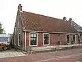 House in Donjum
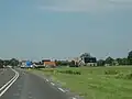 View on Dongjum
References
- "Kerncijfers wijken en buurten 2021". Central Bureau of Statistics. Retrieved 4 April 2022.
- "Postcodetool for 8808HA". Actueel Hoogtebestand Nederland (in Dutch). Het Waterschapshuis. Retrieved 4 April 2022.
- Aantal inwoners per buurt/dorp Archived 2012-08-12 at the Wayback Machine - Franekeradeel
External links
 Media related to Dongjum at Wikimedia Commons