Domagné
Domagné (French pronunciation: [dɔmaɲe]; Breton: Dovanieg) is a commune in the Ille-et-Vilaine department in Brittany in northwestern France.
Domagné
Dovanieg | |
|---|---|
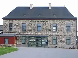 Town hall | |
 Coat of arms | |
Location of Domagné | |
 Domagné  Domagné | |
| Coordinates: 48°04′16″N 1°23′25″W | |
| Country | France |
| Region | Brittany |
| Department | Ille-et-Vilaine |
| Arrondissement | Fougères-Vitré |
| Canton | Châteaugiron |
| Intercommunality | CA Vitré Communauté |
| Government | |
| • Mayor (2020–2026) | Bernard Renou[1] |
| Area 1 | 29.00 km2 (11.20 sq mi) |
| Population | 2,422 |
| • Density | 84/km2 (220/sq mi) |
| Time zone | UTC+01:00 (CET) |
| • Summer (DST) | UTC+02:00 (CEST) |
| INSEE/Postal code | 35096 /35113 |
| Elevation | 43–96 m (141–315 ft) |
| Website | www |
| 1 French Land Register data, which excludes lakes, ponds, glaciers > 1 km2 (0.386 sq mi or 247 acres) and river estuaries. | |
Population
Inhabitants of Domagné are called Domagnéens in French.
| Year | Pop. | ±% p.a. |
|---|---|---|
| 1968 | 1,232 | — |
| 1975 | 1,220 | −0.14% |
| 1982 | 1,487 | +2.87% |
| 1990 | 1,499 | +0.10% |
| 1999 | 1,633 | +0.96% |
| 2007 | 1,975 | +2.41% |
| 2012 | 2,255 | +2.69% |
| 2017 | 2,305 | +0.44% |
| Source: INSEE[3] | ||
References
- "Répertoire national des élus: les maires". data.gouv.fr, Plateforme ouverte des données publiques françaises (in French). 2 December 2020.
- "Populations légales 2020". The National Institute of Statistics and Economic Studies. 29 December 2022.
- Population en historique depuis 1968, INSEE
External links
Wikimedia Commons has media related to Domagné.
- Mayors of Ille-et-Vilaine Association Archived 2012-01-14 at the Wayback Machine (in French)
This article is issued from Wikipedia. The text is licensed under Creative Commons - Attribution - Sharealike. Additional terms may apply for the media files.