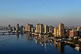
Downtown Cairo
Downtown Cairo (Egyptian Arabic: وسط البلد Wust al-Balad, "middle of town") is the colloquial name given to the 19th-century western expansion of Egypt's capital Cairo, between the historic medieval Cairo, and the Nile, which became the commercial center of the city during the 20th century.[1] Given its rich architectural heritage from the era of Khedive Ismail, it is has been officially named Khedival Cairo and declared by the government as a protected Area of Value,[2] with many of its buildings also deemed protected. Administratively Wust al-Balad covers areas of qism Qasr al-Nil, and the Abdeen and Ezbekia districts. The protected Khedival Cairo covers a larger area extending south to Sayida Zeinab.[2]
History
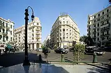
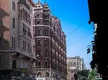
Downtown Cairo was designed by prestigious French architects who were commissioned by Khedive Ismail during his visit to Paris, and since then he wanted to make the Egyptian Kingdom capital better than Paris and to be the jewel of the orient. It was he who stressed the importance of European style urban planning in Cairo, to include broad, linear gridded streets, geometric harmony and modern European architectural style.
It was once home to the prosperous elite of late 19th and early 20th century Cairo. It is a relic of a bygone era — Egypt's belle epoque[3] — and demonstrates the vision for developing Egypt. Yet decades of neglect by the neighbourhood's landlords and tenants following the burning of most of Cairo's buildings during the popular Cairo fire incident prior to the 1952 Revolution led by Gamal Abdel Nasser, and the ensuing departure of the upper classes, have left the splendor of its ornate edifices mired in decay. Lax enforcement of laws and regulations gave way to the entry of commercial establishments into the neighborhood, mostly with no regard to maintaining aesthetic harmony or preserving the historic buildings of Downtown Cairo. Now, most of the historic buildings within the area have been renovated by the Ministry of housing, utilities and urban development.
Landmarks
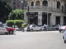
Tahrir Square
A major public town square in made internationally famous during the 2011 Egyptian Revolution.
Qasr al-Nil Street
One of Wust al-Balad's main streets, lined with vintage architecture from the late 19th and early 20th century European Beaux-Arts and Egyptian—Islamic—Moorish Revival styles.
Talaat Harb Street
Another important Wust al-Balad street, with famous cafes and restaurants.
Yacobian Building
A model of upper-class life in mid 20th Century Wust al-Balad, the Yacobian Building and its residents were fictionalised as a metaphor for Cairo's later deterioration in the award-winning novel The Yacobian Building.
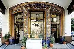
Groppi
Groppi is one of the first and most famous ice cream shops in Cairo, located in Talaat Harb Square. It was founded in 1909 by the Swiss Groppi family, survived the nationalization movement in the 1950s and 1960s, and was owned by the Groppi family until 1981 when it was bought by Abdul-Aziz Lokma.[4]
Café Riche
One of the most renowned downtown landmarks, on the 29th of Talaat Harb Street, is the Café Riche which opened in 1908.[5] At various times a meeting place for intellectuals and revolutionaries, the cafe witnessed many historically significant events over the 20th century. It is said to be where King Farouk saw his second wife,[5] Nariman Sadek; where the perpetrator of the 1919 failed assassination attempt on Egypt's last Christian Prime Minister, Youssef Wahba Pasha lay in wait for his target;[5] and where several members of the resistance during the 1919 revolution met in the basement to organize their activities and print their flyers. Patrons included Egyptian Nobel Prize winner and nationalist novelist Naguib Mahfouz and the then-future president Gamal Abdel Nasser.
Restoration
There has been renewed interest from the government and the private sector since the 2000s to restore Down Town/ Khedival Cairo. The government has done mostly cosmetic work, repainting facades and replacing store signage.[6]
See also
References
- "Khedivial Cairo". egymonuments.gov.eg. Retrieved 2023-03-26.
- Khedival Cairo protection boundaries (PDF) (in Arabic). Cairo: National Organistation for Urban Harmony. 2022.
- Volait, Mercedes (2013-02-02). "The reclaiming of "Belle Époque" Architecture in Egypt (1989-2010): On the Power of Rhetorics in Heritage-Making". ABE Journal (3). doi:10.4000/abe.371. ISSN 2275-6639.
- Salama, Vivian (August 20, 2012). The enduring charm of Café Groppi. Newsweek.com.
- "A Riche history: The café at the heart of revolutionary Cairo". The Economist. 17 December 2011. Retrieved 29 December 2011.
- "Behind the scenes of Egypt's project to face-lift Khedivial Cairo - Al-Monitor: Independent, trusted coverage of the Middle East". www.al-monitor.com. Retrieved 2023-03-26.

