Drouwenerveen
Drouwenerveen is a village in the Dutch province of Drenthe. It is a part of the municipality of Borger-Odoorn and lies about 20 km east of Assen.
Drouwenerveen | |
|---|---|
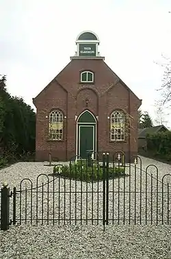 Church | |
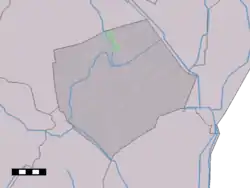 Drouwenerveen in the municipality of Borger-Odoorn. | |
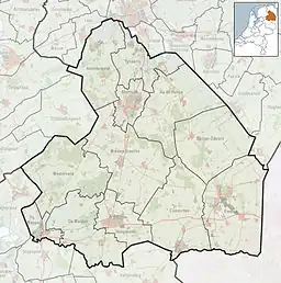 Drouwenerveen Location of the village in the province of Drenthe  Drouwenerveen Drouwenerveen (Netherlands) | |
| Coordinates: 52°58′N 6°51′E | |
| Country | Netherlands |
| Province | Drenthe |
| Municipality | Borger-Odoorn |
| Area | |
| • Total | 3.32 km2 (1.28 sq mi) |
| Elevation | 6 m (20 ft) |
| Population (2021)[1] | |
| • Total | 275 |
| • Density | 83/km2 (210/sq mi) |
| Time zone | UTC+1 (CET) |
| • Summer (DST) | UTC+2 (CEST) |
| Postal code | 9525[1] |
| Dialing code | 0599 |
The village was first mentioned in 1781 as "Gasselter en Drouwer Veenen", and means "the peat area belonging to Drouwen".[3] Drouwererveen started as a peat excavation village around 1820, and is a linear settlement along the road from Drouwen.[4]
Drouwenerveen was home to 305 people in 1840.[5] The Dutch Reformed church was built around 1915, and has become a residential house.[4]
References
- "Kerncijfers wijken en buurten 2021". Central Bureau of Statistics. Retrieved 10 April 2022.
- "Postcodetool for 9525TA". Actueel Hoogtebestand Nederland (in Dutch). Het Waterschapshuis. Retrieved 10 April 2022.
- "Drouwenerveen". Etymologiebank (in Dutch). Retrieved 10 April 2022.
- Ronald Stenvert (2001). Drouwenerveen (in Dutch). Zwolle: Waanders. p. 61. ISBN 90 400 9454 3. Retrieved 10 April 2022.
- "Drouwenerveen". Plaatsengids (in Dutch). Retrieved 10 April 2022.
Wikimedia Commons has media related to Drouwenerveen.
This article is issued from Wikipedia. The text is licensed under Creative Commons - Attribution - Sharealike. Additional terms may apply for the media files.