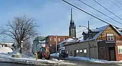
East Angus, Quebec
East Angus (French pronunciation: [istɛ̃ɡys]) is a city in Le Haut-Saint-François Regional County Municipality, in Quebec, Canada. The city had a population of 3,741 as of the Canada 2011 Census.
East Angus | |
|---|---|
 | |
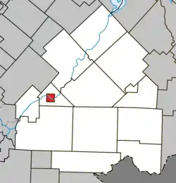 Location within Le Haut-Saint-François RCM | |
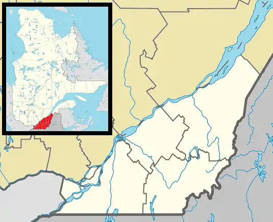 East Angus Location in southern Quebec | |
| Coordinates: 45°29′N 71°40′W[1] | |
| Country | |
| Province | |
| Region | Estrie |
| RCM | Le Haut-Saint-François |
| Constituted | March 14, 1912 |
| Government | |
| • Mayor | Robert G. Roy |
| • Federal riding | Compton—Stanstead |
| • Prov. riding | Mégantic |
| Area | |
| • Total | 8.30 km2 (3.20 sq mi) |
| • Land | 7.91 km2 (3.05 sq mi) |
| Population | |
| • Total | 3,741 |
| • Density | 472.7/km2 (1,224/sq mi) |
| • Pop 2006-2011 | |
| Time zone | UTC−5 (EST) |
| • Summer (DST) | UTC−4 (EDT) |
| Postal code(s) | |
| Area code | 819 |
| Highways | |
| Website | www |
Demographics
In the 2021 Census of Population conducted by Statistics Canada, East Angus had a population of 3,840 living in 1,653 of its 1,718 total private dwellings, a change of 4.9% from its 2016 population of 3,659. With a land area of 7.84 km2 (3.03 sq mi), it had a population density of 489.8/km2 (1,268.6/sq mi) in 2021.[4]
References
- "Reference number 142194 in Banque de noms de lieux du Québec". toponymie.gouv.qc.ca (in French). Commission de toponymie du Québec.
- "Geographic code 41060 in the official Répertoire des municipalités". www.mamh.gouv.qc.ca (in French). Ministère des Affaires municipales et de l'Habitation.
- "East Angus, Quebec (Code 2441060) Census Profile". 2011 census. Government of Canada - Statistics Canada.
- "Population and dwelling counts: Canada, provinces and territories, and census subdivisions (municipalities), Quebec". Statistics Canada. February 9, 2022. Retrieved August 29, 2022.
External links
 Media related to East Angus, Quebec at Wikimedia Commons
| Cities & Towns | |
|---|---|
| Municipalities | |
| Townships | |
| |
This article is issued from Wikipedia. The text is licensed under Creative Commons - Attribution - Sharealike. Additional terms may apply for the media files.