Hampden, Quebec
Hampden is a township municipality of about 200 people in Le Haut-Saint-François Regional County Municipality, in the Estrie region of Quebec, Canada.
Hampden | |
|---|---|
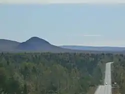 Pain de Sucre | |
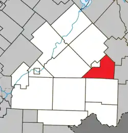 Location within Le Haut-Saint-François RCM | |
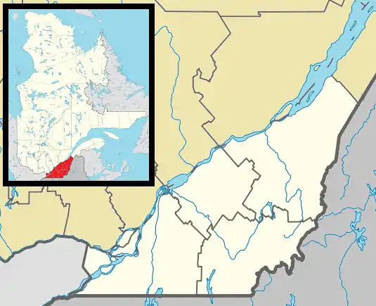 Hampden Location in southern Quebec | |
| Coordinates: 45.5°N 71.25°W[1] | |
| Country | |
| Province | |
| Region | Estrie |
| RCM | Le Haut-Saint-François |
| Constituted | January 1, 1874 |
| Government | |
| • Mayor | Bertrand Prévost |
| • Federal riding | Compton—Stanstead |
| • Prov. riding | Mégantic |
| Area | |
| • Total | 111.80 km2 (43.17 sq mi) |
| • Land | 111.68 km2 (43.12 sq mi) |
| Population | |
| • Total | 193 |
| • Density | 1.7/km2 (4/sq mi) |
| • Pop 2016-2021 | |
| Time zone | UTC−5 (EST) |
| • Summer (DST) | UTC−4 (EDT) |
| Postal code(s) | |
| Area code | 819 |
| Highways | |
| Website | www |
Demographics
In the 2021 Census of Population conducted by Statistics Canada, Hampden had a population of 193 living in 87 of its 114 total private dwellings, a change of 9.7% from its 2016 population of 176. With a land area of 111.68 km2 (43.12 sq mi), it had a population density of 1.7/km2 (4.5/sq mi) in 2021.[4]
References
- "Reference number 27855 in Banque de noms de lieux du Québec". toponymie.gouv.qc.ca (in French). Commission de toponymie du Québec.
- "Geographic code 41075 in the official Répertoire des municipalités". www.mamh.gouv.qc.ca (in French). Ministère des Affaires municipales et de l'Habitation.
- "Census Profile, 2021 Census - Hampden, Canton (Municipalité de), Quebec". 29 March 2023.
- "Population and dwelling counts: Canada, provinces and territories, and census subdivisions (municipalities), Quebec". Statistics Canada. February 9, 2022. Retrieved August 28, 2022.
External links
 Media related to Hampden, Quebec at Wikimedia Commons
Places adjacent to Hampden, Quebec | |
|---|---|
| Cities & Towns | |
|---|---|
| Municipalities | |
| Townships | |
| |
This article is issued from Wikipedia. The text is licensed under Creative Commons - Attribution - Sharealike. Additional terms may apply for the media files.