Elgin Vale, Queensland
Elgin Vale is a rural locality in the Gympie Region, Queensland, Australia.[2] In the 2016 census, Elgin Vale had a population of 24 people.[1]
| Elgin Vale Queensland | |||||||||||||||
|---|---|---|---|---|---|---|---|---|---|---|---|---|---|---|---|
.jpg.webp) Elgin Vale Sawmill, 2008 | |||||||||||||||
 Elgin Vale | |||||||||||||||
| Coordinates | 26.4316°S 152.2094°E | ||||||||||||||
| Population | 24 (2016 census)[1] | ||||||||||||||
| • Density | 0.204/km2 (0.528/sq mi) | ||||||||||||||
| Postcode(s) | 4615 | ||||||||||||||
| Area | 117.7 km2 (45.4 sq mi) | ||||||||||||||
| Time zone | AEST (UTC+10:00) | ||||||||||||||
| Location | |||||||||||||||
| LGA(s) | Gympie Region | ||||||||||||||
| State electorate(s) | Nanango | ||||||||||||||
| Federal division(s) | Wide Bay | ||||||||||||||
| |||||||||||||||
Geography
Tinglemara is neighbourhood in the west of the locality (26.4333°S 152.1833°E).[3][4]
History
In 1847 John Mortimer selected Manumbar, a 64,000-acre (26,000 ha) holding between Nanango and present day Goomeri, which included the site of the Elgin Vale sawmill.[5]
When land was resumed from the Gallangowan run of Manumbar in 1878, 400 acres (160 ha) were set aside for a Camping and Water Reserve (R.81) at the confluence of the Gallangowan and Moonda-Waamba Creeks. It was on Mortimer's recommendation that this area was gazetted, as it was the only permanent source of water in the locality. In 1879, Messrs J & A Porter took up much of the surrounding land, constructing a homestead "Elgin Vale" in close proximity to the reserve.[5]
Elgin Vale Provisional School opened in May 1899 and closed in 1905.[6]
The first sawmill located on Camping and Water Reserve 81, (also known as Scrubby Paddock), was established by Ross and Company in 1908. This operation is thought to have moved to Goomeri in 1914.[5]
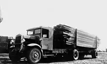
During 1926–27, Thomas Herbert (Harry) Spencer established a new sawmill at Elgin Vale, by relocating his sawmill at Sefton (north of Kilkivan) to the reserve. Commercial processing of timber was underway by late 1927.[5]
The establishment of the sawmill brought workers and their families to the area. The second Elgin Vale Provisional School opened on 24 January 1927, becoming Elgin Vale State School in 1948.[6] It was at 2876 Manumbar Road (26.4409°S 152.1950°E) adjacent to the sawmill.[7][8][4] The school closed on 10 August 1979.[6] In 1982, the school building was bought by the Elgin Vale branch of the Queensland Country Women's Association.[5][9]
The sawmill was bought and sold over the years, but, by 1986, there was not sufficient timber in the local area to keep the mill viable. The Elgin Vale sawmill ceased operating as a commercial venture on 16 March 1987.[5]
In the 2016 census, Elgin Vale had a population of 24 people.[1]
Heritage listings

Elgin Vale has a number of heritage-listed sites, including:
- Elgin Vale Sawmill, Manumbar Road (26.444°S 152.1923°E)[5]
Education
There are no schools in Elgin Vale. The nearest government primary school is Moffatdale State School in Moffatdale to the north-west. The nearest government secondary schools are Goomeri State School (to Year 10) in Goomeri to the north, Murgon State High School (to Year 12) in Murgon to the north-west, and Nanango State High School (to Year 12) in Nanango to the south-west.[4]
Community groups
The Elgin Vale branch of the Queensland Country Women's Association meets at the QCWA Rooms at the former Elgin Vale State School.[10]
References
- Australian Bureau of Statistics (27 June 2017). "Elgin Vale (SSC)". 2016 Census QuickStats. Retrieved 20 October 2018.
- "Elgin Vale – locality in Gympie Region (entry 46327)". Queensland Place Names. Queensland Government. Retrieved 7 March 2022.
- "Tinglemara – locality unbounded in Gympie Regional (entry 34637)". Queensland Place Names. Queensland Government. Retrieved 7 March 2022.
- "Queensland Globe". State of Queensland. Retrieved 6 May 2022.
- "Elgin Vale Sawmill (entry 602762)". Queensland Heritage Register. Queensland Heritage Council. Retrieved 1 August 2014.
- Queensland Family History Society (2010), Queensland schools past and present (Version 1.01 ed.), Queensland Family History Society, ISBN 978-1-921171-26-0
- "Manumbar" (Map). Queensland Government. 1943. Archived from the original on 5 May 2022. Retrieved 6 May 2020.
- "Parish of Gallangowan" (Map). Queensland Government. 1971. Archived from the original on 5 May 2022. Retrieved 6 May 2022.
- Thurecht, Lois (6 August 2014). "Back To Elgin Vale Reunion". southburnett.com.au. Archived from the original on 5 May 2022. Retrieved 5 May 2022.
- "Branch Locations". Queensland Country Women's Association. Archived from the original on 26 December 2018. Retrieved 26 December 2018.
Attribution
![]() This Wikipedia article incorporates text from "The Queensland heritage register" published by the State of Queensland under CC-BY 3.0 AU licence (accessed on 7 July 2014, archived on 8 October 2014).
This Wikipedia article incorporates text from "The Queensland heritage register" published by the State of Queensland under CC-BY 3.0 AU licence (accessed on 7 July 2014, archived on 8 October 2014).