Extertal
Extertal is a municipality in the Lippe district of North Rhine-Westphalia, Germany, with c. 11,500 inhabitants (2013).
Extertal | |
|---|---|
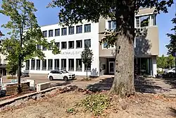 Town hall | |
 Coat of arms | |
Location of Extertal within Lippe district 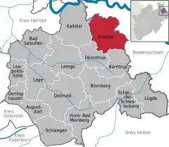 | |
 Extertal 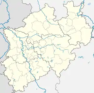 Extertal | |
| Coordinates: 52°04′00″N 09°07′00″E | |
| Country | Germany |
| State | North Rhine-Westphalia |
| Admin. region | Detmold |
| District | Lippe |
| Subdivisions | 12 |
| Government | |
| • Mayor (2020–25) | Frank Meier[1] |
| Area | |
| • Total | 92.49 km2 (35.71 sq mi) |
| Elevation | 240 m (790 ft) |
| Population (2021-12-31)[2] | |
| • Total | 10,926 |
| • Density | 120/km2 (310/sq mi) |
| Time zone | UTC+01:00 (CET) |
| • Summer (DST) | UTC+02:00 (CEST) |
| Postal codes | 32699 |
| Dialling codes | 05262, 05751, 05754 |
| Vehicle registration | LIP |
| Website | www.extertal.de |
Extertal is located on the northern edge of the circle in the Teutoburg Nature Reserve, directly adjacent to Lower Saxony. The Exter and Humme rivers flow through the region. The municipality has its headquarters in the Bösingfeld district. Neighbouring cities are Rinteln, Aerzen, Barntrup, Dörentrup and Kalletal.
The highest point of the city is at 371 metres above sea level. The municipality dimensions are about 12.2 kilometres east-west and about 12.5 kilometres north-south.
Mayors
Elected in September 2020, the mayor of Extertal is Frank Meier.[1]
Churches and religious communities
- Evangelical Reformed Church (Church of Lippe) in Bösingfeld, Mittelstrasse 33
- Evangelical Reformed Church (Church of Lippe) in Almena, Kirchstrasse 1, 32699 Extertal-Almena
- Evangelical Reformed Church (Church of Lippe) in Silixen, Dietrich-Bonhoeffer-Strasse 5
- Catholic Church: Adolf-Kolping-Weg 1
- Free Evangelical Community: Mühlenstrasse 4
- Jehovah's Witnesses: Papenweg 2
- New Apostolic Church: Bahnhofstrasse
References
- Wahlergebnisse in NRW Kommunalwahlen 2020, Land Nordrhein-Westfalen, accessed 21 June 2021.
- "Bevölkerung der Gemeinden Nordrhein-Westfalens am 31. Dezember 2021" (in German). Landesbetrieb Information und Technik NRW. Retrieved 20 June 2022.
External links
- Official website (in German)
Towns and municipalities in Lippe | ||
|---|---|---|
Coat of Arms of Lippe district | ||
This article is issued from Wikipedia. The text is licensed under Creative Commons - Attribution - Sharealike. Additional terms may apply for the media files.