Garmab Rural District
Garmab Rural District (Persian: دهستان گرماب)[3] is in Chahardangeh District of Sari County, Mazandaran province, Iran.
Garmab Rural District
Persian: دهستان گرماب | |
|---|---|
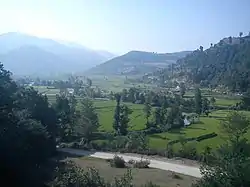 Pol-e Garmab | |
 Garmab Rural District | |
| Coordinates: 36°18′23″N 53°24′20″E[1] | |
| Country | Iran |
| Province | Mazandaran |
| County | Sari |
| District | Chahardangeh |
| Population (2016)[2] | |
| • Total | 5,804 |
| Time zone | UTC+3:30 (IRST) |
At the National Census of 2006, its population was 6,610 in 1,554 households.[4] There were 5,533 inhabitants in 1,638 households at the following census of 2011.[5] At the most recent census of 2016, the population of the rural district was 5,804 in 1,971 households. The largest of its 35 villages was Churet, with 1,008 people.[2]
References
- OpenStreetMap contributors (30 May 2023). "Garmab Rural District (Sari County)" (Map). OpenStreetMap. Retrieved 30 May 2023.
- "Census of the Islamic Republic of Iran, 1395 (2016)". AMAR (in Persian). The Statistical Center of Iran. p. 02. Archived from the original (Excel) on 7 October 2021. Retrieved 19 December 2022.
- Iranian National Committee for Standardization of Geographical Names website (in Persian)
- "Census of the Islamic Republic of Iran, 1385 (2006)". AMAR (in Persian). The Statistical Center of Iran. p. 02. Archived from the original (Excel) on 20 September 2011. Retrieved 25 September 2022.
- "Census of the Islamic Republic of Iran, 1390 (2011)" (Excel). Iran Data Portal (in Persian). The Statistical Center of Iran. p. 02. Retrieved 19 December 2022.
This article is issued from Wikipedia. The text is licensed under Creative Commons - Attribution - Sharealike. Additional terms may apply for the media files.