Garnakar, Nagorno-Karabakh
Garnakar (Armenian: Գառնաքար) or Chormanly (Azerbaijani: Çormanlı) is a village that is, de facto, in the Martakert Province of the breakaway Republic of Artsakh; de jure, it is in the Kalbajar District of Azerbaijan, in the disputed region of Nagorno-Karabakh. The village has an ethnic Armenian-majority population, and also had an Armenian majority in 1989.[2]
Garnakar / Chormanly
Գառնաքար / Çormanlı | |
|---|---|
 Garnakar / Chormanly  Garnakar / Chormanly | |
| Coordinates: 40°02′06″N 46°34′05″E | |
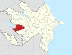
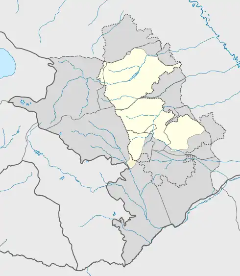
| Country (de facto) | |
| • Province | Martakert |
| Country (de jure) | |
| • District | Kalbajar |
| Elevation | 964 m (3,163 ft) |
| Population (2015)[1] | |
| • Total | 161 |
| Time zone | UTC+4 (AMT) |
History
During the Soviet period, the village was part of the Mardakert District of the Nagorno-Karabakh Autonomous Oblast.
Historical heritage sites
Historical heritage sites in and around the village include the 9th-century Hamami Church (Armenian: Համամի եկեղեցի, romanized: Hamami Yekeghetsi), the church of Hangats (Armenian: Հանգած) from between the 11th and 13th centuries, the fortress of Natarin (Armenian: Նատարին) or Ded (Armenian: Դեդ), the church of Mughdusi (Armenian: Մուղդուսի), two villages – one of them named Hamami Dzor (Armenian: Համամի ձոր), a cemetery and khachkars from between the 12th and the 13th centuries, the Mughdusi Cave, and an 18th/19th-century cemetery.[1]
Economy and culture
The population is mainly engaged in agriculture and animal husbandry. As of 2015, the village has a municipal building, a school, two shops, and a medical centre.[1]
References
- Hakob Ghahramanyan. "Directory of socio-economic characteristics of NKR administrative-territorial units (2015)".
- Андрей Зубов. "Андрей Зубов. Карабах: Мир и Война". drugoivzgliad.com.
- "The Results of the 2005 Census of the Nagorno-Karabakh Republic" (PDF). National Statistic Service of the Republic of Artsakh.
External links
Capital: Martakert | ||
| Urban communities |  | |
| Rural communities |
| |
| Not under Artsakh control | ||