Goënga
Goënga (West Frisian: Goaiïngea) is a village in Súdwest-Fryslân municipality in the province of Friesland, the Netherlands. It had a population of around 240 in January 2017.[3]
Goënga
Goaiïngea | |
|---|---|
Village | |
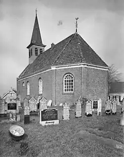
 Goënga Church (1959) | |
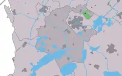
 Location in the former Wymbritseradiel municipality | |
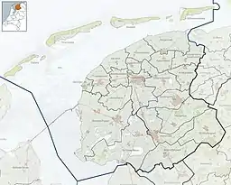
 Goënga Location in the Netherlands  Goënga Goënga (Netherlands) | |
| Coordinates: 53°3′16″N 5°41′33″E | |
| Country | |
| Province | |
| Municipality | |
| Area | |
| • Total | 1.52 km2 (0.59 sq mi) |
| Elevation | −0.2 m (−0.7 ft) |
| Population (2021)[1] | |
| • Total | 255 |
| • Density | 170/km2 (430/sq mi) |
| Postal code | 8628[1] |
| Dialing code | 0515 |
History
The village was first mentioned in 13th century as Goingum, and means "settlement of the people of Goaije".[4] Goënga is a terp (artificial living hill) village from the middle ages.[5] It was located to the east of the former Middelzee.[6] It was connected to Sneek via a canal.[5]
The Dutch Reformed church dates from 1758 and has a tower from 1787 which contains a bell from 1342 made by Stephanus.[5] The former clergy house has been turned into a private house.[7]
Goënga was home to 183 people in 1840.[7] Before 2011, the village was part of the Wymbritseradiel municipality. Nowadays it a part of the Súdwest-Fryslân.[7]
Gallery
 Houses in Goënga
 View on Goënga
References
- "Kerncijfers wijken en buurten 2021". Central Bureau of Statistics. Retrieved 5 April 2022.
two entries
- "Postcodetool for 8628EK". Actueel Hoogtebestand Nederland (in Dutch). Het Waterschapshuis. Retrieved 5 April 2022.
- Kerncijfers wijken en buurten 2017 - CBS Statline
- "Goënga - (geografische naam)". Etymologiebank (in Dutch). Retrieved 5 April 2022.
- Ronald Stenvert & Sabine Broekhoven (2000). "Goënga" (in Dutch). Zwolle: Waanders. ISBN 90 400 9476 4. Retrieved 5 April 2022.
- "Goënga". Friesland Wonderland (in Dutch). Retrieved 5 April 2022.
- "Goënga". Plaatsengids (in Dutch). Retrieved 5 April 2022.