Tjalhuizum
Tjalhuizum (West Frisian: Tsjalhuzum) is a small village in Súdwest-Fryslân in the province Friesland of the Netherlands. It had a population of around 25 in January 2017.[3]
Tjalhuizum
Tsjalhuzum | |
|---|---|
Village | |
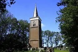
 Tjalhuizum Church Tower | |
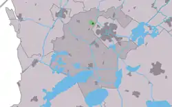
 Location in the former Wymbritseradiel municipality | |
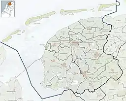
 Tjalhuizum Location in the Netherlands  Tjalhuizum Tjalhuizum (Netherlands) | |
| Coordinates: 53°2′44″N 5°36′43″E | |
| Country | |
| Province | |
| Municipality | |
| Area | |
| • Total | 0.96 km2 (0.37 sq mi) |
| Elevation | 0.6 m (2.0 ft) |
| Population (2021)[1] | |
| • Total | 20 |
| • Density | 21/km2 (54/sq mi) |
| Postal code | 8772[1] |
| Dialing code | 0515 |
History
The village was first mentioned in the 13th century as Tyelahusum, and means "settlement of Tjalle".[4] The church was demolished in 1817, however the tower has remained standing.[5]
Tjalhuizum was home to 51 people in 1840.[5] In 1972, a 10 metres (33 ft) high World War II monument has been placed in Tjalhuizum along the IJsbrechtum naar Nijland. The monument serves as a remembrance for the lost lives in the municipality of Wymbritseradiel.[6] Annually on 4 May, the school children from IJsbrechtum and Nijland walk to the monument, observe two of minutes of silence at 20:00 followed by the signing of the Frisian anthem.[5] Before 2011, the village was part of the Wymbritseradiel municipality.[5]
Gallery
 Tsjalhuzum, war monument
References
- "Kerncijfers wijken en buurten 2021". Central Bureau of Statistics. Retrieved 6 April 2022.
- "Postcodetool for 8772AA". Actueel Hoogtebestand Nederland (in Dutch). Het Waterschapshuis. Retrieved 6 April 2022.
- Kerncijfers wijken en buurten 2017 - CBS Statline
- "Tjalhuizum - (geografische naam)". Etymologiebank (in Dutch). Retrieved 6 April 2022.
- "Tjalhuizum". Plaatsengids (in Dutch). Retrieved 6 April 2022.
- "De Hoanne (Oorlogsmonument)". Keunstwurk (in Dutch). Retrieved 6 April 2022.
External links
![]() Media related to Tjalhuizum at Wikimedia Commons
Media related to Tjalhuizum at Wikimedia Commons