Gorenje, Kočevje
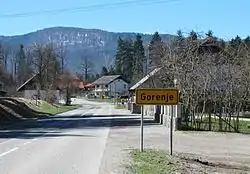
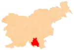
Gorenje (pronounced [ɡɔˈɾeːnjɛ]; in older sources also Gornja vas,[2][3] German: Obrern[3][4]) is a settlement north of Kočevje in southern Slovenia. The area is part of the traditional region of Lower Carniola and is now included in the Southeast Slovenia Statistical Region.[5] It includes the hamlets of Pri Studencu (German: Bein Brunnwirth)[3] and Plumbirt.[6]
Gorenje | |
|---|---|
 | |
 Gorenje Location in Slovenia | |
| Coordinates: 45°40′17″N 14°51′18″E | |
| Country | |
| Traditional region | Lower Carniola |
| Statistical region | Southeast Slovenia |
| Municipality | Kočevje |
| Area | |
| • Total | 0.68 km2 (0.26 sq mi) |
| Elevation | 498 m (1,634 ft) |
| Population (2002) | |
| • Total | 327 |
| [1] | |
Name
The name Gorenje is shared by several settlements in Slovenia. It arose through ellipsis of Gorenje selo (literally, 'upper village'), denoting the elevation of the place in relation to a neighboring settlement.[7] Gorenje stands about 18 meters (59 ft) higher than the neighboring villages to the west.
Cultural heritage
A small late 19th-century chapel in the centre of the village is dedicated to Saint Joseph.[8]
References
- Statistical Office of the Republic of Slovenia
- Intelligenzblatt zur Laibacher Zeitung, no. 141. 24 November 1849, p. 26.
- Leksikon občin kraljestev in dežel zastopanih v državnem zboru, vol. 6: Kranjsko. 1906. Vienna: C. Kr. Dvorna in Državna Tiskarna, pp. 42–43.
- Ferenc, Mitja. 2007. Nekdanji nemški jezikovni otok na kočevskem. Kočevje: Pokrajinski muzej, p. 4.
- Kočevje municipal site
- Savnik, Roman (1971). Krajevni leksikon Slovenije, vol. 2. Ljubljana: Državna založba Slovenije. p. 222.
- Snoj, Marko (2009). Etimološki slovar slovenskih zemljepisnih imen. Ljubljana: Modrijan. pp. 143–144.
- Slovenian Ministry of Culture register of national heritage reference number ešd 14005
External links
 Media related to Gorenje at Wikimedia Commons
- Gorenje on Geopedia
- Pre–World War II map of Gorenje with oeconyms and family names


