Gurdari
Gurdari is a village/ Bauxite mining centre in the Bishunpur CD block in the Gumla subdivision of the Gumla district in the Indian state of Jharkhand.
Gurdari | |
|---|---|
Village | |
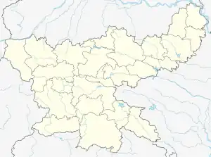
 Gurdari Location in Jharkhand, India  Gurdari Gurdari (India) | |
| Coordinates: 23.334048°N 84.252568°E | |
| Country | |
| State | Jharkhand |
| District | Gumla |
| Government | |
| • Type | Federal democracy |
| Population (2011) | |
| • Total | 3,432 |
| Languages * | |
| • Official | Hindi, Urdu |
| Time zone | UTC+5:30 (IST) |
| PIN | 835220 |
| Telephone/ STD code | 06524 |
| Vehicle registration | JH 07 |
| Literacy | 70.14% |
| Lok Sabha constituency | Lohardaga |
| Vidhan Sabha constituency | Bishunpur |
| Website | gumla |
Geography
M: municipality, CT: census town, R: rural/ urban centre, H: historical/ religious centre, T: tourist centre, B: Bauxite mining centre
Owing to space constraints in the small map, the actual locations in a larger map may vary slightly
Location
Gurdari is located at 23.334048°N 84.252568°E
Area overview
The map alongside presents a rugged area, consisting partly of flat-topped hills called pat and partly of an undulating plateau, in the south-western portion of Chota Nagpur Plateau. Three major rivers – the Sankh, South Koel and North Karo - along with their numerous tributaries, drain the area. The hilly area has large deposits of Bauxite. 93.7% of the population lives in rural areas.[1][2]
Note: The map alongside presents some of the notable locations in the district. All places marked in the map are linked in the larger full screen map.
Civic administration
There is a police station at Gurdari.[3]
Demographics
According to the 2011 Census of India, Gurdari had a total population of 3,432, of which 1,864 (54%) were males and 1,568 (46%) were females. Population in the age range 0–6 years was 622. The total number of literate persons in Gurdari was 1,971 (70.14% of the population over 6 years).[4]
(*For language details see Bishunpur block#Language and religion)
Bauxite mining
Bauxite and laterite (aluminium ore) is found in "villages of Amtipani, Langdatanr, Chirodih, Jalim, Narma, Bahagara and Gurdari of Bishunpur block, Langatanr, Lupungpat and Chota-agiatu in Chainpur block and Hanrup, Serengdag and Jalim in Ghaghra block. The total number of bauxite mines is twenty one".[5]
In Gumla district the mines are operated manually/ semi-mechanised methods. After blasting, manual sorting and sizing of bauxite from the run of mine ore is practiced in the mine.[6][7]
Gurdari Bauxite Mining Project, covering 584.19 ha, is operated by Hindalco Industries.[8]
References
- "District Census Handbook, Gumla, Series 21, Part XII A" (PDF). page 7: Natural Divisions, Page 38: 2011 Census Findings–Population and its Distribution. Directorate of Census Operations Jharkhand. Retrieved 29 October 2021.
- "Chota Nagpur plateau". Britannica. Retrieved 29 October 2021.
- "District Police Profile - Gumla". Jharkhand Police. Retrieved 25 October 2021.
- "District Census Handbook, Gumla, Series 21, Part XII B" (PDF). Rural PCA-C.D. blocks wise Village Primary Census Abstract, location no. 375487, pages 54-55. Directorate of Census Operations Jharkhand. Retrieved 25 October 2021.
- "District Gumla:Backward Region Grant Fund, Annual Action Plan, 2011-2012" (PDF). Page 6: Natural Resources / Minerals. District Administration, Gumla. Retrieved 25 October 2021.
- "Mining and Production of Bauxite in India" (PDF). Bauxite Mnograph. Retrieved 25 October 2021.
- "MCDR Inspection Report" (PDF). Page 6: Exploitation. Indian Bureau of Mines – Minerals Development and Regulation Department. Retrieved 25 October 2021.
- "Environment Clearance for Gurdari Bauxite Mining Project" (PDF). Page 6. Hindalco – Aditya Birla Group. Retrieved 25 October 2021.