Kairo, Lohardaga
Kairo is a village in the Kairo CD block in the Lohardaga Sadar subdivision of the Lohardaga district in the Indian state of Jharkhand.
Kairo | |
|---|---|
Village | |
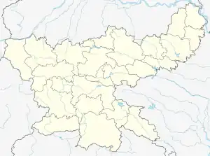
 Kairo Location in Jharkhand, India  Kairo Kairo (India) | |
| Coordinates: 23.4517°N 84.8276°E | |
| Country | |
| State | Jharkhand |
| District | Lohardaga |
| Government | |
| • Type | Federal democracy |
| Population (2011) | |
| • Total | 4,553 |
| Languages * | |
| • Official | Hindi, Urdu |
| Time zone | UTC+5:30 (IST) |
| PIN | 835213 |
| Telephone/ STD code | 06526 |
| Vehicle registration | JH 08 |
| Literacy | 65.83% |
| Lok Sabha constituency | Lohardaga |
| Vidhan Sabha constituency | Loharadaga |
| Website | lohardaga |
Geography
M: municipality, R: rural/ urban centre, B: Bauxite mining centre
Owing to space constraints in the small map, the actual locations in a larger map may vary slightly
Location
Kairo is located at 23.4517°N 84.8276°E
Area overview
The map alongside shows an undulating plateau area with the hilly tract in the west and north-west. Three Bauxite mining centres are marked. It is an overwhelmingly rural district with 87.6% of the population living in the rural areas.[1]
Note: The map alongside presents some of the notable locations in the district. All places marked in the map are linked in the larger full screen map.
Civic administration
Police station
There is a police station at Kairo.[2]
CD block HQ
The headquarters of Kairo CD block are located at Kairo village.[3]
Demographics
According to the 2011 Census of India, Kairo had a total population of 4,553, of which 2,309 (51%) were males and 2,244 (49%) were females. Population in the age range 0–6 years was 731. The total number of literate persons in Kairo was 2,516 (65.83% of the population over 6 years).[4]
(*For language details see Kairo block#Language and religion)
Education
R.P. Memorial Public School is a Hindi-medium coeducational institution established at Utka in 2012 and managed by an unrecognised body. It has facilities for teaching from class VI to class XII.[5]
References
- "District Census Handbook, Lohardaga, Series 21, Part XII A" (PDF). Page 9: Physical features, Page 22: Census findings. Directorate of Census Operations Jharkhand. Retrieved 23 October 2021.
- "District Police Profile - Lohardaga". Jharkhand Police. Retrieved 22 October 2021.
- "District Census Handbook, Lohardga, Series 21, Part XII A" (PDF). Map of Lohardaga district on the third page. Directorate of Census Operations Jharkhand. Retrieved 22 October 2021.
- "District Census Handbook, Lohardaga, Series 21, Part XII B" (PDF). Rural PCA-C.D. blocks wise Village Primary Census Abstract, location no. 363043, page 86-87. Directorate of Census Operations Jharkhand. Retrieved 22 October 2021.
- "R.P.Memorial Public School". Schools.org. Retrieved 22 October 2021.