Haiming, Tyrol
Haiming is a municipality and the name of its largest town, located in the district of Imst in the Austrian state of Tyrol.
Haiming | |
|---|---|
 Coat of arms | |
 Location in the district | |
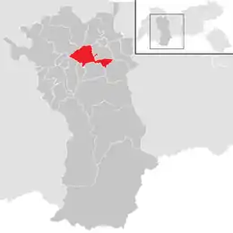
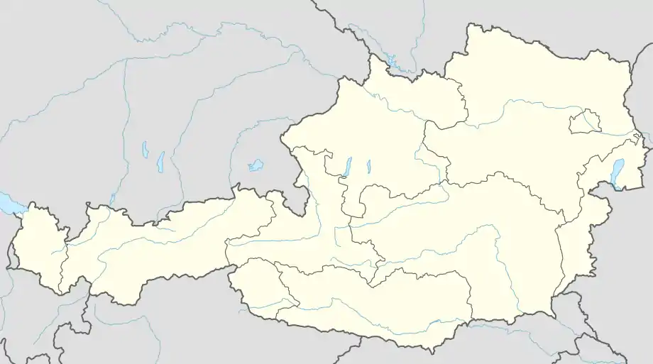 Haiming Location within Austria | |
| Coordinates: 47°15′12″N 10°52′53″E | |
| Country | Austria |
| State | Tyrol |
| District | Imst |
| Government | |
| • Mayor | Josef Leitner (ÖVP) |
| Area | |
| • Total | 40.21 km2 (15.53 sq mi) |
| Elevation | 670 m (2,200 ft) |
| Population (2018-01-01)[2] | |
| • Total | 4,659 |
| • Density | 120/km2 (300/sq mi) |
| Time zone | UTC+1 (CET) |
| • Summer (DST) | UTC+2 (CEST) |
| Postal code | 6425 |
| Area code | 05266 |
| Vehicle registration | IM |
| Website | www.haiming.tirol.gv.at |
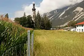
Haiming, churchtower: Pfarrkirche Sankt Chrysanthus und Daria
Geography
The town of Haiming is located 11 km east of Imst. The municipality consists eight villages.
Climate
| Climate data for Haiming, Tyrol (1971–2000) | |||||||||||||
|---|---|---|---|---|---|---|---|---|---|---|---|---|---|
| Month | Jan | Feb | Mar | Apr | May | Jun | Jul | Aug | Sep | Oct | Nov | Dec | Year |
| Record high °C (°F) | 19.2 (66.6) |
18.7 (65.7) |
23.4 (74.1) |
25.6 (78.1) |
30.8 (87.4) |
33.9 (93.0) |
38.3 (100.9) |
35.7 (96.3) |
31.1 (88.0) |
24.7 (76.5) |
21.7 (71.1) |
16.8 (62.2) |
38.3 (100.9) |
| Average high °C (°F) | 2.8 (37.0) |
5.7 (42.3) |
11.1 (52.0) |
14.7 (58.5) |
20.0 (68.0) |
22.4 (72.3) |
25.0 (77.0) |
24.4 (75.9) |
20.5 (68.9) |
15.0 (59.0) |
7.2 (45.0) |
2.8 (37.0) |
14.3 (57.7) |
| Daily mean °C (°F) | −2.9 (26.8) |
−1.1 (30.0) |
3.7 (38.7) |
7.3 (45.1) |
12.7 (54.9) |
15.4 (59.7) |
17.6 (63.7) |
16.9 (62.4) |
12.8 (55.0) |
7.4 (45.3) |
1.3 (34.3) |
−2.3 (27.9) |
7.4 (45.3) |
| Average low °C (°F) | −6.8 (19.8) |
−5.4 (22.3) |
−1.7 (28.9) |
1.3 (34.3) |
5.9 (42.6) |
9.1 (48.4) |
11.1 (52.0) |
11.0 (51.8) |
7.4 (45.3) |
2.7 (36.9) |
−2.4 (27.7) |
−5.8 (21.6) |
2.2 (36.0) |
| Record low °C (°F) | −25.4 (−13.7) |
−19.0 (−2.2) |
−16.8 (1.8) |
−6.8 (19.8) |
−3.8 (25.2) |
−0.8 (30.6) |
3.1 (37.6) |
1.5 (34.7) |
−3.3 (26.1) |
−9.1 (15.6) |
−17.8 (0.0) |
−22.4 (−8.3) |
−25.4 (−13.7) |
| Average precipitation mm (inches) | 35.8 (1.41) |
31.5 (1.24) |
40.7 (1.60) |
35.4 (1.39) |
64.1 (2.52) |
96.1 (3.78) |
110.4 (4.35) |
103.1 (4.06) |
64.0 (2.52) |
42.9 (1.69) |
47.7 (1.88) |
45.0 (1.77) |
716.7 (28.22) |
| Average snowfall cm (inches) | 19.2 (7.6) |
25.1 (9.9) |
7.8 (3.1) |
0.8 (0.3) |
0.3 (0.1) |
0.0 (0.0) |
0.0 (0.0) |
0.0 (0.0) |
0.0 (0.0) |
0.0 (0.0) |
8.5 (3.3) |
17.4 (6.9) |
79.1 (31.1) |
| Average precipitation days (≥ 1.0 mm) | 6.3 | 5.2 | 6.6 | 6.9 | 10.1 | 12.2 | 12.4 | 12.6 | 8.3 | 6.3 | 7.4 | 7.4 | 101.7 |
| Average relative humidity (%) (at 14:00) | 65.4 | 52.0 | 40.2 | 39.1 | 40.6 | 44.1 | 44.5 | 46.2 | 47.0 | 49.8 | 60.5 | 70.8 | 50.0 |
| Source: Central Institute for Meteorology and Geodynamics[3] | |||||||||||||
Population
| Year | Pop. | ±% |
|---|---|---|
| 1869 | 1,275 | — |
| 1880 | 1,250 | −2.0% |
| 1890 | 1,211 | −3.1% |
| 1900 | 1,185 | −2.1% |
| 1910 | 1,206 | +1.8% |
| 1923 | 1,270 | +5.3% |
| 1934 | 1,386 | +9.1% |
| 1939 | 1,467 | +5.8% |
| 1951 | 2,761 | +88.2% |
| 1961 | 2,447 | −11.4% |
| 1971 | 2,976 | +21.6% |
| 1981 | 3,263 | +9.6% |
| 1991 | 3,463 | +6.1% |
| 2001 | 3,901 | +12.6% |
| 2011 | 4,349 | +11.5% |
Economy
Its main source of income is summer tourism.
References
- "Dauersiedlungsraum der Gemeinden Politischen Bezirke und Bundesländer - Gebietsstand 1.1.2018". Statistics Austria. Retrieved 10 March 2019.
- "Einwohnerzahl 1.1.2018 nach Gemeinden mit Status, Gebietsstand 1.1.2018". Statistics Austria. Retrieved 9 March 2019.
- "Klimadaten von Österreich 1971–2000 – Tirolh-Haiming" (in German). Central Institute for Meteorology and Geodynamics. Archived from the original on 12 October 2019. Retrieved 20 October 2019.
Wikimedia Commons has media related to Haiming (Tirol).
This article is issued from Wikipedia. The text is licensed under Creative Commons - Attribution - Sharealike. Additional terms may apply for the media files.