Hank Aaron State Trail
The Hank Aaron State Trail is a 15.2-mile (24.5 km)[1] rail trail in Milwaukee County, Wisconsin. The trail is named after former Milwaukee Braves and Milwaukee Brewers right fielder Hank Aaron[2] and is built on a former roadbed of the Milwaukee Road. As of 2023, according to the Wisconsin Department of Natural Resources, approximately 200,000 people use the trail annually.[3]
| Hank Aaron State Trail | |
|---|---|
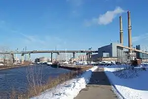
 Hank Aaron State Trail near the Valley Power Plant | |
| Length | 15.2 mi (24.5 km) |
| Location | Milwaukee County, Wisconsin |
| Established | 2000 |
| Trailheads | Lakeshore State Park Underwood Parkway, Wauwatosa, Wisconsin |
| Use | Shared-use path |
| Elevation gain/loss | +272 ft going westward |
| Website | dnr |
History
Following a recommendation by then-mayor John Norquist's Bicycle Task Force to develop an east-west trail through the Menomonee Valley, the trail opened in 2000 with a length of only a third of a mile, near American Family Field, though a segment between 13th Street and 25th Street was added shortly after.[4]: 61 In August 2006, the trail stretched from Lakeshore State Park in the east to American Family Field in the west.[5] In 2010, a four-mile westward extension to 94th Place was completed, setting the total trail length to ten miles.[6] In November 2011, the trail was expanded from 94th Place to Underwood Parkway, though this section was composed of compacted gravel.[7] In 2012, a one-mile spur connecting to Mitchell Park Horticultural Conservatory was added.[8] In 2014, a ramp and stairway were added to the trail near 6th Street to allow easy access to street level.[9] In 2018, the compacted gravel section of the trail west of 94th Place was paved with the completion of the reconstruction of the Zoo Interchange.[9] In 2019, a connection to Wisconsin Highway 100 near the Milwaukee County Zoo was added.[10]
In May 2019, installation began for People of the Road, a set of metal sculptures on the trail honoring the workers of the Milwaukee Road.[11] By July 2020, installation of all five sculptures was complete.[12]
In 2020, the trail was designated part of U.S. Bicycle Route 30.[13]
Route
The trail begins on the shore of Lake Michigan in Lakeshore State Park (43°02′14″N 87°53′51″W). The trail travels west through Milwaukee, passing by the Harley-Davidson Museum, Potawatomi Hotel & Casino, American Family Field, and the Wisconsin State Fair Park. The trail ends at the Oak Leaf Trail in Wauwatosa, Wisconsin (43°02′10″N 88°04′00″W).[14] The elevation increases by 272 feet when traveling westward.[10]
Access
The trail is open to walkers, joggers, bicyclists, and in-line skaters.[2] Much of the trail is accessible to people with disabilities.[2]
| City | Street | Direction | Notes |
|---|---|---|---|
| Milwaukee | Milwaukee Street | North and east | Near Lakeshore State Park Connects to Oak Leaf Trail Milwaukee River Line and Lake Line Eastern terminus of trail |
| Erie Street | East and south | Near Henry Maier Festival Park | |
| Water Street | East and south | Connects to Kinnickinnic River Trail | |
| 2nd Street | North, east, and south | Eastward end of off-street portion Connects to Oak Leaf Trail Kinnickinnic Line | |
| 6th Street | North and south | Near Harley-Davidson Museum | |
| Emmber Lane | North and south | Near Potawatomi Hotel & Casino | |
| 25th Street | North | ||
| 32nd Street | North | ||
| 37th Street | South | Near Mitchell Park Horticultural Conservatory Near People of the Road | |
| 44th Street | North and south | Near American Family Field | |
| Mitchell Boulevard | North and south | ||
| West Allis | 56th Street | South | |
| Hawley Road | North and south | ||
| Milwaukee | 68th Street | North | |
| 76th Street | North and south | Near Wisconsin State Fair Park | |
| 84th Street | North and south | Connects to Oak Leaf Trail Kinnickinnic Line | |
| 89th Street | South | ||
| 94th Place | South | ||
| West Allis | 108th Street | North and south | Near Milwaukee County Zoo Connects to Wisconsin Highway 100 |
| 116th Street | West and south | ||
| Wauwatosa | 121st Street | North and south | |
| Underwood Parkway | North and south | Connects to Oak Leaf Trail Root River Line Western terminus of trail |
References
- Rail-Trails: Michigan & Wisconsin. Birmingham, AL: Wilderness Press. 2017. p. 44. ISBN 9780899978734.
- "Hank Aaron State Trail". Wisconsin DNR. Retrieved August 15, 2016.
- "Sinkhole Detected On Hank Aaron State Trail". Urban Milwaukee. 2023-07-14. Retrieved 2023-07-16.
- Maher, Rothenbueler (2019). Milwaukee County's Oak Leaf Trail: A History. Charleston, SC: Arcadia Publishing. ISBN 9781467140683.
- Cook, Melissa (2006-08-08). "Ceremony to mark expansion of Hank Aaron State Trail". Wisconsin DNR. Retrieved 2022-12-19.
- "Hank Aaron State Trail Valley Passage and Extension". The Sigma Group. Retrieved 2022-12-19.
- Held, Tom (2011-11-07). "Hank Aaron State Trail extension ready for finishing touches". Milwaukee Journal Sentinel. Retrieved 2022-12-19.
- "Ground broken on new segment of Hank Aaron State Trail". FOX 6 Now Milwaukee. 2012-08-30. Retrieved 2022-12-20.
- "Frequently Asked Questions". Friends of Hank Aaron State Trail. Retrieved 2022-12-20.
- Nickel, Lori (2019-09-01). "Chin Up: Joy riding through Milwaukee on the Hank Aaron State Trail". Milwaukee Journal Sentinel. Retrieved 2023-03-26.
- Quirmbach, Chuck (2019-05-16). "New Sculptures Honor Milwaukee Road Railway Workers". WUWM. Retrieved 2023-02-20.
- "People of the Road: An Art Tribute". Friends of Hank Aaron State Trail. Retrieved 2023-02-20.
- "Wisconsin bicycle route recognized by national organization". Hometown News LP. 2020-08-29. Retrieved 2022-12-19.
- "Hank Aaron State Trail Map" (PDF). Friends of Hank Aaron State Trail. Retrieved December 18, 2022.