Hedrick, Indiana
Hedrick is a small unincorporated community in Jordan Township, Warren County, in the U.S. state of Indiana.[3]
Hedrick, Indiana | |
|---|---|
 Looking east toward Hedrick along County Road 100 South | |
 Hedrick  Hedrick  Hedrick | |
| Coordinates: 40°18′6″N 87°29′27″W | |
| Country | United States |
| State | Indiana |
| County | Warren |
| Township | Jordan |
| Founded | 1881 |
| Area | |
| • Total | 0.04 sq mi (0.10 km2) |
| • Land | 0.04 sq mi (0.10 km2) |
| • Water | 0.00 sq mi (0.00 km2) |
| Elevation | 709 ft (216 m) |
| Population (2020) | |
| • Total | 67 |
| • Density | 1,675.00/sq mi (643.15/km2) |
| Time zone | UTC-5 (Eastern (EST)) |
| • Summer (DST) | UTC-4 (EDT) |
| ZIP code | 47993 |
| Area code | 765 |
| GNIS feature ID | 435978 |
History
The town of Hedrick began on July 31, 1881 with its platting by locals Parmenas G. Smith and G. W. Compton. The first house was built by John Hendricks and the first store opened by Zarse & Ahrens. The town also gained a drug store operated by Frank Hartman and a school house erected in the early 1880s.[4] A post office was established in Hedrick on January 14, 1880 and closed on January 31, 1959.[5]
A tornado nearly destroyed Hedrick on April 17, 1922. The storm cut a path through the town an eighth of a mile wide, killing four residents, destroying six homes and ten businesses, and leaving only three buildings intact. Including persons who lived near Hedrick but not within city limits, 11 people were killed and 35 injured.[6][7] Following the storm, newspapers estimated from ten to fifty thousand people flocked to the area to view the destruction, prompting the governor to deploy part of the state militia to control the crowds and prevent looting.[8]
Geography
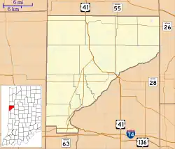
Hedrick is located on flat, open farmland on the southern edge of Jordan Township, at the intersection of County Roads 900 West and 100 South. It is about 2 miles (3.2 km) east of the Illinois border, 11 miles (18 km) west of the county seat of Williamsport, and 1.5 miles (2.4 km) north of State Road 28. Its elevation is 709 feet.[3] Prior to the founding of the town, a wooded site called Hedrick's Grove stood to the east of nearby Redwood Creek.[9]
References
- "2020 U.S. Gazetteer Files". United States Census Bureau. Retrieved March 16, 2022.
- "US Board on Geographic Names". United States Geological Survey. October 25, 2007. Retrieved July 10, 2016.
- "USGS detail on Hedrick, Indiana". Retrieved July 10, 2016.
- Goodspeed, Weston A. (1883). "Towns and Villages of Warren County". Counties of Warren, Benton, Jasper and Newton, Indiana: Historical and Biographical. Chicago: F. A. Battey & Co.
- A History of Warren County, Indiana (175th Anniversary Edition). Warren County Historical Society. 2002. p. 220.
- "32 Dead, 500 Hurt in Tornadoes' Path", The New York Times, April 19, 1922, p. 9
- Grazulis, Thomas P. (1993). Significant tornadoes, 1680-1991: A Chronology and Analysis of Events. St. Johnsbury, Vermont: Environmental Films. p. 779. ISBN 1-879362-03-1.
- Foxworthy, Jane Ellen (2002). "Jordan Township". A History of Warren County, Indiana (175th Anniversary Edition). Warren County Historical Society.
- Illustrated Historical Atlas of the State of Indiana. Chicago: Baskin, Forster & Company. 1876.
- "Census of Population and Housing". Census.gov. Retrieved June 4, 2016.