Herbert, Saskatchewan
Herbert is a town located in the Rural Municipality of Morse No. 165, in southwest Saskatchewan, Canada. The community is 48 km east of the city of Swift Current, and 197 km west of Regina, the provincial capital, on the Trans-Canada Highway. Its population as of 2016 was 856.[1]
Herbert | |
|---|---|
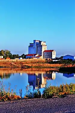
 Early morning light on the grain elevators in Herbert. | |
| Motto: Have you seen Herbert? | |
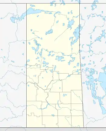
 Herbert Location of Herbert in Saskatchewan  Herbert Herbert (Canada) | |
| Coordinates: 50.42728°N 107.22781°W | |
| Country | Canada |
| Province | Saskatchewan |
| Census division | 7 |
| Rural Municipality | Morse |
| Post office Founded | 1904-10-01 |
| Government | |
| • Mayor | Ron Mathies |
| • CAO | Michelle Mackow |
| • Governing body | Herbert Town Council |
| Area | |
| • Land | 3.78 km2 (1.46 sq mi) |
| Population (2016)[1] | |
| • Total | 856 |
| • Density | 200.7/km2 (520/sq mi) |
| Time zone | CST |
| Postal code | S0H 2A0 |
| Area code | 306 |
| Highways | Trans-Canada Highway, Highway 612 & Highway 645 |
| Railways | Canadian Pacific Railway |
| Website | Official website |
| [2][3] | |
Herbert was named after the British diplomat Sir Michael Henry Herbert. It is the hometown of CBC Sports broadcaster Don Wittman. Herbert was also the home of former senator Jack Wiebe.
Attractions
The Herbert Train Station Museum is the best place to stop for information on the town of Herbert. The train station is located on 625 Railway Avenue.[4] The Klassen Museum (c. 1916) is a Municipal Heritage Property on the Canadian Register of Historic Places.[5]
Education
Herbert School offers kindergarten to grade 12 and is in the Chinook School Division 211
Recreation
Herbert has a skating rink and a curling rink, a swimming pool, a number of ball diamonds, and a gym within the school.
Herbert is also home to the Herbert Stampede, a Canadian Cowboys Association approved Rodeo. Herbert Stampede was the CCA's 2008 and 2014 Rodeo of the year. The Herbert Stampede also features the very popular Wild Cow Race and The Wild West Parade.[6]
Amenities
Herbert also has a Highway Inn Restaurant, CO-OP store, a pharmacy, a hospital/nursing home, a senior home, a public library, MCC thrift store, a car wash & a post office.
Demographics
In the 2021 Census of Population conducted by Statistics Canada, Herbert had a population of 770 living in 313 of its 338 total private dwellings, a change of -10% from its 2016 population of 856. With a land area of 3.69 km2 (1.42 sq mi), it had a population density of 208.7/km2 (540.5/sq mi) in 2021.[7]
| 2021 | 2016 | 2011 | |
|---|---|---|---|
| Population | 770 (-10.0% from 2016) | 856 (+12.8% from 2011) | 759 (+8.4% from 2006) |
| Land area | 3.69 km2 (1.42 sq mi) | 3.78 km2 (1.46 sq mi) | +2.3 km2 (0.89 sq mi) |
| Population density | 208.6/km2 (540/sq mi) | 226.3/km2 (586/sq mi) | 200.7/km2 (520/sq mi) |
| Median age | 49.6 (M: 48.8, F: 49.6) | 46.8 (M: 46.0, F: 47.4) | 57.6 (M: 56.8, F: 59.0) |
| Private dwellings | 338 (total) 313 (occupied) | 356 (total) | 323 (total) |
| Median household income | $60,400 |
References
- "Census Profile, 2016 Census". Statistics Canada. Government of Canada. 8 February 2017.
- National Archives, Archivia Net. "Post Offices and Postmasters". Archived from the original on 25 December 2018. Retrieved 21 August 2014.
- Government of Saskatchewan, MRD Home. "Municipal Directory System". Archived from the original on 15 January 2016. Retrieved 21 August 2014.
- Find a Museum. "Herbert CPR Train Station Museum". Archived from the original on 18 September 2012. Retrieved 21 August 2014.
- Canada's Historic Places. "Klassen Museum". Archived from the original on 26 August 2014. Retrieved 21 August 2014.
- Tourism Saskatchewan. "Herbert Annual Stampede". Archived from the original on 26 August 2014. Retrieved 21 August 2014.
- "Population and dwelling counts: Canada, provinces and territories, census divisions and census subdivisions (municipalities), Saskatchewan". Statistics Canada. 9 February 2022. Retrieved 1 April 2022.
- "2021 Community Profiles". 2021 Canadian Census. Statistics Canada. 4 February 2022. Retrieved 19 October 2023.
- "2016 Community Profiles". 2016 Canadian Census. Statistics Canada. 12 August 2021. Retrieved 16 June 2017.
- "2011 Community Profiles". 2011 Canadian Census. Statistics Canada. 21 March 2019. Retrieved 22 August 2014.
- "2006 Community Profiles". 2006 Canadian Census. Statistics Canada. 20 August 2019.
- "2001 Community Profiles". 2001 Canadian Census. Statistics Canada. 18 July 2021.
