Abernethy, Saskatchewan
Abernethy (2021 population: 190) is a village in the Canadian province of Saskatchewan within the Rural Municipality of Abernethy No. 186 and Census Division No. 6. It is about one hour east of Regina, one hour west of Yorkton, and approximately five hours northwest of Winnipeg. To the south of Abernethy lies the Qu'Appelle Valley in which Katepwa Beach is located.
Abernethy | |
|---|---|
| Village of Abernethy | |
.jpg.webp) Abernethy Church | |
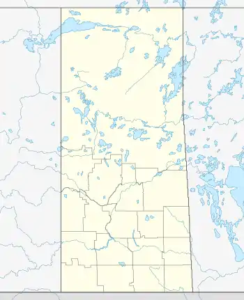
 Abernethy Location of Abernethy in Saskatchewan  Abernethy Abernethy (Canada) | |
| Coordinates: 50.444°N 103.252°W | |
| Country | Canada |
| Province | Saskatchewan |
| Region | Southwest |
| Census division | 6 |
| Rural Municipality | Abernethy |
| Established | 1904 |
| Government | |
| • Mayor | Kevin Stryker |
| • Administrator | Lisa Fayant |
| • Governing body | Abernethy Village Council |
| Area | |
| • Total | 1.03 km2 (0.40 sq mi) |
| Population (2021)[1] | |
| • Total | 190 |
| • Density | 197.7/km2 (512/sq mi) |
| Time zone | CST |
| Postal code | S0A 0A0 |
| Area codes | 306, 639 |
| Highways | Highway 22 |
| Historic Sites | Motherwell Homestead |
| Website | Village of Abernethy |
| [2][3][4][5] | |
The current mayor is Kevin Stryker, and the village council consists of Janet Englot, Marty Fayant, Mark Harrison, and Colin Ward.
History
Abernethy was incorporated as a village on July 26, 1904.[6] Abernethy celebrated its one hundredth anniversary in the summer of 2004 with a centennial celebration held at the same time as the annual agricultural fair.[7]
Historic sites
- Abernethy is home to the Motherwell Homestead, which is a National Historic Site and is the original homestead of Saskatchewan's first minister of agriculture W.R. Motherwell.
- Abernethy and District Memorial Hall is a Municipal Heritage Property, that was constructed in 1921, to commemorate the return of soldiers from World War I. Funds for the hall were raised through local donations in the community. The hall was designed by Storey and Van Egmond of Regina.[8]
- Christ Anglican Church is a Municipal Heritage Property, that was constructed near Abernethy in 1886, and relocated into the village in 1904.[9]
Demographics
In the 2021 Census of Population conducted by Statistics Canada, Abernethy had a population of 190 living in 86 of its 108 total private dwellings, a change of -6.9% from its 2016 population of 204. With a land area of 0.98 km2 (0.38 sq mi), it had a population density of 193.9/km2 (502.1/sq mi) in 2021.[12]
In the 2016 Census of Population, Abernethy recorded a population of 204 living in 84 of its 104 total private dwellings, a 3.9% change from its 2011 population of 196. With a land area of 1.03 km2 (0.40 sq mi), it had a population density of 198.1/km2 (513.0/sq mi) in 2016.[13]
Economy
Abernethy is primarily an agricultural community. Businesses in this village include an ice cream store called Grammies, a photographery business named Anela Snaps, a crochet business named Country Cozy Crochet, as well as a CO-OP gas and grocery store. All these local businesses can be found on Facebook.
Education
For schooling, children are bussed to Lemberg and Neudorf in the east and Balcarres in the west. Abernethy School was closed in 1994 and, due to lack of proper maintenance, had to be destroyed in the summer of 2005.
References
- "2021 Community Profiles". Statistics Canada. Government of Canada. Retrieved 2022-09-07.
- National Archives, Archivia Net, Post Offices and Postmasters, archived from the original on 2006-10-06
- Government of Saskatchewan, MRD Home, Municipal Directory System, archived from the original on 2011-07-06
- Canadian Textiles Institute. (2005), CTI Determine your provincial constituency, archived from the original on 2007-09-11
- Commissioner of Canada Elections, Chief Electoral Officer of Canada (2005), Elections Canada On-line, archived from the original on 2007-04-21
- "Urban Municipality Incorporations". Saskatchewan Ministry of Government Relations. Archived from the original on October 15, 2014. Retrieved June 1, 2020.
- Dance on the Bridge: A History of Abernethy and Area. Abernethy Heritage Association, 1983. ISBN 978-0-919533-28-8.
- Abernethy and District Memorial Hall Heritage Property Details Archived July 6, 2011, at the Wayback Machine
- Christ Anglican Church Heritage Property Details Archived July 6, 2011, at the Wayback Machine
- "Saskatchewan Census Population" (PDF). Saskatchewan Bureau of Statistics. Archived from the original (PDF) on September 24, 2015. Retrieved May 31, 2020.
- "Saskatchewan Census Population". Saskatchewan Bureau of Statistics. Retrieved May 31, 2020.
- "Population and dwelling counts: Canada, provinces and territories, census divisions and census subdivisions (municipalities), Saskatchewan". Statistics Canada. February 9, 2022. Retrieved April 1, 2022.
- "Population and dwelling counts, for Canada, provinces and territories, and census subdivisions (municipalities), 2016 and 2011 censuses – 100% data (Saskatchewan)". Statistics Canada. February 8, 2017. Retrieved May 30, 2020.
