Neilburg
Neilburg (2016 population: 379) is a village in the Canadian province of Saskatchewan within the Rural Municipality of Hillsdale No. 440 and Census Division No. 13. A grade K–12 school is located in the village that services the Neilburg area as well as grade 7–12 students from Marsden.
Village of Neilburg | |
|---|---|
Village | |
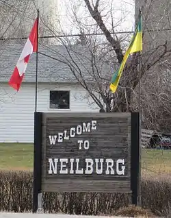
 Village sign | |
 | |
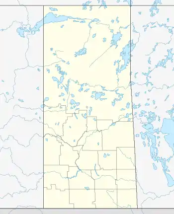
| Coordinates: 52.833°N 109.633°W | |
| Country | Canada |
| Province | Saskatchewan |
| Region | Saskatchewan |
| Census division | 13 |
| Rural Municipality | Hillsdale No. 440 |
| School Division | Northwest School Division No. 203 |
| Post office Founded | N/A |
| Incorporated (Hamlet) | 1923[1] |
| Incorporated (Village) | 1946[1] |
| Government | |
| • Mayor | Brent Wiens |
| • Deputy Mayor | Aaron Gibbons |
| • Governing body | Neilburg Village Council |
| Elevation | 677 m (2,221 ft) |
| Population (2016)[2] | |
| • Total | 379 |
| Time zone | UTC−7 (MST) |
| • Summer (DST) | UTC−6 (MDT) |
| Postal code | S0M 2C0 |
| Area code | 306 |
| Highways | |
| Website | www.neilburg.ca |
| [3][4][5][6] | |
Neilburg was named after an early settler, Clifford O’Neil. The first post office was in his home and was located about one mile south-east of where the village is today. Neilburg was established as a hamlet in 1923 and by 1946, it had grown big enough to be incorporated as the village of Neilburg.
The village is about 6 kilometres away from the north-east corner of Manitou Lake. On the north-west corner of the lake is Big Manitou Regional Park.
History
Neilburg incorporated as a village on January 1, 1947.[7]
In 1999 crop circles were discovered in a field near the village.[8]
Demographics
In the 2021 Census of Population conducted by Statistics Canada, Neilburg had a population of 371 living in 160 of its 192 total private dwellings, a change of -2.1% from its 2016 population of 379. With a land area of 1.24 km2 (0.48 sq mi), it had a population density of 299.2/km2 (774.9/sq mi) in 2021.[11]
In the 2016 Census of Population, the Village of Neilburg recorded a population of 379 living in 157 of its 175 total private dwellings, a -18.2% change from its 2011 population of 448. With a land area of 1.22 km2 (0.47 sq mi), it had a population density of 310.7/km2 (804.6/sq mi) in 2016.[2]
References
- Village of Neilburg, 13 June 2010
- "Population and dwelling counts, for Canada, provinces and territories, and census subdivisions (municipalities), 2016 and 2011 censuses – 100% data (Saskatchewan)". Statistics Canada. 8 February 2017. Retrieved 30 May 2020.
- National Archives, Archivia Net, Post Offices and Postmasters
- Government of Saskatchewan, MRD Home, Municipal Directory System, archived from the original on 21 November 2008
- Canadian Textiles Institute. (2005), CTI Determine your provincial constituency, archived from the original on 11 September 2007
- Commissioner of Canada Elections, Chief Electoral Officer of Canada (2005), Elections Canada On-line, archived from the original on 21 April 2007
- "Urban Municipality Incorporations". Saskatchewan Ministry of Government Relations. Archived from the original on 15 October 2014. Retrieved 1 June 2020.
- Arndt, Judy. "Crop Circles - Neilburg, Saskatchewan, Canada - Sept. 1999". Treasure House Imports. Retrieved 16 February 2008.
- "Saskatchewan Census Population" (PDF). Saskatchewan Bureau of Statistics. Archived from the original (PDF) on 24 September 2015. Retrieved 31 May 2020.
- "Saskatchewan Census Population". Saskatchewan Bureau of Statistics. Retrieved 31 May 2020.
- "Population and dwelling counts: Canada, provinces and territories, census divisions and census subdivisions (municipalities), Saskatchewan". Statistics Canada. 9 February 2022. Retrieved 1 April 2022.
