Hnahlan
Hnahlan is a border town in the Champhai Rural Development Block of Champhai district of Mizoram state in India.[1]
Hnahlan | |
|---|---|
Village | |
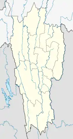 Hnahlan Location in Mizoram, India  Hnahlan Hnahlan (India) | |
| Coordinates: 23.6937905°N 93.3817264°E | |
| Country | India |
| State | Mizoram |
| District | Champhai |
| Block | Champhai |
| Elevation | 1,522 m (4,993 ft) |
| Population (2011) | |
| • Total | 3,157 |
| Time zone | UTC+5:30 (IST) |
| 2011 census code | 271344 |
Demographics
According to the 2011 census of India, Hnahlan has 569 households. The effective literacy rate (i.e. the literacy rate of population excluding children aged 6 and below) is 92.95%.[2]
| Total | Male | Female | |
|---|---|---|---|
| Population | 3157 | 1602 | 1555 |
| Children aged below 6 years | 575 | 296 | 279 |
| Scheduled caste | 2 | 1 | 1 |
| Scheduled tribe | 3059 | 1525 | 1534 |
| Literates | 2400 | 1256 | 1144 |
| Workers (all) | 1735 | 877 | 858 |
| Main workers (total) | 1725 | 872 | 853 |
| Main workers: Cultivators | 1563 | 744 | 819 |
| Main workers: Agricultural labourers | 1 | 1 | 0 |
| Main workers: Household industry workers | 3 | 1 | 2 |
| Main workers: Other | 158 | 126 | 32 |
| Marginal workers (total) | 10 | 5 | 5 |
| Marginal workers: Cultivators | 6 | 3 | 3 |
| Marginal workers: Agricultural labourers | 0 | 0 | 0 |
| Marginal workers: Household industry workers | 0 | 0 | 0 |
| Marginal workers: Others | 4 | 2 | 2 |
| Non-workers | 1422 | 725 | 697 |
Economy and border haat trade
Hnahlan is one of the 4 Border Haats (markets) in Mizoram, others being at Sangau, Vaphai (Saikhumphai) and Zote, all of which boost the local trade and economy.[3] Hnahlan is one of the largest grapes producing area in the region.
Transport and connectivity
Zokhawthar (75 km south) provides connectivity to India–Myanmar–Thailand Trilateral Highway (IMT),[4] and Asian Highway Network and Asian Highway 1 (AH1).[5] Lengpui Airport in Aizawl (260 km west) is the nearest airport in India. Sairang railhead of Bairabi–Sairang line 270 km west is the nearest railway station.
See also
References
- "Mizoram villages" (PDF). Land Records Information Systems Division, NIC. Archived from the original (PDF) on 6 August 2014. Retrieved 22 August 2015.
- "District Census Handbook - Champhai" (PDF). 2011 Census of India. Directorate of Census Operations, Mizoram. Retrieved 22 August 2015.
- Outlook India India, Myanmar likely to set up four Border Haats, Outlook India, 20 Aug 2019.
- The Role of BIMSTEC in Revitalising India’s Northeast, ORF, 23 Jun 2021.
- New road, rail links to make Manipur gateway to SE Asia: CM, The Hindu, November 08, 2018.
| State symbols | |
|---|---|
| Government | |
| Topics | |
| Districts | |
| Urban Areas | |
| Infrastructure | |
| Education | |
| Tourism | |
| Protected areas | |
| Mizo Culture | |