Humphreys Peak
Humphreys Peak (Hopi: Aaloosaktukwi, Navajo: Dookʼoʼoosłííd) is the highest natural point and the second most prominent peak after Mount Graham in the U.S. state of Arizona,[5] with an elevation of 12,637 feet (3,852 m)[1] and is located within the Kachina Peaks Wilderness in the Coconino National Forest, about 11 miles (17.7 km) north of Flagstaff, Arizona. Humphreys Peak is the highest of a group of dormant volcanic peaks known as the San Francisco Peaks.[6]
| Humphreys Peak | |
|---|---|
| Hopi: Aaloosaktukwi Navajo: Doko'o'osliid | |
 Humphreys Peak in winter 2004 | |
| Highest point | |
| Elevation | 12,637 ft (3,852 m) NAVD 88[1] |
| Prominence | 6,039 ft (1,841 m)[2] |
| Isolation | 245.85 miles (395.66 km) |
| Listing | |
| Coordinates | 35°20′46.8″N 111°40′40.6″W[1] |
| Geography | |
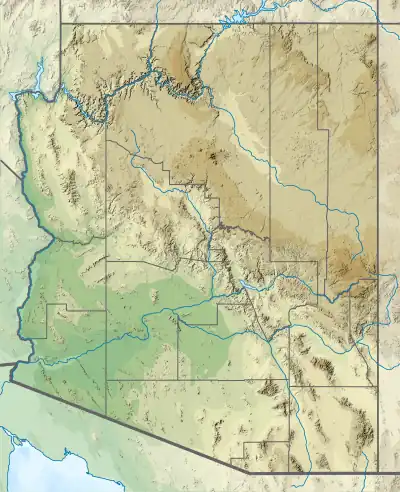
 Humphreys Peak | |
| Location | Coconino County, Arizona, U.S. |
| Parent range | San Francisco Peaks |
| Topo map | USGS Humphreys Peak |
| Geology | |
| Mountain type | igneous, volcanic |
| Volcanic field | San Francisco volcanic field |
| Climbing | |
| Easiest route | Humphreys Trail, class 1[4] |
Humphreys Peak was named in about 1870 for General Andrew A. Humphreys, a U.S. Army officer who was a Union general during the American Civil War, and who later became Chief of Engineers of the United States Army Corps of Engineers. However, a General Land Office map from 1903 showed the name San Francisco Peak applied to this feature (apparently borrowed from San Francisco Mountain on which the peak stands). Thus the United States Board on Geographic Names approved the variant name in 1911. In 1933, the application of the names was rectified.[7]
Climate
The climate at the top of the mountain belongs to the dry-summer subarctic climate (Köppen: Dsc), close to the tundra climate (Köppen: ET), and the climate a little further down the mountainside is Hemiboreal climate (Köppen: Dsb) or warm dry-summer Mediterranean climate (Köppen: Csb). Six months of the year average temperatures below 32 °F (0 °C), and only July averages temperatures above 50 °F (10 °C). No month has a dew point higher than 32 °F (0 °C).
| Climate data for Humphreys Peak 35.3403 N, 111.6838 W, Elevation: 11,965 ft (3,647 m) (1991–2020 normals) | |||||||||||||
|---|---|---|---|---|---|---|---|---|---|---|---|---|---|
| Month | Jan | Feb | Mar | Apr | May | Jun | Jul | Aug | Sep | Oct | Nov | Dec | Year |
| Average high °F (°C) | 31.4 (−0.3) |
31.3 (−0.4) |
35.2 (1.8) |
41.2 (5.1) |
49.4 (9.7) |
60.6 (15.9) |
63.8 (17.7) |
61.7 (16.5) |
56.7 (13.7) |
48.3 (9.1) |
38.8 (3.8) |
31.8 (−0.1) |
45.8 (7.7) |
| Daily mean °F (°C) | 20.5 (−6.4) |
19.9 (−6.7) |
23.3 (−4.8) |
28.0 (−2.2) |
35.9 (2.2) |
46.2 (7.9) |
50.9 (10.5) |
49.4 (9.7) |
44.0 (6.7) |
35.5 (1.9) |
27.3 (−2.6) |
20.9 (−6.2) |
33.5 (0.8) |
| Average low °F (°C) | 9.6 (−12.4) |
8.5 (−13.1) |
11.5 (−11.4) |
14.8 (−9.6) |
22.4 (−5.3) |
31.7 (−0.2) |
38.0 (3.3) |
37.2 (2.9) |
31.3 (−0.4) |
22.7 (−5.2) |
15.9 (−8.9) |
10.1 (−12.2) |
21.1 (−6.0) |
| Average precipitation inches (mm) | 5.35 (136) |
5.39 (137) |
5.02 (128) |
2.46 (62) |
1.50 (38) |
0.56 (14) |
3.38 (86) |
5.25 (133) |
3.09 (78) |
2.97 (75) |
3.30 (84) |
5.40 (137) |
43.67 (1,108) |
| Average dew point °F (°C) | 3.1 (−16.1) |
4.8 (−15.1) |
5.6 (−14.7) |
5.7 (−14.6) |
10.9 (−11.7) |
10.7 (−11.8) |
26.7 (−2.9) |
30.5 (−0.8) |
25.6 (−3.6) |
13.7 (−10.2) |
7.3 (−13.7) |
3.5 (−15.8) |
12.3 (−10.9) |
| Source: PRISM Climate Group[8] | |||||||||||||
See also
References
- "Frisco". NGS Data Sheet. National Geodetic Survey, National Oceanic and Atmospheric Administration, United States Department of Commerce. Retrieved November 13, 2008.
- "Humphreys Peak, Arizona". Peakbagger.com. Retrieved November 13, 2008.
- "United States State High Points (plus DC)". Peakbagger.com. Retrieved August 17, 2016.
- "Humphreys Trail #51". Coconino National Forest, U.S. Forest Service. Retrieved February 4, 2014.
- "Elevations and Distances in the United States". United States Geological Survey. April 29, 2005. Archived from the original on June 1, 2008. Retrieved March 29, 2009.
- "Humphreys Trail #51". Coconino National Forest, U.S. Forest Service. Retrieved February 4, 2014.
- "Humphreys Peak". Geographic Names Information System. United States Geological Survey, United States Department of the Interior. Retrieved June 30, 2021.
- "PRISM Climate Group, Oregon State University". PRISM Climate Group, Oregon State University. Retrieved September 30, 2023.
To find the table data on the PRISM website, start by clicking Coordinates (under Location); copy Latitude and Longitude figures from top of table; click Zoom to location; click Precipitation, Minimum temp, Mean temp, Maximum temp; click 30-year normals, 1991-2020; click 800m; click Retrieve Time Series button.
External links
- "Humphreys Peak". SummitPost.org.
- "The peaks cam project". U.S. Forest Service.
- "Kachina Trail #150". U.S. Forest Service.
- "Humphreys Peak Trail #151." HikeArizona.com.
- "Kachina Peaks Wilderness." U.S. Forest Service.
