Isipingo
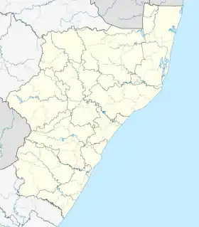
Isipingo is a town situated 19 kilometres (12 mi) south of Durban in KwaZulu-Natal, South Africa and currently forms part of eThekwini Metropolitan Municipality. The town is named after the Siphingo River, which in turn is thought to be named (in the Zulu language) for the intertwining cat-thorn shrubs (Scutia myrtina) present in the area, or the river's winding course.[2]
Isipingo | |
|---|---|
 Isipingo 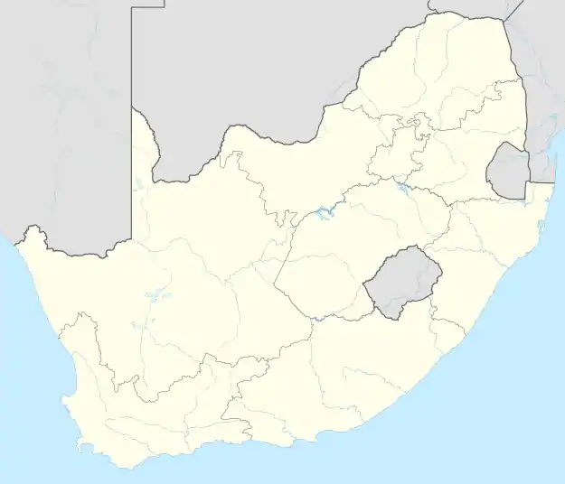 Isipingo | |
| Coordinates: 29°59′59″S 30°56′42″E | |
| Country | South Africa |
| Province | KwaZulu-Natal |
| Municipality | eThekwini |
| Main Place | Durban |
| Government | |
| • Councillor | Shad Nowbuth |
| Area | |
| • Total | 10.43 km2 (4.03 sq mi) |
| Population (2011)[1] | |
| • Total | 30,193 |
| • Density | 2,900/km2 (7,500/sq mi) |
| Racial makeup (2011) | |
| • Black African | 40.6% |
| • Coloured | 1.5% |
| • Indian/Asian | 56.95% |
| • White | 0.25% |
| • Other | 0.7% |
| First languages (2011) | |
| • English | 59.3% |
| • Zulu | 32.8% |
| • Xhosa | 4.5% |
| • Afrikaans | 0.9% |
| • Sotho | 0.85% |
| Time zone | UTC+2 (SAST) |
| Postal code (street) | 4133 |
| PO box | 4110 |
History
Dick King went to Natal in 1828 and was awarded a large stretch of land between the Umlaas/uMlaza and Mbokodweni rivers at present-day Isipingo Rail, an area where he had already acquired some farmland and built himself a house. King managed a sugar mill in Isipingo until his death in 1871 and was buried in the town.
In May 1853, the Natal Mercury reported that Mr Jeffels of Isipingo ventured into sugarcane cultivation and is erecting buildings for sugar manufacturing. The indenture system was used from 1860 to supply cheap Indian labour to the sugar cane farms in Isipingo and the surrounding areas.
In 1880, the railway line named the South Coast Line extension from Rossburgh in Durban to Isipingo Rail was completed and opened. Between 1893 and the outbreak of the Second Boer War, the South Coast Line was extended 44 km (27 mi) from Isipingo Rail to Park Rynie.[3]
In 1962, the Natal Provincial Council made a decision to incorporate Isipingo Rail and Isipingo Beach into the Borough of Amanzimtoti, a seaside town 10 kilometres further south and 1963, Isipingo Rail and Isipingo Beach were declared Indian Group Areas. By government decree, Isipingo Beach and Isipingo Rail would be amalgamated into a single Indian area, to be called Isipingo.[4]
In 1972, Isipingo was no longer under the administration of Amanzimtoti and instead was governed by the Isipingo Town Board, an all-Indian self-governing local authority and later in 1974 achieved Borough status.
The elite apartheid era suburb of Isipingo Hills was then created.
World War II plane crashes
During the Second World War the Coastal Command (Southern Air Command SAAF) deployed 10 Squadron SAAF at Durban and Isipingo – this unit functioned as a torpedo bomber/ coastal reconnaissance squadron. They operated from runways that had been cut out of sugarcane fields- it was in this area that the main runway of the now defunct Durban International Airport was later built.[5][lower-alpha 1] The squadron headquarters is now home to the Amanzimtoti Country Club (originally named Isipingo Golf Club).
In 1942 the squadron returned to its defense purposes and were re-equipped with Mohawks and Kittyhawks. There are several incidents of Kittyhawk[lower-alpha 2] crashes near Isipingo:[6]
- 5009 - crashed near Isipingo on 19 June 1944, 2Lt C. V. J. Giddey survived
- 5010 - crashed near Isipingo on 7 December 1943
- 5013 - caught fire in flight and crashed near Umbilo on 1 November 1943, 2Lt F. E. Hamm survived
- 5014 - stalled after takeoff and crashed near Isipingo on 2 October 1943, 2Lt K. L. Clur survived
- 5021 - crashed near Isipingo on 4 October 1943, 2Lt R. A. Hamlyn killed
- 5027 - crashed near Isipingo on 22 December 1943, 2Lt A. N. Blake killed
- 5082 - crashed near Isipingo on 18 December 1944
Geography
Topographically, Isipingo is both hilly and flat with the hilly area located towards the interior along the Siphingo River whilst along the coast, the suburb of Isipingo Beach lies on a high sandy ridge. A flat coastal plain separates the hilly areas of the Siphingo River and the ridge of Isipingo Beach.
In terms of the site of Isipingo, most of the built-up area of the town is concentrated towards the interior with Isipingo Beach being an outlier as it is separated from the rest of the town by the adjoining industrial area of Prospecton. The town is flanked by Reunion and the defunct Durban International Airport to the north, Athlone Park and Umbogintwini to the south and Umlazi to the west.
Isipingo is divided into seven neighbourhoods with the most established being Isipingo Rail (inland alongside the railway) and Isipingo Beach which are separated by Prospecton. Alongside Isipingo Rail and Isipingo Beach, other suburbs that form part of the town include Isipingo Hills, Malaba Hills, Lotus Park, Orient Hills and Malukazi.
Economy
Isipingo Rail, centered on Phila Ndwandwe Road serves as Isipingo’s Central Business District and an important retail and transport hub for the town.
Industries
The adjoining major industrial area of Prospecton is the location of one of South Africa's largest automobile assembly plants, that of Toyota. The facility, covering almost 9 square kilometres (3.5 sq mi), is a place of employment for many Isipingo residents.
Retail
Shopping in Isipingo is mainly characterised by typical high street shopping on Phila Ndwandwe Road in Isipingo Rail, lined with several national and local retailers and businesses. In addition, significant wholesale stores also exist in the Isipingo area. Three shopping centres serve Isipingo, namely Isipingo Main, Isipingo Junction and the Isipingo Station Centre (a new retail development on the railway station completed in 2020).[7][8]
Amenities
In terms of public amenities, Isipingo is served by a police station, two libraries (Isipingo Civic Library in Orient Hills and the Isipingo Beach Library) and a SASSA regional office.
Isipingo is solely served by the Isipingo Hospital, a private hospital in Isipingo Rail owned by Joint Medical Holdings.[9] In terms of public health, Isipingo is served by the Isipingo Clinic which is classified as a local authority/municipal clinic.[10]
The area has access to fine beaches, Reunion Park Beach, Isipingo Beach River Mouth, Tiger Rocks Beach and Dakota Beach, which are regularly frequented by bathers and fishermen, especially during the sardine run.
Transport
Rail
Isipingo lies on the main commuter line between Durban and Kelso on the South Coast (South Coast Line) operated by Metrorail which currently operates commuter railway services from the Isipingo Railway Station (in Isipingo Rail) to Reunion and Durban as well as Umbogintwini, Amanzimtoti, Kingsburgh, Umkomaas, Scottburgh and Kelso
Roads
Isipingo is serviced by one highway, namely the N2 highway which connects the vicinity with Durban to the north and with Amanzimtoti and Port Shepstone to the south. Isipingo is connected to the N2 via Joyner Road/Jeffels Road and the R102 Prospecton Road.
The main arterial route intersecting Isipingo Rail CBD is Phila Ndwandwe Road which lies between the M30 in Umlazi and M35 in Isipingo Rail. Of importance are also the R102 (South Coast Road) to Reunion and Durban, the M35 (Wilcox Road) to Umlazi and Mfundi Mngadi Drive to Umbogintwini and KwaMakhutha. Isipingo Beach has limited access and can only be accessed through The Avenue East via the R102 in Prospecton.
Religious sites
There are a number of Hindu temples, four mosques; Isipingo Hills Musjid, Isipingo Beach Musjid, Taleemuddeen Maddrassa Mosque, and Musjid Muqarrabeen, Masjid Mehboobia in Isipingo rail and numerous Christian churches.
Landmarks and important sites
- Isipingo Temple, founded in 1870, dedicated to the Goddess Marieaman
- The grave of Dick King.[11]
- Toyota manufacturing plant in Prospecton.
- SAPREF Oil Refinery (owned by Shell and BP)
- The town also a has a transit camp on the main road, created as a result of the FIFA World Cup 2010.
- Numerous Hindu Temples including Isipingo Hindi Sabha in Isipingo Hills, Dharam Mandhir in Lotus Park and Shree Hanuman Mandhir in Orient Hills
Notes and references
- Durban's International airport is now at La Mercy and is known as King Shaka International Airport
- an alternate name for a US World War II fighter aircraft Curtiss P-40 Warhawk variants
- Sum of the Sub Places Isipingo Beach, Isipingo Hills, Isipingo Rail and Lotus Park from Census 2011.
- Raper, P.E. (1987). Dictionary of Southern African Place Names. Johannesburg: Lowry. p. 223. ISBN 0947042067.
- "Durban Timeline 1497-1990 | South African History Online". www.sahistory.org.za. Retrieved 15 April 2022.
- Fiat_Lux_1972_v7_7_Sep_part2.pdf (ukzn.ac.za)
- "Fighters Over Durban".
- "Kittyhawk crashes during WWII".
- "Project: Isipingo Retail Development | L2B". Leads 2 Business. Retrieved 29 June 2023.
- "KwaZulu-Natal : Isipingo Retail Development - Prasa".
- "Joint Medical Holdings Group | Group of Hospitals". jmh.co.za. Retrieved 24 May 2023.
- KwaZulu-Natal Clinics kznhealth.gov.za
- Buttigieg, Gerald (18 August 2012). "St James Anglican Church, Dick King graveyard". eggsa.org. Retrieved 10 October 2017.
.svg.png.webp)