Janaki Rural Municipality (Banke District)
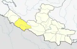
Janaki is a rural municipality in Banke District located in Lumbini Province of Nepal.
Janaki Rural Municipality
जानकी गाउँपालिका | |
|---|---|
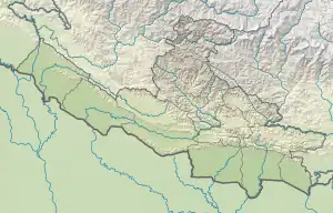
 Janaki Rural Municipality Location in Lumbini Province  Janaki Rural Municipality Janaki Rural Municipality (Nepal) | |
| Coordinates: 28.115513°N 81.611785°E | |
| Country | |
| Province | Lumbini |
| District | Banke |
| No. of wards | 6 |
| Established | 10 March 2017 |
| Incorporated (VDC) | Saigaun, Belbhar, Khajura Khurda, Belahari and Ganapur |
| Government | |
| • Chairperson | Chhabban Khan (NC) |
| • Vice-chairperson | Ram Pyari Yadav (NC) |
| Area | |
| • Total | 63.32 km2 (24.45 sq mi) |
| Population (2021) | |
| • Total | 46,536 |
| • Density | 730/km2 (1,900/sq mi) |
| Time zone | UTC+5:45 (Nepal Standard Time) |
| Headquarter | Khajura Khurda |
| Website | Official Website |
The rural municipality was established In 2017 while the Nepalese government restructured 753 new local level units cancelling the old thousands of local level units. The rural municipality was created merging the then five following VDCs: Saigaun, Belbhar, Khajura Khurda, Belahari and Ganapur. A small portion (ward no. 23) of the then Nepalganj (the rural area) was also merged with this new local level unit.[1] [2] [3] [4] Total area of this rural municipality is 63.32 square kilometres (24.45 sq mi) and it is divided into 6 wards. 37,839 individuals live here according to the 2011 Nepal census. 46,536 individual lives here according to the 2021 Nepal census.[2][5]
Demographics
At the time of the 2011 Nepal census, Janaki Rural Municipality had a population of 37,847. Of these, 59.8% spoke Awadhi, 22.5% Urdu, 13.3% Nepali, 2.1% Maithili, 0.6% Magar, 0.4% Doteli, 0.4% Tharu, 0.3% Newar, 0.2% Bhojpuri and 0.4% other languages as their first language.
In terms of ethnicity/caste, 22.3% were Musalman, 8.7% Yadav, 7.3% Kurmi, 7.0% Chamar/Harijan/Ram, 6.8% Chhetri, 6.0% Kanu, 4.0% other Dalit, 2.9% Magar, 2.5% other Terai and 32.5% others.
In terms of religion, 76.4% were Hindu, 22.2% Muslim, 0.7% Christian, 0.4% Buddhist, 0.1% Kirati and 0.2% others.[6]
References
- "District Corrected Last for RAJAPATRA" (PDF). www.mofald.gov.np. Retrieved 17 July 2018.
- "स्थानीय तहहरुको विवरण" [Details of the local level bodies]. www.mofald.gov.np/en (in Nepali). Ministry of Federal Affairs and Local Development. Retrieved 17 July 2018.
- "New local level structure comes into effect from today". www.thehimalayantimes.com. The Himalayan Times. 10 March 2017. Retrieved 17 July 2018.
- "New local level units come into existence". www.kathmandupost.ekantipur.com. 11 March 2017. Retrieved 18 July 2018.
- "राष्ट्रिय जनगणना २०७८ प्रारम्भिक नतिजा". www.cbs.gov.np. Central Bureau of Statics, Nepal. 26 January 2022. Retrieved 29 May 2022.
- NepalMap Demographics
