Joghatai Rural District
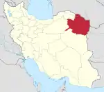
Joghatai Rural District (Persian: دهستان جغتای) is in the Central District of Joghatai County, Razavi Khorasan province, Iran.
Joghatai Rural District
دهستان جغتاd | |
|---|---|
 Joghatai Rural District | |
| Coordinates: 36°35′18″N 57°08′09″E[1] | |
| Country | |
| Province | Razavi Khorasan |
| County | Joghatai |
| District | Central |
| Population (2016)[2] | |
| • Total | 10,912 |
| Time zone | UTC+3:30 (IRST) |
At the National Census of 2006, its population (as a part of the former Joghatai District of Sabzevar County) was 10,374 in 2,605 households.[3] There were 10,313 inhabitants in 2,904 households at the following census of 2011, by which time the district had been separated from the county in the establishment of Joghatai County.[4] At the most recent census of 2016, the population of the rural district was 10,912 in 3,261 households. The largest of its 39 villages was Shahrestanak, with 2,156 people.[2]
References
- OpenStreetMap contributors (30 April 2023). "Joghatai Rural District (Joghatai County)" (Map). OpenStreetMap. Retrieved 30 April 2023.
- "Census of the Islamic Republic of Iran, 1395 (2016)". AMAR (in Persian). The Statistical Center of Iran. p. 09. Archived from the original (Excel) on 2 April 2022. Retrieved 19 December 2022.
- "Census of the Islamic Republic of Iran, 1385 (2006)". AMAR (in Persian). The Statistical Center of Iran. p. 09. Archived from the original (Excel) on 20 September 2011. Retrieved 25 September 2022.
- "Census of the Islamic Republic of Iran, 1390 (2011)" (Excel). Iran Data Portal (in Persian). The Statistical Center of Iran. p. 09. Retrieved 19 December 2022.
| Capital | |||||||||||||||||||||
|---|---|---|---|---|---|---|---|---|---|---|---|---|---|---|---|---|---|---|---|---|---|
| Districts |
| ||||||||||||||||||||
This article is issued from Wikipedia. The text is licensed under Creative Commons - Attribution - Sharealike. Additional terms may apply for the media files.