Kalarooch
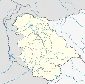
Kalarooch, also known as Kalaroos, is a pass of Kupwara district in the union territory of Jammu and Kashmir, India. It is surrounded by mountains which increases its beauty. The village is located 5 km (3.1 mi) from district headquarters Kupwara.
Raj Sing
Hatmulla | |
|---|---|
Town | |
 Raj Sing Location in Jammu and Kashmir, India  Raj Sing Raj Sing (India) | |
| Coordinates: 34.49°N 74.25°E | |
| Country | India |
| Union Territory | Jammu & Kashmir |
| District | Kupwara |
| Population (2011) | |
| • Total | 37,233[1] |
| Languages | |
| • Official | Kashmiri, Urdu, Hindi, Dogri, English[2][3] |
| Time zone | UTC+5:30 (IST) |
| PIN | 193222[4] |
Demographics
According to the 2011 census of India, Kalarooch has 5007 households.[5] The literacy rate of Kalarooch village was 48.76% compared to 67.16% of Jammu and Kashmir. In Kalarooch, Male literacy stands at 59.72% while the female literacy rate was 35.55%.
| Total | Male | Female | |
|---|---|---|---|
| Population | 37233 | 20338 | 16895 |
| Children aged below 6 years | 9354 | 5104 | 4250 |
| Scheduled caste | 53 | 53 | 0 |
| Scheduled tribe | 12038 | 6219 | 5819 |
| Literacy | 48.76% | 59.72% | 35.55% |
| Workers (all) | 10030 | 8304 | 1726 |
| Main workers (total) | 3502 | – | – |
| Marginal workers (total) | 6528 | 5223 | 1305 |
Transport
Rail
The nearest railway stations to Baramulla are Sopore railway station and Baramulla railway station both located at a distance of 42 kilometres respectively.
Air
The nearest airport is Srinagar International Airport located at a distance of 95 kilometres and is a 2.5-hour drive.
See also
References
- "Kalarooch Population". Our Hero. Retrieved 19 March 2020.
- "The Jammu and Kashmir Official Languages Act, 2020" (PDF). The Gazette of India. 27 September 2020. Retrieved 27 September 2020.
- "Parliament passes JK Official Languages Bill, 2020". Rising Kashmir. 23 September 2020. Retrieved 30 May 2021.
- "Kalarooch (Google Maps)". Google Maps. Retrieved 19 March 2020.
- "Kalarooch Population". Our Hero. Retrieved 19 March 2020.