Sumbal, Jammu and Kashmir
Sumbal is a town and a notified area committee in the Bandipora district of the Indian union territory of Jammu and Kashmir. Sumbal is 19 kilometres away from Srinagar (the summer capital of Jammu and Kashmir). Sumbal city is divided into 13 wards, for which elections are held every 5 years.
Sumbal, Jammu and Kashmir
Sumbal | |
|---|---|
Town | |
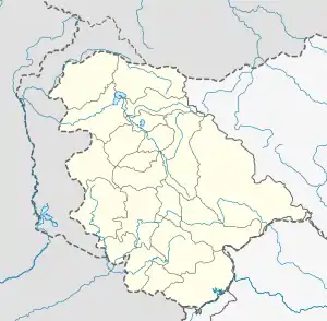 Sumbal, Jammu and Kashmir Location in Jammu and Kashmir, India  Sumbal, Jammu and Kashmir Sumbal, Jammu and Kashmir (India) | |
| Coordinates: 34.23°N 74.63°E | |
| Country | |
| Union territory | Jammu and Kashmir |
| District | Bandipora |
| Elevation | 1,557 m (5,108 ft) |
| Population (2001) | |
| • Total | 10,737 |
| Languages | |
| • Official | Kashmiri, Urdu, Hindi, Dogri, English[1][2] |
| Time zone | UTC+5:30 (IST) |
| Vehicle registration | JK |
Geography
Sumbal is located at 34.23°N 74.63°E.[3] It has an average elevation of 1557 metres (5108 feet).
Demographics
At the 2001 India census, Sumbal had a population of 10,737. Males constitute 51% of the population and females 49%. Sumbal has an average literacy rate of 29%, lower than the national average of 59.5%: male literacy is 39%, and female literacy is 18%. In Sumbal, 13% of the population is under 6 years of age.[4]
See also
- Manzoor Dar, a notable cricketer of Sumbal
- Uri
References
- "The Jammu and Kashmir Official Languages Act, 2020" (PDF). The Gazette of India. 27 September 2020. Retrieved 27 September 2020.
- "Parliament passes JK Official Languages Bill, 2020". Rising Kashmir. 23 September 2020. Retrieved 23 September 2020.
- Falling Rain Genomics, Inc - Sumbal
- "Census of India 2001: Data from the 2001 Census, including cities, villages and towns (Provisional)". Census Commission of India. Archived from the original on 16 June 2004. Retrieved 1 November 2008.
This article is issued from Wikipedia. The text is licensed under Creative Commons - Attribution - Sharealike. Additional terms may apply for the media files.