Khok Chamrae
Khok Chamrae (Thai: โคกชำแระ) is a tambon (subdistrict) located in the central region of Thung Si Udom district, in Ubon Ratchathani Province, Thailand.[1][2] In 2021, it had a population of 6,056 people.[1] Neighbouring subdistricts are (clockwise from the south) Na Kasem, Kut Ruea, Kut Salao, Na Hom, Nong Om, and Som Sa-at.[2]
Khok Chamrae
โคกชำแระ | |
|---|---|
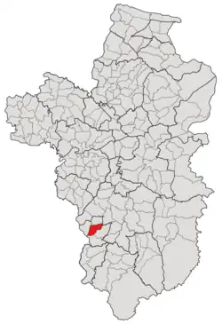 Subdistrict location in Ubon Ratchathani province | |
| Country | Thailand |
| Province | Ubon Ratchathani |
| District | Thung Si Udom |
| Number of Muban | 9 |
| Number of Mu | 10 |
| Subdistrict established | 1991 |
| Area | |
| • Total | 46 km2 (18 sq mi) |
| Population (2021) | |
| • Total | 6,056 |
| • Density | 131.65/km2 (341.0/sq mi) |
| Time zone | UTC+7 (ICT) |
| Postal code | 34160 |
History
The tambon was founded in 1991 by incorporating eight settlements in the southern part of Nong Om in the Det Udom district.[3] A year later, both Khok Chamrae and its parent tambon, together with three other subdistricts, including Thung Thoeng, Na Kasem, and Kut Ruea, were split off from Det Udom district to create a minor district (king amphoe) called Thung Si Udom.[4] However, the inclusion of tambon Thung Thoeng into the new district was undone a year later, on June 1.[5]
After its establishment, the tambon was governed by the Subdistrict Council of Khok Chamrae, until March 3, 1997, when the council was upgraded by the Department of Provincial Administration to be the Subdistrict Administrative Organization of Khok Chamrae.[2]
Geography
The tambon is located in the central region of the Thung Si Udom district, on the river plains of the Chamrae Creek (ห้วยชำแระ), one of the tributaries of the Lam Dom Yai River (ลำโดมใหญ่).[2]
Administration
The subdistrict of Khok Chamrae is divided into nine administrative villages (mubans; หมู่บ้าน), one of which, Khok Chamrae village, was further divided into two community groups (Mu; หมู่).[1] The entire area is governed by the Subdistrict Administrative Organization of Khok Chamrae (องค์การบริหารส่วนตำบลโคกชำแระ; Khok Chamrae SAO).[1][2]
As of the 2021 census, it had a population of 6,056 people with 2,059 households. The following is a list of the subdistrict's mubans, which roughly correspond to the villages.[1]
| Village | Group (Mu) | Household | Population | |
|---|---|---|---|---|
| Romanized name | Thai name | |||
| Nong Khok | หนองคก | 1 | 342 | 681 |
| Non Swang | โนนสวาง | 2 | 126 | 436 |
| Khok Chamrae | โคกชำแระ | 3 | 270 | 823 |
9 | 217 | 549 | ||
| Nong Sano | หนองสะโน | 4 | 123 | 466 |
| Kham Klang | คำกลาง | 5 | 116 | 472 |
| Palan | พะลาน | 6 | 143 | 368 |
| Non Du | โนนดู่ | 7 | 226 | 704 |
| Nong Sa-nom | หนองสนม | 8 | 297 | 1,113 |
| Si Udom | ศรีอุดม | 10 | 198 | 427 |
| Central house Registration | 1 | 17 | ||
| Total | 2,059 | 6,056 | ||
References
- "โครงสร้างข้อมูลสถิติจำนวนประชากร" (in Thai). Department of Provincial Administration of Thailand. 2021. Archived from the original on 14 December 2022. Retrieved 15 December 2022. Alt URL
- "ข้อมูลพื้นฐาน". www.khokchamrae.go.th (in Thai). Subdistrict Administrative Organization of Khok Chamrae. Archived from the original on 3 July 2022. Retrieved 16 December 2022.
- "ประกาศกระทรวงมหาดไทย เรื่อง ตั้งและกำหนดเขตตำบลในท้องที่อำเภอเดชอุดมและอำเภอโพธิ์ไทร จังหวัดอุบลราชธานี" (PDF). www.ratchakitcha.soc.go.th (in Thai). Royal Thai Government Gazette. 1 July 1991. Archived from the original (PDF) on 1 August 2019. Retrieved 16 December 2022.
- "ประกาศกระทรวงมหาดไทย เรื่อง แบ่งเขตท้องที่อำเภอเดชอุดม จังหวัดอุบลราชธานี ตั้งเป็นกิ่งอำเภอทุ่งศรีอุดม" (PDF). www.ratchakitcha.soc.go.th (in Thai). Royal Thai Government Gazette. 22 April 1992. Archived from the original (PDF) on 5 June 2022.
- "ประกาศกระทรวงมหาดไทย เรื่อง เปลี่ยนแปลงเขตกิ่งอำเภอทุ่งศรีอุดม อำเภอเดชอุดม จังหวัดอุบลราชธานี" (PDF). www.ratchakitcha.soc.go.th (in Thai). Royal Thai Government Gazette. 8 June 1993. Archived from the original (PDF) on 5 June 2022. Retrieved 16 December 2022.