Nong Om
Nong Om (Thai: หนองอ้ม) is a tambon (subdistrict) located in the northernmost area of Thung Si Udom district, in Ubon Ratchathani Province, Thailand.[1][2] In 2021, it had a population of 5,993 people.[1] Neighbouring subdistricts are (clockwise from the south) Khok Chamrae, Na Hom, Thung Thoeng, Na Krasaeng, and Som Sa-at.[2]
Nong Om
หนองอ้ม | |
|---|---|
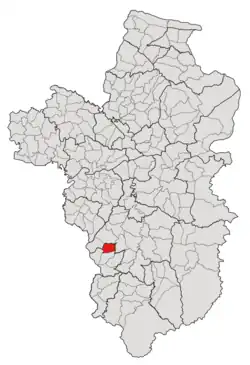 Subdistrict location in Ubon Ratchathani province | |
| Country | Thailand |
| Province | Ubon Ratchathani |
| District | Thung Si Udom |
| Mubans | 9 |
| Number of Mu | 10 |
| Subdistrict established | 1969 |
| Area | |
| • Total | 35 km2 (14 sq mi) |
| Population (2021) | |
| • Total | 5,993 |
| • Density | 171.23/km2 (443.5/sq mi) |
| Time zone | UTC+7 (ICT) |
| Postal code | 34160 |
History
The tambon Nong Om was formed in 1969, by splitting off 10 villages in the southeastern region of Thung Thoeng in Det Udom district.[3] Later in 1991, the southwestern region of the tambon, which consisted of eight villages, was cut off to establish a new division, Khok Chamrae.[4] A year after the demarcation, both Nong Om and Khok Chamrae, together with three other subdistricts, including Thung Thoeng, Na Kasem, and Kut Ruea, were split off from Det Udom district to create a minor district (king amphoe) called Thung Si Udom.[5] However, the inclusion of tambon Thung Thoeng into the new district was undone a year later, on June 1, 1993.[6]
Geography
The tambon is located in the northern region of the Thung Si Udom district, on the undulating land between the low river plains of the Lam Dom Yai River (ลำโดมใหญ่) in the east and of the Huai Khayung Creek (ห้วยขะยุง) in the west.[2]
Administration
The Nong Om subdistrict is divided into nine administrative villages (mubans; หมู่บ้าน), one of which, Nong Om village, was further divided into two community groups (Mu; หมู่).[1] The entire area is governed by the Subdistrict Administrative Organization of Nong Om (องค์การบริหารส่วนตำบลหนองอ้ม; Nong Om SAO).[1][2]
As of the 2021 census, it had a population of 5,809 people with 1,903 households. The following is a list of the subdistrict's mubans, which roughly correspond to the villages.[1]
| Village | Group (Mu) | Household | Population | |
|---|---|---|---|---|
| Romanized name | Thai name | |||
| Nong Om | หนองอ้ม | 1 | 300 | 744 |
3 | 223 | 626 | ||
| Nong Khee Ten | หนองขี้เต็น | 2 | 264 | 886 |
| Ben | เบญจ์ | 4 | 263 | 921 |
| Nong Si Kha | หนองสี่ขา | 5 | 135 | 408 |
| Non Rang | โนนรัง | 6 | 150 | 513 |
| Hong Por | ห่องปอ | 7 | 165 | 575 |
| Nong Bua Dong | หนองบัวดง | 8 | 89 | 263 |
| Thong Sawad | ทองสวัสดิ์ | 9 | 177 | 493 |
| Nong Bua | หนองบัว | 10 | 137 | 380 |
| Total | 1,903 | 5,809 | ||
References
- "โครงสร้างข้อมูลสถิติจำนวนประชากร" (in Thai). Department of Provincial Administration of Thailand. 2021. Archived from the original on 14 December 2022. Retrieved 15 December 2022. Alt URL
- "องค์การบริหารส่่วนตำบลหนองอ้ม". www.nongom.go.th (in Thai). Subdistrict Administrative Organization of Nong Om. Archived from the original on 5 July 2022. Retrieved 16 December 2022.
- "ประกาศกระทรวงมหาดไทย เรื่อง ตั้งและเปลี่ยนแปลงเขตตำบลในท้องที่อำเภอเดชอุดม อำเภอบุณฑริก อำเภอตระการพืชผล อำเภอพิบูลมังสาหาร อำเภอกุดชุม อำเภอยโสธร และอำเภอวารินชำราบ จังหวัดอุบลราชธานี" (PDF). www.ratchakitcha.soc.go.th (in Thai). Royal Thai Government Gazette. 29 July 1969. Archived from the original (PDF) on 26 October 2021. Retrieved 16 December 2022.
- "ประกาศกระทรวงมหาดไทย เรื่อง ตั้งและกำหนดเขตตำบลในท้องที่อำเภอเดชอุดมและอำเภอโพธิ์ไทร จังหวัดอุบลราชธานี" (PDF). www.ratchakitcha.soc.go.th (in Thai). Royal Thai Government Gazette. 1 July 1991. Archived from the original (PDF) on 1 August 2019. Retrieved 16 December 2022.
- "ประกาศกระทรวงมหาดไทย เรื่อง แบ่งเขตท้องที่อำเภอเดชอุดม จังหวัดอุบลราชธานี ตั้งเป็นกิ่งอำเภอทุ่งศรีอุดม" (PDF). www.ratchakitcha.soc.go.th (in Thai). Royal Thai Government Gazette. 22 April 1992. Archived from the original (PDF) on 5 June 2022.
- "ประกาศกระทรวงมหาดไทย เรื่อง เปลี่ยนแปลงเขตกิ่งอำเภอทุ่งศรีอุดม อำเภอเดชอุดม จังหวัดอุบลราชธานี" (PDF). www.ratchakitcha.soc.go.th (in Thai). Royal Thai Government Gazette. 8 June 1993. Archived from the original (PDF) on 5 June 2022. Retrieved 16 December 2022.