Na Hom, Thung Si Udom
Na Hom (Thai: นาห่อม) is a tambon (subdistrict) located in the westernmost area of Thung Si Udom district, in Ubon Ratchathani Province, Thailand.[1][2] In 2021, it had a population of 4,640 people.[1] Neighbouring subdistricts are (clockwise from the south) Tha Khlo, Thung Thoeng, Nong Om, and Khok Chamrae.[2]
Na Hom
นาห่อม | |
|---|---|
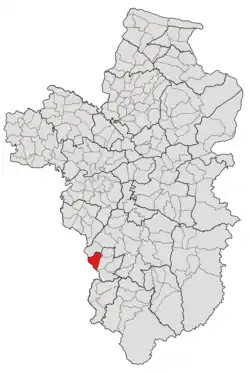 Subdistrict location in Ubon Ratchathani province | |
| Country | Thailand |
| Province | Ubon Ratchathani |
| District | Thung Si Udom |
| Number of Muban | 8 |
| Number of Mu | 11 |
| Subdistrict established | 1993 |
| Area | |
| • Total | 45 km2 (17 sq mi) |
| Population (2021) | |
| • Total | 4,640 |
| • Density | 103.11/km2 (267.1/sq mi) |
| Time zone | UTC+7 (ICT) |
| Postal code | 34160 |
History
Following the 1992 separation of five districts from Det Udom: Thung Thoeng, Nong Om, Na Kasem, Khok Chamrae, and Kut Ruea to form a minor district (king amphoe) called "Thung Si Udom,"[3] some communities in tambon Thung Thoeng preferred to remain affiliated with the original district, so the central government decided to split the tambon into two portions, the upper portion of which is now Thung Thoeng and was transferred back to Det Udom in the following year,[4] while the lower region, which consisted of nine villages, was formed a new subdistrict called "Na Hom,"[5] and has been governed by Thung Si Udom since then.[4]
After its establishment, the tambon was governed by the Subdistrict Council of Na Hom, until May 25, 1997, when the council was upgraded by the Department of Provincial Administration to be the Subdistrict Administrative Organization of Na Hom.[2]
Geography
The tambon is located in the western region of the Thung Si Udom district, on the undulating land between the low river plains of the Lam Dom Yai River (ลำโดมใหญ่) in the east and of the Huai Khayung Creek (ห้วยขะยุง) in the west.[2]
Administration
The subdistrict of Na Hom is divided into eight administrative villages (mubans; หมู่บ้าน), one of which, Na Hom village, was further divided into three community groups (Mu; หมู่).[1] The entire area is governed by the Subdistrict Administrative Organization of Na Hom (องค์การบริหารส่วนตำบลนาห่อม; Na Hom SAO).[1][2]
As of the 2021 census, it had a population of 4,640 people with 1,451 households. The following is a list of the subdistrict's mubans, which roughly correspond to the villages.[1]
| Village | Group (Mu) | Household | Population | |
|---|---|---|---|---|
| Romanized name | Thai name | |||
| Na Hom | นาห่อม | 1 | 163 | 474 |
10 | 82 | 313 | ||
11 | 170 | 651 | ||
| Non Chan | โนนจาน | 2 | 156 | 419 |
| Nong Nam Khun | หนองน้ำขุ่น | 4 | 180 | 596 |
| Wang Muang | วังม่วง | 5 | 95 | 326 |
| Kham Nok Plao | คำนกเปล้า | 6 | 122 | 389 |
| Nong Bua Aree | หนองบัวอารีย์ | 7 | 182 | 492 |
| Tha To | ตาโท | 8 | 130 | 428 |
| Nong Chik | หนองจิก | 9 | 100 | 308 |
| Central House Registration | 0 | 0 | ||
| Total | 1,451 | 4,640 | ||
Chief Executive
The following is a list of the Chief Executives of the Subdistrict Administrative Organization of Na Hom since its establishment in 1997.[2]
| Chief Executive | Term of Office | Note | |
|---|---|---|---|
| Romanized name | Thai name | ||
| Sern Ka-mueang | เสริม กาเมือง | February–March 1998 (1 month) | Designated |
| Duangchan Bunlo | ดวงจันทร์ บุญหล่อ | March–November 1998 (8 months) | Indirect election |
| Singkai Pilarat | สิงไค พิลารัตน์ | November 1998–January 1999 (2 months) | Indirect election |
| Thanom Kaewphraprap | ถนอม แก้วพระปราบ | January 1999–April 1999 (3 months) | Indirect election |
| Chalerm Sirinai | เฉลิม ศิรินัย | April 1999–June 2001 (2 years and 2 months) | Indirect election |
| Thanom Worthong | ถนอม วอทอง | June 2001–June 2005 (4 years) | Indirect election |
| Sutee Karuna | สุธี กรุณา | July 2005–July 2009 (4 years) | Direct election |
| Noppalak Supalak | นพลักษณ์ ศุภลักษณ์ | September 2009–September 2013 (4 years) | Direct election |
| Narin Boonkhachon | นรินทร์ บุญขจร | October 2013–October 2017 (4 years) | Direct election |
| October 2017–October 2021 (4 years) | Appointed by the National Council for Peace and Order | ||
| October 2021–Present (2 years) | Direct election | ||
References
- "โครงสร้างข้อมูลสถิติจำนวนประชากร" (in Thai). Department of Provincial Administration of Thailand. 2021. Archived from the original on 14 December 2022. Retrieved 15 December 2022. Alt URL
- "ประวัติความเป็นมา". www.nahom.go.th (in Thai). Subdistrict Administrative Organization of Na Hom. Archived from the original on 19 June 2022. Retrieved 16 December 2022.
- "ประกาศกระทรวงมหาดไทย เรื่อง แบ่งเขตท้องที่อำเภอเดชอุดม จังหวัดอุบลราชธานี ตั้งเป็นกิ่งอำเภอทุ่งศรีอุดม" (PDF). www.ratchakitcha.soc.go.th (in Thai). Royal Thai Government Gazette. 22 April 1992. Archived from the original (PDF) on 5 June 2022.
- "ประกาศกระทรวงมหาดไทย เรื่อง เปลี่ยนแปลงเขตกิ่งอำเภอทุ่งศรีอุดม อำเภอเดชอุดม จังหวัดอุบลราชธานี" (PDF). www.ratchakitcha.soc.go.th (in Thai). Royal Thai Government Gazette. 8 June 1993. Archived from the original (PDF) on 5 June 2022. Retrieved 16 December 2022.
- "ประกาศกระทรวงมหาดไทย เรื่อง ตั้งและกำหนดเขตตำบลในท้องที่อำเภอพิบูลมังสาหาร อำเภอวารินชำราบ และกิ่งอำเภอทุ่งศรีอุดม อำเภอเดชอุดม จังหวัดอุบลราชธานี" (PDF). www.ratchakitcha.soc.go.th (in Thai). Royal Thai Government Gazette. 13 November 1992. Archived from the original (PDF) on 5 June 2022. Retrieved 16 December 2022.