Kiphire district
Kiphire District (Pron:/ˈkɪfɑɪə/) is a district in the Indian state of Nagaland. At 1,130 square kilometres (440 sq mi), the district is the tenth-most populous district of Nagaland and 625th most populous district in India with 74,004 inhabitants.[3] The district is home to 3.74% population of Nagaland. The district headquarters is at Kiphire, 230 kilometres from state-capital Kohima. It is the fourth most backward district in India, according to the 2018 NITI Aayog rankings.[4]
Kiphire District | |
|---|---|
 Kiphire District of Nagaland | |
| Nickname: Land of Minerals | |
.svg.png.webp) Kiphire District in Nagaland | |
| Country | |
| State | Nagaland |
| Headquarters | Kiphire |
| Government | |
| • Lok Sabha Constituency | Nagaland |
| • MP[1] | Tokheho Yepthomi, NDPP |
| • Assembly constituencies | 2 constituencies |
| • Deputy Commissioner[2] | Sh. T. Wati Aier, (NCS) |
| Area | |
| • Total | 1,130 km2 (440 sq mi) |
| Elevation | 896 m (2,940 ft) |
| Population (2011) | |
| • Total | 74,004[3] |
| Demographics | |
| • Literacy[3] | 69.54% |
| • Sex ratio[3] | 956 ♀/ 1000 ♂ |
| Languages | |
| • Official | English |
| • Spoken | Sangtam, Sümi, Chirr, English, Yimkhiungrü |
| Time zone | UTC+05:30 (IST) |
| ISO 3166 code | IN-NL-PE |
| Major highways | |
| Website | kiphire |
History
Kiphire district was carved out of Tuensang district in 2003. It became the eleventh district of Nagaland after it was carved out.[5][3] An administrative headquarters at Kiphire was created on 16 June 1952 after surveys were done to open more administrative headquarters. The district was formally created in 2003 with 7 subdivisions, namely, Seyochung, Pungro, Amahator, Kiphire Sadar, Longmatra, Sitimi and Kiusam.[3][6] Another subdivision, namely, Khongsa was carved out of Pungro subdivision taking the total number of subdivisions of Kiphire district to 8.[3] The first Base Area Superintendent of the district was S.D. Lakhar. The district was earlier part of the Tuensang district which was under the NEFA.[5]
Geography
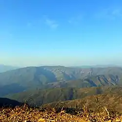
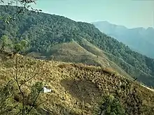
The area of the district is 1,130 square kilometres (440 sq mi).[3] It is bounded by Tuensang and Noklak districts in the north, Zünheboto district in the west, Phek district in the south and Myanmar in the east. It is headquartered at Kiphire, which is at an altitude of 896 m above sea level. The major towns of this district are Seyochung, Sitimi, Pungro and Kiphire. Nagaland's highest peak, Mount Saramati (3826 metres) is located in this district. Kiphire also has an earth station. Kisatong village is another tourist destination in the district.
Climate
The overall climate of the district is hot and humid during the summers and cold during winter. The temperature during the winter months touches a low of 2.7 degrees Celsius while in summer it reaches a high of 37.0 degrees Celsius. The district enjoys south-east Monsoon with average rainfall between 1500 mm to 1800 mm occurring over about 6 months from May to October.[7]
Administration
The district headquarters is at Kiphire. The district has 8 subdivisions namely Kiphire Sadar, Pungro, Seyochung, Khongsa, Amahator, Kiusam, Longmatra and Sitimi. The present Deputy Commissioner of the district is T. Wati Aier.[2]
Demographics
| Year | Pop. | ±% |
|---|---|---|
| 1901 | NA | — |
| 1911 | NA | — |
| 1921 | NA | — |
| 1931 | NA | — |
| 1941 | NA | — |
| 1951 | NA | — |
| 1961 | 15,635 | — |
| 1971 | 18,398 | +17.7% |
| 1981 | 28,931 | +57.3% |
| 1991 | 51,845 | +79.2% |
| 2001 | 106,591 | +105.6% |
| 2011 | 74,004 | −30.6% |
| Source: [8][note 1] | ||
According to the 2011 census Kiphire District has a population of 74,004,[6] roughly equal to the nation of Dominica.[9] This gives it a ranking of 625th in India (out of a total of 640). Kiphire has a sex ratio of 956 females for every 1000 males,[3] and a literacy rate of 69.54%.[3]
The district is predominantly inhabited by the Sangtam, Chirr, Makware, Yimkhiung and Sümi tribes. The tribal population constitutes 96.5% of the entire district.[3]
Religion
Christianity is the largest religion in the district, followed by 97% of the people. Hinduism is the second-largest religion with 1.41% adherents. Islam and Buddhism form 0.76% and 0.28% of the population respectively.[6]
Languages
The following languages, namely Sangtam, Sümi, Chirr, Makury and Yimkhiungrü are spoken in Kiphire District.
Government and politics

The district has two vidhan sabha constituences, namely, Seyochung Sitimi and Pungro Kiphire. The MLA of Seyochung Sitimi is V. Kashiho Sangtam of the BJP and the MLA of Pungro Kiphire is T. Yangseo Sangtam who is an independent politician.[10] The last elections were held in 2018. The next legislative assembly election will be held in 2023.
As part of Lok Sabha, Kiphire district is part of the Nagaland Lok Sabha constituency. In the 2019 Indian general election, Tokheho Yepthomi of the NDPP won by 16,000 votes over his rival K.L. Chishi of the Indian National Congress.[1] The next general election is in 2024.
Economy


Agriculture
Around 70% of the population of Kiphire district is engaged in agriculture.[7] The main agricultural system practised in the district is Shifting cultivation or Jhum cultivation. Rice, Maize, a local variety of kidney beans called Kholar and Soya beans constitutes the major crops in the jhum fields. About 32 groups of crops are widely grown in the district. Out of these, cereals such as Rice, Maize, millets are the most widely cultivated crops in terms of production and area coverage. Other crops grown are varieties of pulses and cash crops such as potatoes. Oranges. Papayas, Bananas and Pineapples are the major fruits grown throughout the district.
Industry


There are no major industries in the district. However, weaving forms the most important industry in the district. Basket weaving and Woodworking are common household industries practised by many people in Kiphire district and throughout Nagaland.[7]
Education
According to the 2011 census of India, the district has a literacy rate of 69.54%. The Scheduled Tribes have a literacy rate of 96.52%.[3]
Colleges
- Zisaji Presidency College, Kiphire[11]
Tourism

Tourist footfall in Kiphire district is low. Connectivity and communication infrastructure is very limited in the district. The number of tourists visiting Kiphire has seen growth in the past few years. Below are few of the tourist attractions in the district:[7][12]
- Mount Saramati, peak 3,826 metres (12,552 ft)
- Limestone Caves, Salumi and Mimi villages
- Zungki River
- Fakim Wildlife Sanctuary, Fakim
The limestone caves at Saluni, Mimi and other villages in Pungro subdivision are yet to be explored. The Tizu/Zungki River is a national waterway. It was declared a national waterway in 2016.[13]
Transportation
Air
The nearest airports are Dimapur Airport and Imphal Airport located 307 and 318 kilometres from the district headquarters Kiphire. There are two helipads in the district.[14] One is in Kiusam and the other is in Pungro.
Rail
The nearest railway station is Dimapur railway station located 313 kilometres from district headquarters Kiphire.
Notes
- Kiphire district was created after 2001.
References
- "Lok Sabha Members". Lok Sabha. Retrieved 12 July 2021.
- "Kiphire DC". Kiphire district website. Retrieved 18 July 2021.
- "Kiphire district census" (PDF). Govt of India Census Handbook. Retrieved 19 July 2021.
- Mahendra K Singh. "Part of NCR, Mewat is most backward district". Times of India. Retrieved 9 April 2021.
- "Kiphire History". Kiphire district website. Retrieved 19 July 2021.
- "Kiphire district religion". Census India 2011. Retrieved 19 July 2021.
- "Kiphire district Census Part A" (PDF). Government of India Census Handbook. Retrieved 19 July 2021.
- "Decadal Variation In Population Since 1901" (PDF). Govt of India. Retrieved 19 July 2021.
- US Directorate of Intelligence. "Country Comparison:Population". Archived from the original on 13 June 2007. Retrieved 1 October 2010.
Dominica 72,969 July 2011 est.
- "State Legislature of Nagaland". Nagaland official website. Retrieved 19 July 2021.
- "Colleges/Universities in Kiphire district". Kiphire district website. Retrieved 19 July 2021.
- "Tourist places in Kiphire district". Kiphire district website. Retrieved 19 July 2021.
- "Minister Kronu to take up Tizu-Zungki Inland Waterways Project". Morung Express. Retrieved 30 March 2021.
- "How To Reach". Kiphire district website. Retrieved 19 July 2021.
- "Kiphire Transport". Kiphire district website. Retrieved 19 July 2021.