Koki (village)
Koki[lower-alpha 1] (Russian: Коки, Ingush: Коки) is a medieval village (aul) in the Dzheyrakhsky District of Ingushetia. It is part of the rural settlement (administrative center) of Guli.[4] Koki is the ancestral village of Ingush taïp Kokurkhoy (Ingush: Кокурхой).[5]
Koki
Коки | |
|---|---|
| Other transcription(s) | |
| • Ingush | Коки |
.jpg.webp) | |
Location of Koki | |
 Koki Location of Koki 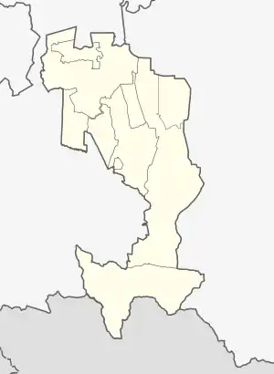 Koki Koki (Republic of Ingushetia) | |
| Coordinates: 42°47′19.68″N 44°58′38.67″E | |
| Country | Russia |
| Federal subject | Ingushetia |
| Population | |
| • Total | 0 |
| • Subordinated to | Dzheyrakhsky District |
| Time zone | UTC+3 (MSK |
| OKTMO ID | 26620450291 |
Geography
The village is located on a forest clearing 1580 m above sea level on the slope of Mount Cherekhkort, on the left bank of the Guloykhi River, not far from the border with Georgia. The nearest settlements are: in the northeast — Vovnushki, in the south — Nelkh, in the northwest — Puy, in the valley of the Assa River.[6]
History
According to the family tree of the Kokurkhoy, they were also known as the sons of Ferta Shouli,[7] who were among the defenders of the "Ghalghaï outposts" (Ingush: Ghalghaï Koashke), historically also known as the "Durdzuk Gates" in the valley of the Assa River.[8] The tower complex of Koki was estimated to be built no later than the 17th century. It now consists of the ruins of a battle tower and six residential tower buildings, which in the past were united by means of a stone defensive wall into a single fortified complex. On the neighboring slope, across a mountain stream, there are the ruins of more structures, usually called "Upper Koki", which are easily visible from the Guloy-khi gorge.[9]
In the autumn of 1910, the towers of the village of Koki were blown up by tsarist troops, for harboring abrek Zelimkhan. In 1911, the inhabitants of Koki (Kek) and the neighboring village of Nelkh (Nilkh) were deported to the Irkutsk and Yenisei provinces in Siberia. In 1913, the repressed were rehabilitated and allowed to return to their homeland, but it was not possible to restore the towers.[10][11]
Notes
References
- Russian Federal State Statistics Service (2011). Всероссийская перепись населения 2010 года. Том 1 [2010 All-Russian Population Census, vol. 1]. Всероссийская перепись населения 2010 года [2010 All-Russia Population Census] (in Russian). Federal State Statistics Service.
- "Об исчислении времени". Официальный интернет-портал правовой информации (in Russian). 3 June 2011. Retrieved 19 January 2019.
- Килиматов 2018, pp. 16–18.
- "Закон Республики Ингушетия от 23 февраля 2009 года № 5-РЗ «Об установлении границ муниципальных образований Республики Ингушетия и наделении их статусом сельского поселения, муниципального района и городского округа»".
- Килиматов 2018, p. 17.
- Проект «Открытый Кавказ». "Карта" (in Russian).
- Килиматов 2018, p. 4.
- Яковлев 1925, pp. 102–103.
- "Башенный комплекс Коки". Открытый Кавказ (in Russian).
- "О том, как ингуши пострадали от царских властей из-за отказа выдать абрека Зелимхана". grozny-inform.ru. 2 March 2018.
- Газета «Русское слово», № 238, от 16 окт. 1910.
Bibliography
- Килиматов, А. М. (2018). Кокурхой: история факты документы [Kokurkhoy: history facts documents]. Нальчик: «Тетраграф». pp. 1–411. ISBN 978-5-00066-126-0.
- Яковлев, Н. Ф. (1925). Ингуши [The Ingush] (in Russian). Москва: Типография Госиздата „Красный Пролетарий“. pp. 3–134.