Kolhabi
Kolhabi (Nepali: कोल्हवी ) is a municipality in Bara District in the Madhesh Province of Nepal. It was formed in 2016 occupying current 11 sections (wards) from previous 11 former VDCs.[2] It occupies an area of 157.4 km2 with a total population of 43,036.[3][4][1]
Kolhabi
कोल्हबी | |
|---|---|
 Kolhabi Location in Nepal | |
| Coordinates: 27.07°N 85.18°E | |
| Country | Nepal |
| Province | Madhesh Province |
| District | Bara District |
| Area | |
| • Total | 157.4 km2 (60.8 sq mi) |
| Population (2011)[1] | |
| • Total | 43,036 |
| • Density | 270/km2 (710/sq mi) |
| • Religions | Hindu Muslim Christian |
| Languages | |
| • Local | Bhojpuri |
| Time zone | UTC+5:45 (NST) |
| Postal Code | 44400 |
| Area code | 053 |
| Website | http://www.kolhabimun.gov.np/ |
Demographics
At the time of the 2011 Nepal census, Kolhabi Municipality had a population of 44,082. Of these, 50.8% spoke Tharu, 24.0% Bhojpuri, 16.5% Nepali, 4.2% Maithili, 1.9% Tamang, 1.0% Urdu, 0.9% Newar and 0.5% Magar as their first language.[5]
In terms of ethnicity/caste, 59.3% were Tharu, 8.1% Hill Brahmin, 5.1% Musahar, 4.6% Chhetri, 3.6% Chamar/Harijan/Ram, 2.4% Tamang, 2.2% Musalman, 1.7% Dusadh/Paswan/Pasi, 1.5% Teli, 1.4% Newar, 1.1% Magar, 1.0% Mallaha, 0.8% Bin, 0.8% Kami, 0.7% Kalwar, 0.6% Kanu, 0.5% Hajjam/Thakur, 0.5% Majhi, 0.5% Nuniya, 0.4% Koiri/Kushwaha, 0.3% Terai Brahmin, 0.3% Damai/Dholi, 0.3% other Terai, 0.3% Thakuri, 0.2% Kathabaniyan, 0.2% Sanyasi/Dasnami, 0.2% Sonar, 0.2% Yadav, 0.1% other Dalit, 0.1% Dhanuk, 0.1% Dhobi, 0.1% Gharti/Bhujel, 0.1% Kurmi, 0.1% Mali, 0.1% Rai, 0.1% Thami and 0.1% others.[6]
In terms of religion, 95.0% were Hindu, 2.5% Buddhist, 2.2% Muslim, 0.3% Christian and 0.1% others.[7]
In terms of literacy, 57.7% could read and write, 2.2% could only read and 40.0% could neither read nor write.[8]
References
- Nepal, Government of Nepal (November 2012). ""National Population and Housing Census 2011 (Village Development Committee/Municipality)" (PDF). National Planning Commission. Archived from the original (PDF) on 5 October 2018. Retrieved 22 December 2018.
- "PM formally announces 744 local units operational". My Republica. Archived from the original on 13 August 2018. Retrieved 13 August 2018.
- "स्थानिय तह". 103.69.124.141. Archived from the original on 31 August 2018. Retrieved 1 September 2018.
- "Population Ward Level 753 Local Unit" (PDF). CBS. 2 June 2017. Archived from the original (PDF) on 27 January 2018. Retrieved 22 December 2018.
- NepalMap Language
- NepalMap Caste
- NepalMap Religion
- NepalMap Literacy
Headquarter: Kalaiya | ||
| Sub-Metropolitan Cities | 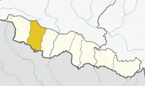 | |
| Municipalities | ||
| Rural municipalities | ||