Kooringal, Queensland
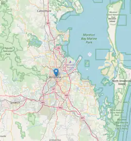
Kooringal is a coastal town and locality on the south-west coast of Moreton Island within the City of Brisbane, Queensland, Australia.[2][3] In the 2016 census the locality of Kooringal had a population of 45 people.[1]
| Kooringal Queensland | |||||||||||||||
|---|---|---|---|---|---|---|---|---|---|---|---|---|---|---|---|
 Kooringal | |||||||||||||||
| Coordinates | 27.35°S 153.4205°E | ||||||||||||||
| Population | 45 (2016 census locality)[1] | ||||||||||||||
| • Density | 230/km2 (580/sq mi) | ||||||||||||||
| Postcode(s) | 4025 | ||||||||||||||
| Area | 0.2 km2 (0.1 sq mi) | ||||||||||||||
| Time zone | AEST (UTC+10:00) | ||||||||||||||
| LGA(s) | City of Brisbane | ||||||||||||||
| State electorate(s) | Redcliffe | ||||||||||||||
| Federal division(s) | Bonner | ||||||||||||||
| |||||||||||||||
Geography
Kooringal consists of a few streets of housing along the south-western tip of Moreton Island. It is connected to the other settlements on the island by two routes:[4]
- the Toulkerrie-Kooringal Bypass Road which travels north through the mangroves along the west coast until the sandy western beach commences. At this point the road becomes known as the Tangalooma-Kooringal Road and travels along the western beach until it reaches Tangalooma.[4]
- the Mirapool Lagoon Bypass Road which crosses the island to the east coast beach, where it becomes the Mirapool - Middle Track Road and follows the eastern beach to the north
Located just to the north-east of the locality is the Kooringal Airstrip (also known as Baroco) which is 500 metres (1,600 ft) long.[5][6] A vehicular barge service operates from Amity Point to Kooringal at some times of year. Otherwise, vehicles must use the barge to Tangalooma and drive south to Kooringal.[7]
A small island (informally known as Crab Island) is to the north-west of Kooringal and the channel between them is called Days Gutter.[8]
Campbell Point is the point at the southern end of Kooringal Esplanade (27.3553°S 153.4191°E).[9]
History
Campbell Point was named after George Peter Campbell (son of James Campbell), the Secretary of the Brisbane Tug and Steamship Company Ltd. In 1902 he acquired a lease for 66 square miles (170 km2) for most of Moreton Island, noting that the island as a whole is approximately 186 square kilometres (72 sq mi). He built a house and stock yard at this headland. In 1903 he began shipping drought-stricken cattle from western Queensland to the island to fatten them up for sale.[9][10][11]
In the 2011 census, Kooringal had a population of 297 people.[12]
In the 2016 census the locality of Kooringal had a population of 45 people.[1]
Economy
The Toulkerrie Oyster Farm produces fresh Moreton Bay rock oysters; it takes around three years to grow the oysters large enough for the table. The farming process is environmentally sustainable and won the 2010 National Landcare Awards for Sustainable Farm Practices.[5][13]
Amenities
Moorgumpin Park (also known as The Dal Pope Reserve) is at 45 Kooringal Esplanade (27.3529°S 153.4198°E). It has public toilets.[14][15]
Kooringal Fire Station is an operational fire station metro (27.3490°S 153.4221°E).[16]
Attractions
The waters in the Kooringal area are noted for their fishing. Consequently, many of the buildings in Kooringal are holiday homes and fishing clubhouses.[5]
References
- Australian Bureau of Statistics (27 June 2017). "Kooringal (SSC)". 2016 Census QuickStats. Retrieved 20 October 2018.
- "Kooringal – town in City of Brisbane (entry 18491)". Queensland Place Names. Queensland Government. Retrieved 26 December 2020.
- "Kooringal – locality in City of Brisbane (entry 49460)". Queensland Place Names. Queensland Government. Retrieved 26 December 2020.
- "Queensland Globe". State of Queensland. Retrieved 21 June 2015.
- "Destinations". Visit Moreton Island. Archived from the original on 21 June 2015. Retrieved 21 June 2015.
- "Baroco Airport - YBCX - Airport Guide". airportguide.com. Archived from the original on 24 September 2016. Retrieved 24 August 2020.
- "How to get here". Archived from the original on 27 February 2015. Retrieved 21 June 2015.
- "Days Gutter (entry 9482)". Queensland Place Names. Queensland Government. Retrieved 21 June 2015.
- "Campbell Point – point in City of Brisbane (entry 5983)". Queensland Place Names. Queensland Government. Retrieved 26 December 2020.
- "East Moreton". The Queenslander. Vol. LXIII, no. 1403. Queensland, Australia. 11 October 1902. p. 840. Retrieved 22 February 2021 – via National Library of Australia.
- "Cattle on Moreton Island". The Telegraph. No. 9, 472. Queensland, Australia. 31 March 1903. p. 7 (SECOND EDITION). Archived from the original on 22 February 2021. Retrieved 22 February 2021 – via National Library of Australia.
- Australian Bureau of Statistics (31 October 2012). "Kooringal". 2011 Census QuickStats. Retrieved 21 June 2015.
- "About MBRO". Moreton Bay Rock Oysters. Archived from the original on 21 June 2015. Retrieved 21 June 2015.
- "Land for public recreation - Queensland". Queensland Open Data. Queensland Government. 20 November 2020. Archived from the original on 22 November 2020. Retrieved 22 November 2020.
- "Kooringal parks". Brisbane City Council. Archived from the original on 4 December 2020. Retrieved 22 February 2021.
- "Emergency services facilities - Queensland". Queensland Open Data. Queensland Government. 18 November 2020. Archived from the original on 24 November 2020. Retrieved 24 November 2020.
Further reading
- Ludlow, Peter (2012), Moreton Bay people 2012, Peter Ludlow, ISBN 978-0-9577260-9-3