Korostyshiv
Korostýšiv (Ukrainian: Корости́шів, Polish: Korosteszów, Russian: Коросты́шев) is a city in Zhytomyr Raion, Zhytomyr Oblast, Ukraine. Prior to 2020, it served as the administrative center of the former Korostyshiv Raion. Population: 24,129 (2022 estimate).[1]
Korostyshiv
Корости́шів | |
|---|---|
 Church of the Nativity of the Virgin Mary in Korostyshiv | |
 Flag  Coat of arms | |
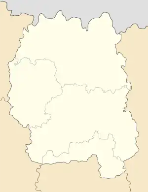
 Korostyshiv Location in the Ukraine  Korostyshiv Korostyshiv (Ukraine) | |
| Coordinates: 50°19′N 29°04′E | |
| Country | |
| Oblast | |
| Raion | Zhytomyr Raion |
| Population (2022) | |
| • Total | 24,129 |
| Time zone | UTC+2 (EET) |
| • Summer (DST) | UTC+3 (EEST) |
History
The city was founded around the VI-VII centuries. According to legend, the town was called Khminychi and was the center of one of the Drevlians tribes, the Minskians.
The first written mention as a village of Zhitomirsky Uyezd, Kyiv Voivodeship of the Grand Duchy of Lithuania dates back to March 26, 1499. For sixty-five years it belonged to the Chornobyl Kmyts, a well-known and influential family of Right-bank Ukraine. Since 1565, after it was sold by Filon Kmita,[2] the town became the property of the Olizar family,[3] who later received the title of counts.
In July 1768, Ivan Bondarenko's Cossacks visited the town.[4]
In 1779, Magdeburg rights and a coat of arms were granted with the image of the family emblem of the Olizar Counts: a golden church flag with a cross on a red background (noble coat of arms "Radvan"). After the second partition of Poland in 1793, Korostyshiv became part of the Russian Empire. Since 1795, the town has been part of the Radomyslsky Uyezd of the Volhynian Governorate, and since 1797 it has been transferred to the Kyiv Governorate, which was part of it for more than 120 years. The Olizar family remained the owners of Korostyshev until 1873. Most of the lands of the manor were forests.
According to the 1897 census, 7,863 residents lived in the city.
On Oct 9, 1900 Henry de La Vaulx (1870–1930 and a companion set a distance record in a balloon traveling 1200 miles from Vincennes to Korostyshiv. in 35.75 hours
In 1938, the status of a city was granted.[5][6]
In January 1989, the population was 28 046 people.[7]
Gallery
 Korostyshiv railway station terminal
 City park
 Fountain in the park
 War memorial in Korostyshiv
 Korostyshiv pedagogical college
 Teteriv River in Korostyshiv
 Korostyshiv quarry
International relations
Twin towns — Sister cities
 Kohtla-Järve, Estonia[8]
References
- Чисельність наявного населення України на 1 січня 2022 [Number of Present Population of Ukraine, as of January 1, 2022] (PDF) (in Ukrainian and English). Kyiv: State Statistics Service of Ukraine. Archived (PDF) from the original on 4 July 2022.
- "Polona". polona.pl. Retrieved 2022-07-30.
- "Єршов В. О. Духовний світ митця Г. П. Олізара [Архівовано 1 липня 2015 у Wayback Machine.] // Українська полоністика. 2005. — № 2. — С. 157—173" (PDF).
- Букет Євген. Іван Бондаренко — останній полковник Коліївщини. Історичний нарис. — Київ: Видавництво «Стікс», 2014. — 320 с. ISBN 978-966-2401-09-7
- Відомості Верховної Ради СРСР. — 1938. — № 21. — 15 грудня. — С. 4.
- ИнфоРост, Н. П. "ГПИБ | СССР. Административно-территориальное деление союзных республик : изменения, происшедшие за время с 1/X 1938 г. по 1/III 1939 г. - М., 1939". elib.shpl.ru. Retrieved 2022-07-30.
- Всесоюзная перепись населения 1989 г. Численность городского населения союзных республик, их территориальных единиц, городских поселений и городских районов по полу
- "Välissuhted" (in Estonian). Kohtla-Järve linn. Retrieved 1 March 2012.