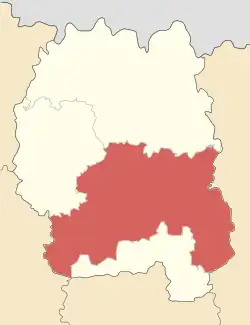
Zhytomyr Raion
Zhytomyr Raion (Ukrainian: Житомирський район) is a raion (district) of Zhytomyr Oblast, northern Ukraine. Its administrative centre is located at Zhytomyr. The raion covers an area of 1,441 square kilometres (556 sq mi). Population: 606,433 (2022 estimate).[1]
Zhytomyr Raion
Житомирський район | |
|---|---|
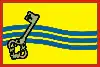 Flag 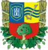 Coat of arms | |
 | |
| Coordinates: 50°12′17″N 28°38′55″E | |
| Country | |
| Oblast | |
| Admin. center | Zhytomyr |
| Subdivisions | 31 hromadas |
| Area | |
| • Total | 1,441 km2 (556 sq mi) |
| Population (2022)[1] | |
| • Total | 606,433 |
| • Density | 420/km2 (1,100/sq mi) |
| Time zone | UTC+02:00 (EET) |
| • Summer (DST) | UTC+03:00 (EEST) |
| Area code | +380 |
On 18 July 2020, as part of the administrative reform of Ukraine, the number of raions of Zhytomyr Oblast was reduced to four, and the area of Zhytomyr Raion was significantly expanded. [2][3] Before the expansion, the area of the raion was 865.2 square kilometres (334.1 sq mi). The January 2020 estimate of the raion population was 72,213 (2020 est.).[4]
In 1928-39 the raion was known as Troianiv Raion centered in a town of Troianiv (today a small village).
References
- Чисельність наявного населення України на 1 січня 2022 [Number of Present Population of Ukraine, as of January 1, 2022] (PDF) (in Ukrainian and English). Kyiv: State Statistics Service of Ukraine. Archived (PDF) from the original on 4 July 2022.
- "Про утворення та ліквідацію районів. Постанова Верховної Ради України № 807-ІХ". Голос України (in Ukrainian). 2020-07-18. Retrieved 2020-10-03.
- "Нові райони: карти + склад" (in Ukrainian). Міністерство розвитку громад та територій України.
- Чисельність наявного населення України на 1 січня 2020 року / Population of Ukraine Number of Existing as of January 1, 2020 (PDF) (in Ukrainian and English). Kyiv: State Statistics Service of Ukraine.
This article is issued from Wikipedia. The text is licensed under Creative Commons - Attribution - Sharealike. Additional terms may apply for the media files.