Kubu Raya Regency
Kubu Raya Regency or Great Kubu Regency is a regency of West Kalimantan, Indonesia. It was created on 17 July 2007 from the (larger) central and southern part of what was at that time the Pontianak Regency. It covers an area of 8,492.10 km2, and it had a population of 500,970 at the 2010 Census[2] and 609,392 at the 2020 Census;[3] the official estimate as at mid 2022 was 622,217 (comprising 317,815 males and 304,402 females).[1] The principal town lies at Sungai Raya, directly adjacent to the City of Pontianak. Despite its close location to Pontianak, the regional capital and economic centre of the West Kalimantan Province, Kubu Raya highly lacks sufficient infrastructure development, which causes general suspicions on the performance of its local government.
Kubu Raya Regency
Kabupaten Kubu Raya | |
|---|---|
 | |
 Coat of arms | |
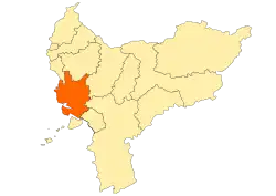 Location within West Kalimantan | |
 Kubu Raya Regency Location in Kalimantan and Indonesia  Kubu Raya Regency Kubu Raya Regency (Indonesia) | |
| Coordinates: 0.3534°S 109.4735°E | |
| Country | Indonesia |
| Province | West Kalimantan |
| Capital | Sungai Raya |
| Government | |
| • Regent | Muda Mahendrawan, SH |
| • Vice Regent | Sujiwo, SE |
| Area | |
| • Total | 8,492.10 km2 (3,278.82 sq mi) |
| Population (2022 estimate)[1] | |
| • Total | 622,217 |
| • Density | 73/km2 (190/sq mi) |
| Time zone | UTC+7 (IWST) |
| Area code | (+62) 561 |
| Website | kuburayakab |
Administrative Districts
The Kubu Raya Regency consists of nine districts (kecamatan), tabulated below with their areas and their populations at the 2010 Census[2] and the 2020 Census,[3] together with the official estimates as at mid 2022.[1] The table includes the locations of the district administrative centres, the number of administrative villages in each district (all classed as rural desa), and its post code.
| Name of District (kecamatan) |
Year formed | Area in km2 | Pop'n Census 2010 | Pop'n Census 2020 | Pop'n Estimate mid 2022 | Admin centre | No. of villages | Post code |
|---|---|---|---|---|---|---|---|---|
| Batu Ampar | — | 2,434.06 | 33,093 | 35,856 | 35,786 | Padang Tikar | 15 | 78385 |
| Terentang | — | 642.01 | 10,177 | 13,235 | 13,686 | Terentang Hilir | 10 | 78392 |
| Kubu | — | 1,594.38 | 36,469 | 42,052 | 42,484 | Kubu | 20 | 78384 |
| Teluk Pakedai (Pakedai Bay) |
— | 334.05 | 18,767 | 20,287 | 20,241 | Selat Remis | 14 | 78383 |
| Sungai Kakap (Kakap River) |
— | 585.14 | 101,200 | 123,102 | 125,659 | Sungai Kakap | 13 | 78380 |
| Rasau Jaya | 2001 (from Sungai Kakap) | 211.34 | 23,499 | 30,346 | 31,337 | Rasau Jaya | 6 | 78381 & 78382 |
| Sungai Raya (a) (Raya River) |
— | 1,190.69 | 188,014 | 234,087 | 240,027 | Sungai Raya | 20 | 78391(b) |
| Sungai Ambawang (Ambawang River) |
1961 (from Sungai Raya) | 1,087.69 | 54,879 | 83,085 | 85,406 | Ambawang Kuala | 14 | 78393 |
| Kuala Mandor B | 1999 (from Sungai Ambawang) | 413.31 | 23,852 | 27,342 | 27,591 | Kuala Mandor | 5 | 78355 |
| Totals | 8,492.10 | 500,970 | 609,392 | 622,217 | Sungai Raya | 117 |
Notes: (a) including the town (then classed as a kelurahan) of Sungai Raya, which had 62,010 inhabitants at the 2010 Census; by the 2020 Census this town had been split into several desa within the district, among which the desa of Sungai Raya had 16,101 inhabitants in mid 2021, Sungai Raya Dalam had 22,652, Kapur had 14,861, Parit Baru had 32,028, Arang Limbung had 26,783. (b) except the desa of Kapur, which has a post code of 78234.
References
- Badan Pusat Statistik, Jakarta, 2023, Kabupaten Kubu Raya Dalam Angka 2023 (Katalog-BPS 1102001.6112)
- Biro Pusat Statistik, Jakarta, 2011.
- Badan Pusat Statistik, Jakarta, 2021.
Regencies and cities of West Kalimantan | ||
|---|---|---|
Capital: Pontianak | ||
| Regencies | ||
| Cities | ||