Landak Regency
Landak Regency is a regency of West Kalimantan province, Indonesia. It was created on 4 October 1999 from the northeastern part of Pontianak Regency. It covers 9,909.10 km2 and had a population of 329,649 at the 2010 Census[2] and 397,610 at the 2020 Census;[3] the official estimate as at mid 2022 was 405,396 (comprising 212,022 males and 193,374 females).[1] The principal town lies at Ngabang. Landak is also one of the four regencies in West Kalimantan whose population is predominantly Catholic, the others being Sanggau, Sekadau, and Sintang.
Landak Regency
Kabupaten Landak | |
|---|---|
 Rombo Dait Waterfall | |
 Coat of arms | |
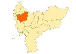 Location within West Kalimantan | |
 Landak Regency Location in Kalimantan and Indonesia  Landak Regency Landak Regency (Indonesia) | |
| Coordinates: 0.4237°N 109.7592°E | |
| Country | Indonesia |
| Province | West Kalimantan |
| Capital | Ngabang |
| Government | |
| • Regent | Samuel,SE. M.Si |
| Area | |
| • Total | 8,831 km2 (3,410 sq mi) |
| Population (mid 2022 estimate)[1] | |
| • Total | 405,396 |
| • Density | 46/km2 (120/sq mi) |
| Time zone | UTC+7 (IWST) |
| Area code | (+62) 563 |
| Website | landakkab |
Administrative Districts
Landak Regency consists of thirteen districts (kecamatan), tabulated below with their areas and their populations at the 2010 Census[2] and the 2020 Census,[3] together with the official estimates as at mid 2022.[1] The table also includes the locations of the district administrative centres, the number of administrative villages in each district (all classed as rural desa), and its post code.
| Name of District (kecamatan) |
Year formed | Area in km2 | Pop'n Census 2010 | Pop'n Census 2020 | Pop'n Estimate mid 2022 | Admin centre | No. of villages | Post code |
|---|---|---|---|---|---|---|---|---|
| Sebangki | 1999 (from Sengah Temila) |
885.60 | 16,653 | 19,582 | 19,919 | Sebangki | 5 | 79358 |
| Ngabang | — | 1,148.10 | 60,583 | 78,153 | 80,153 | Ngabang | 19 | 79354 |
| Jelimpo | 2006 (from Ngabang) |
848.80 | 23,338 | 28,271 | 28,834 | Jelimpo | 13 | 79357 |
| Sengah Temila | — | 1,963.00 | 53,493 | 63,786 | 64,965 | Pahauman | 14 | 79456 |
| Mandor | — | 455.10 | 28,387 | 33,452 | 34,035 | Mandor | 17 | 79355 |
| Menjalin | — | 322.90 | 18,598 | 21,871 | 22,248 | Menjalin | 8 | 79362 |
| Mempawah Hulu (Upper Mempawah) |
— | 496.34 | 32,782 | 40,129 | 40,965 | Karangan | 17 | 79363 |
| Sompak | 2006 (from Mempawah Hulu) |
219.76 | 13,581 | 15,963 | 16,237 | Sompak | 7 | 79361 |
| Menyuke | — | 594.16 | 25,716 | 30,230 | 30,750 | Darit | 16 | 79360 |
| Banyuke Hulu (Upper Banyuke) |
2006 (from Menyuke) |
273.80 | 11,864 | 13,669 | 13,880 | Semade | 7 | 79364 |
| Meranti | 1996 (from Menyuke) |
372.34 | 9,080 | 10,593 | 10,768 | Meranti | 6 | 79366 |
| Kuala Behe | 1999 (from Air Besar) |
968.00 | 13,650 | 16,709 | 17,057 | Kuala Behe | 11 | 79367 |
| Air Besar | — | 1,361.20 | 21,924 | 25,202 | 25,585 | Serimbu | 16 | 79365 |
| Totals 401,103 | 9,909.10 | 329,649 | 397,610 | 405,396 | Ngabang | 156 |
Climate
Ngabang, the seat of the regency has a tropical rainforest climate (Af) with heavy rainfall year-round.
| Climate data for Ngabang | |||||||||||||
|---|---|---|---|---|---|---|---|---|---|---|---|---|---|
| Month | Jan | Feb | Mar | Apr | May | Jun | Jul | Aug | Sep | Oct | Nov | Dec | Year |
| Average high °C (°F) | 30.2 (86.4) |
30.7 (87.3) |
31.2 (88.2) |
31.7 (89.1) |
32.0 (89.6) |
31.7 (89.1) |
31.7 (89.1) |
31.7 (89.1) |
31.5 (88.7) |
31.4 (88.5) |
30.9 (87.6) |
30.6 (87.1) |
31.3 (88.3) |
| Daily mean °C (°F) | 26.3 (79.3) |
26.7 (80.1) |
26.9 (80.4) |
27.3 (81.1) |
27.5 (81.5) |
27.2 (81.0) |
27.1 (80.8) |
27.1 (80.8) |
27.0 (80.6) |
27.0 (80.6) |
26.7 (80.1) |
26.6 (79.9) |
27.0 (80.5) |
| Average low °C (°F) | 22.4 (72.3) |
22.7 (72.9) |
22.7 (72.9) |
22.9 (73.2) |
23.0 (73.4) |
22.7 (72.9) |
22.5 (72.5) |
22.5 (72.5) |
22.6 (72.7) |
22.7 (72.9) |
22.6 (72.7) |
22.6 (72.7) |
22.7 (72.8) |
| Average rainfall mm (inches) | 279 (11.0) |
237 (9.3) |
233 (9.2) |
288 (11.3) |
239 (9.4) |
193 (7.6) |
173 (6.8) |
196 (7.7) |
246 (9.7) |
304 (12.0) |
313 (12.3) |
314 (12.4) |
3,015 (118.7) |
| Source: Climate-Data.org[4] | |||||||||||||
References
- Badan Pusat Statistik, Jakarta, 2023, Kabupaten Landak Dalam Angka 2023 (Katalog-BPS 1102001.6108)
- Biro Pusat Statistik, Jakarta, 2011.
- Badan Pusat Statistik, Jakarta, 2021.
- "Climate: Ngabang". Climate-Data.org. Retrieved 24 November 2020.
Regencies and cities of West Kalimantan | ||
|---|---|---|
Capital: Pontianak | ||
| Regencies | ||
| Cities | ||