La Chapelle-Saint-André
La Chapelle-Saint-André (French pronunciation: [la ʃapɛl sɛ̃.t‿ɑ̃dʁe]) is a commune in the Nièvre department in central France.[3]
La Chapelle-Saint-André | |
|---|---|
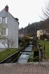 The Sauzay river, at La Chapelle-Saint-André | |
.svg.png.webp) Coat of arms | |
Location of La Chapelle-Saint-André | |
 La Chapelle-Saint-André  La Chapelle-Saint-André | |
| Coordinates: 47°23′42″N 3°20′43″E | |
| Country | France |
| Region | Bourgogne-Franche-Comté |
| Department | Nièvre |
| Arrondissement | Clamecy |
| Canton | Clamecy |
| Intercommunality | Haut Nivernais-Val d'Yonne |
| Government | |
| • Mayor (2020–2026) | Janny Siméon[1] |
| Area 1 | 27.15 km2 (10.48 sq mi) |
| Population | 298 |
| • Density | 11/km2 (28/sq mi) |
| Time zone | UTC+01:00 (CET) |
| • Summer (DST) | UTC+02:00 (CEST) |
| INSEE/Postal code | 58058 /58210 |
| Elevation | 195–310 m (640–1,017 ft) |
| 1 French Land Register data, which excludes lakes, ponds, glaciers > 1 km2 (0.386 sq mi or 247 acres) and river estuaries. | |
See also
References
- "Répertoire national des élus: les maires". data.gouv.fr, Plateforme ouverte des données publiques françaises (in French). 2 December 2020.
- "Populations légales 2020". The National Institute of Statistics and Economic Studies. 29 December 2022.
- INSEE commune file
Wikimedia Commons has media related to La Chapelle-Saint-André.
This article is issued from Wikipedia. The text is licensed under Creative Commons - Attribution - Sharealike. Additional terms may apply for the media files.