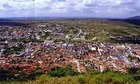
Limoeiro
Limoeiro is a city in Pernambuco, Brazil.
Limoeiro | |
|---|---|
 Limoeiro Overview | |
 Flag  Seal | |
 Limoeiro Limoeiro located in Brazil map | |
| Coordinates: 7°52′30″S 35°27′00″W | |
| Country | |
| State | Pernambuco |
| Region | Agreste |
| Area | |
| • Total | 269.97 km2 (104.24 sq mi) |
| Elevation | 138 m (453 ft) |
| Population (2020 [1]) | |
| • Total | 56,198 |
| Time zone | UTC−3 (BRT) |
| Average Temperature | 25.1 °C (77.2 °F) |

Limoeiro's principal church
Geography
- State - Pernambuco
- Region - Agreste Pernambucano
- Boundaries - Vicência (N); Passira and Feira Nova (S); Carpina, Lagoa do Carro and Buenos Aires (E); Bom Jardim, Salgadinho and João Alfredo (W)
- Area - 269.97 km2
- Elevation - 138 m
- Hydrography - Capibaribe and Goiana rivers
- Vegetation - Caducifólia forest
- Climate - hot, tropical, and humid
- Annual average temperature - 25.1 c
- Distance to Recife - 91 km
Economy
The main economic activities in Limoeiro are based in industry, commerce, tourism and agribusiness; especially plantations of bananas and sugarcane, and the raising of cattle, goats, sheep, pigs and chickens.
Economic indicators
| Population[2] | GDP x(1000 R$).[3] | GDP pc (R$) | PE |
|---|---|---|---|
| 57.243 | 219.496 | 3.951 | 0.37% |
Economy by sector (2006)
| Primary sector | Secondary sector | Service sector |
|---|---|---|
| 5.76% | 12.32% | 81.92% |
References
- IBGE 2020
- http://www.ibge.gov.br/home/estatistica/populacao/estimativa2009/POP2009_DOU.pdf IBGE Population 2009 (Limoeiro, page 33)
- Limoeiro 2007 GDP IBGE page 30 Archived 2016-03-04 at the Wayback Machine
- PE State site - City by city profile
This article is issued from Wikipedia. The text is licensed under Creative Commons - Attribution - Sharealike. Additional terms may apply for the media files.
