Outline of Suriname
The following outline is provided as an overview of and topical guide to Suriname:


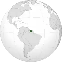
Suriname – sovereign state on the northeastern Atlantic coast of South America, and the smallest country on that continent. It was long inhabited by indigenous tribal peoples with diverse cultures, before being explored and contested by European powers from the 16th century, and eventually coming under Dutch rule in the late 17th century. In 1954, the country became one of the constituent countries of the Kingdom of the Netherlands. On 25 November 1975, the country of Suriname left the Kingdom of the Netherlands to become an independent state, while maintaining close economic, diplomatic, and cultural ties to its former colonizer. Suriname is the only sovereign nation outside Europe where Dutch is spoken by a majority of the population.
General reference

- Pronunciation: /ˈsjʊərɪnæm/, US also /-nɑːm/, Dutch: [ˌsyːriˈnaːmə], Portuguese: [suɾiˈnɐmi], Surinamese: [sraˈnãŋ]
- Common English country name: Suriname
- Official English country name: The Republic of Suriname
- Common endonym(s):
- Official endonym(s):
- Adjectival(s): Surinamese
- Demonym(s): Surinamese
- Etymology: From "Surinen", an indigenous people who inhabited the area at the time of European contact.
- ISO country codes: SR, SUR, 740
- ISO region codes: See ISO 3166-2:SR
- Internet country code top-level domain: .sr
Geography of Suriname

- Suriname is: a country
- Location:
- Northern Hemisphere
- Western Hemisphere
- Time zone: UTC-03
- Extreme points of Suriname
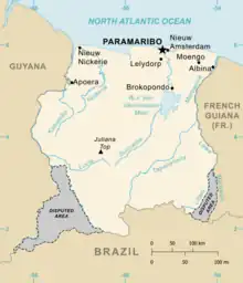
- High: Juliana Top 1,230 m (4,035 ft)
- Low: North Atlantic Ocean 0 m
- Land boundaries: 1,703 km
-
- Coastline: North Atlantic Ocean 386 km
- Population of Suriname: 534,000 - 168th most populous country
- Area of Suriname: 163,821 km2
- Atlas of Suriname
Environment of Suriname

- Climate of Suriname
- Protected areas of Suriname
- Wildlife of Suriname
- Fauna of Suriname
Natural geographic features of Suriname
Regions of Suriname
Ecoregions of Suriname
List of ecoregions in Suriname
Districts of Suriname
Demography of Suriname
Government and politics of Suriname
- Form of government: unitary parliamentary representative democratic republic
- Capital of Suriname: Paramaribo
- Elections in Suriname
- Political parties in Suriname
Branches of the government of Suriname
Executive branch of the government of Suriname
Legislative branch of the government of Suriname
Foreign relations of Suriname
International organization membership
The Republic of Suriname is a member of:[1]
Law and order in Suriname
Law of Suriname
Military of Suriname
- Command
- Forces
Local government in Suriname
Local government in Suriname
History of Suriname
- Timeline of the history of Suriname
- Current events of Suriname
Culture of Suriname
- Cuisine of Suriname
- Languages of Suriname
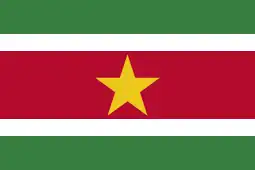
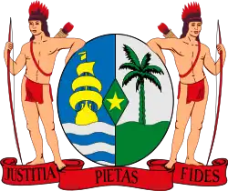
- National symbols of Suriname
- People of Suriname
- Prostitution in Suriname
- Public holidays in Suriname
- Religion in Suriname
- World Heritage Sites in Suriname
Art in Suriname

Economy and infrastructure of Suriname
- Economic rank, by nominal GDP (2007): 154th (one hundred and fifty fourth)
- Agriculture in Suriname
- Communications in Suriname
- Companies of Suriname
- Currency of Suriname: Dollar
- ISO 4217: SRD
- Transport in Suriname
Education in Suriname
See also
References
- "Suriname". The World Factbook. United States Central Intelligence Agency. July 2, 2009. Retrieved July 23, 2009.
External links
- Government of the Republic of Suriname (in Dutch)
- Big database of Suriname websites (in Dutch)
- Business in Suriname Database
 Suriname travel guide from Wikivoyage
- Suriname. The World Factbook. Central Intelligence Agency.
- Outline of Suriname at Curlie
- "Districts of Suriname". Statoids.
- Perry–Castañeda Library Map Collection

