Lower Mount Walker, Queensland
Lower Mount Walker is a locality split between the Scenic Rim Region and City of Ipswich local government areas of South East Queensland, Australia.[2][3] In the 2016 census, Lower Mount Walker had a population of 185 people.[1]
| Lower Mount Walker Queensland | |||||||||||||||
|---|---|---|---|---|---|---|---|---|---|---|---|---|---|---|---|
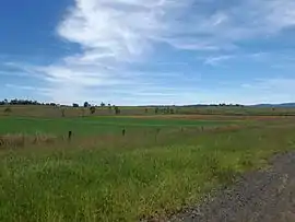 Fields along Stokes Crossing Road, 2015 | |||||||||||||||
 Lower Mount Walker | |||||||||||||||
| Coordinates | 27.7180°S 152.5252°E | ||||||||||||||
| Population | 185 (2016 census)[1] | ||||||||||||||
| • Density | 3.157/km2 (8.177/sq mi) | ||||||||||||||
| Postcode(s) | 4340 | ||||||||||||||
| Area | 58.6 km2 (22.6 sq mi) | ||||||||||||||
| Time zone | AEST (UTC+10:00) | ||||||||||||||
| LGA(s) | |||||||||||||||
| State electorate(s) | Scenic Rim | ||||||||||||||
| Federal division(s) | |||||||||||||||
| |||||||||||||||
Geography
The Bremer River passes through the locality.
Lower Mount Walker is home to a remnant swamp tea-tree forest which is considered critically endangered.[4]
History
Mount Walker Lower Provisional School opened on 12 November 1923. In 1927, the school building was relocated from Mount French to Lower Mount Walker.[5] Mount Walker Lower State School was proclaimed on 19 March 1928. The school closed circa 1945.[6][7] It was at 286-294 Mount Walker West Road (27.7051°S 152.5372°E).[8][9]
In the 2016 census, Lower Mount Walker has a population of 185. The locality contained 70 households, in which 51.4% of the population were males and 48.6% of the population were females with a median age of 44, 6 years above the national average. The average weekly household income was $1,437, $1 below the national average. None of Lower Mount Walker's population was either of Aborigional or Torres Strait Islander descent. 65.2% of the population aged 15 or over were either registered or de facto married, while 34.8% of the population was not married. 31.5% of the population was currently attending some form of a compulsory education. The most common nominated ancestries were Australian (39.1%), English (21.0%) and Scottish (8.2%), while the most common country of birth was Australia (71.8%), and the most commonly spoken language at home was English (85.0%). The most common nominated religions were Catholic (26.7%), Anglican (20.6%) and Not stated (20.0%). The most common occupation was a cleric/administration worker (22.3%) and the majority/plurality of residents worked 40 or more hours per week (60.2%).[1]
References
- Australian Bureau of Statistics (27 June 2017). "Lower Mount Walker (SSC)". 2016 Census QuickStats. Retrieved 20 October 2018.
- "Lower Mount Walker – locality in City of Ipswich (entry 45096)". Queensland Place Names. Queensland Government. Retrieved 16 November 2019.
- "Lower Mount Walker – locality in Scenic Rim Region (entry 45213)". Queensland Place Names. Queensland Government. Retrieved 17 November 2019.
- Neroli Roocke (8 December 2011). "Call to arms for endangered Queensland forest". ABC Rural. Australian Broadcasting Corporation. Retrieved 27 March 2015.
- "COUNTRY NEWS. IPSWICH". The Brisbane Courier. No. 21, 776. Queensland, Australia. 11 November 1927. p. 10. Archived from the original on 13 January 2022. Retrieved 13 March 2017 – via National Library of Australia.
- Queensland Family History Society (2010), Queensland schools past and present (Version 1.01 ed.), Queensland Family History Society, ISBN 978-1-921171-26-0
- "Agency ID 9147, Mount Walker Lower State School". Queensland State Archives. Retrieved 13 April 2015.
- "Queensland Twenty Chain series sheet 2510" (Map). Queensland Government. 1973. Retrieved 11 April 2022.
- "Queensland Globe". State of Queensland. Retrieved 11 April 2022.