North Tamborine, Queensland
North Tamborine is a rural town in the locality of Tamborine Mountain in the Scenic Rim Region, Queensland, Australia.[1]
| North Tamborine Queensland | |
|---|---|
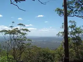
 View from The Knoll | |
 North Tamborine | |
| Coordinates | 27.9231°S 153.2074°E |
| Established | 1875 |
| Postcode(s) | 4272 |
| Time zone | AEST (UTC+10:00) |
| LGA(s) | Scenic Rim Region |
| State electorate(s) | Scenic Rim |
| Federal division(s) | Wright |
Geography
North Tamborine is located 40 kilometres (25 mi) from the Gold Coast.
History
Many early settlers grew maize and grazed dairy cattle.[2] The first guesthouse on the mountain was opened in 1889.[2]
A tourist road to the mountain was completed in 1924.[2] The road brought visitors to the area and the North Tamborine village became the centre for social and business activities. North Tamborine Post Office opened by 1922.[3]
A section of Tamborine National Park known as The Knoll protects forests found in the north of the suburb.
Formerly a suburb in its own right, in 1997, North Tamborine was merged with other former suburbs Eagle Heights and Mount Tamborine to create the larger locality of Tamborine Mountain.[4]
Heritage listings
North Tamborine has a number of heritage-listed sites, including:
- Geissmann Drive: Tamborine Mountain Road[5]
See also
References
- "North Tamborine – town in Scenic Rim Region (entry 24723)". Queensland Place Names. Queensland Government. Retrieved 29 December 2020.
- Queensland Environmental Protection Agency (2000). Heritage Trails of the Great South East. State of Queensland. p. 14. ISBN 0-7345-1008-X.
- Phoenix Auctions History. "Post Office List". Phoenix Auctions. Retrieved 21 February 2021.
- "Eagle Heights". Queensland Places. Centre for the Government of Queensland, University of Queensland. Retrieved 31 January 2016.
- "Tamborine Mountain Road/Geissmann Drive (entry 602365)". Queensland Heritage Register. Queensland Heritage Council. Retrieved 12 July 2013.
External links
![]() Media related to North Tamborine, Queensland at Wikimedia Commons
Media related to North Tamborine, Queensland at Wikimedia Commons